Mače - Cjanovca (Mačenska pot and on SE ridge)
Starting point: Mače (600 m)
| Lat/Lon: | 46,3131°N 14,4187°E |
| |
Name of path: Mačenska pot and on SE ridge
Time of walking: 3 h 35 min
Difficulty: easy marked way
Altitude difference: 1220 m
Altitude difference po putu: 1275 m
Map: Karavanke - osrednji del 1:50.000
Recommended equipment (summer):
Recommended equipment (winter):
Views: 23.687
 | 2 people like this post |
Access to the starting point:
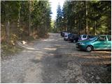
a) From the motorway Ljubljana - Jesenice, take the exit Kranj - East, then continue driving towards Jezersko. When you reach Preddvor, leave the main road and turn left towards the centre of the town, and from there follow the signs for Mače. When you arrive in Mače, continue right at the marked crossroads (left Bašelj, straight ahead St Nicholas Church (the church is not accessible by car)) and follow the narrow road above the village, where there is a large marked parking lot.
b) From the motorway Jesenice - Ljubljana, take the exit Kranj - West and continue left at the first junction. Continue through the underpass under the motorway and then to the roundabout, from where you continue in the direction of Golnik. The road continues through Mlaka pri Kranju, and at the end of the village we turn right in the direction of Srakovlje. We then drive through Srakovlje, Spodnja Bela, Srednja Bela to Zgornja Bela, where we turn right towards Preddvor. At Preddvor we see signs for Mače, which direct us left past the primary school onto the road that climbs up to Maca. When you arrive at Mače, continue right at the marked crossroads (left Bašelj, straight ahead St Nicholas Church (the church is not accessible by car)) and follow the narrow road above the village, where there is a large marked parking lot.
Path description:
At the end of the parking lot you will see signs directing you to the wide cart track, which climbs gently at first. Cart track has a few small forks at the beginning, but we keep slightly to the right and follow the marked path the whole way. Cart track climbs steeply a few times higher up for a short time, and then leads us to direction signs, where we continue to the left in the direction of Devil's Borst.
At the direction signs, leave cart track and continue the ascent along the marked footpath, which begins to climb steeply through the increasingly dense forest. Higher up, the forest thins out, and the path leads us out of the forest onto the increasingly scenic grassy slopes of Zaplata, where we can already see Hudičev boršt in front of us. Here the path climbs steeply once more, and then joins the wider path, which comes from Kališča or from Mač (possibility of descent). Here we continue to the right and after a few steps the path leads us to the edge of the forest, where we see a pleasant little spring. Continue into the forest and after 3 minutes of further walking you will reach the shelter in Hudičev boršt (the shelter is currently still under construction - November 2009).
From the shelter, continue eastwards along the path, which first descends for a short distance, and then passes out of the forest onto the vast grassy slopes, where it crosses occasionally quite steep grassy slopes in a moderate ascent (especially in wet conditions, there is a risk of slipping). After about 20 minutes' walk from the shelter, the path passes into the wods again, and then continues to the crossroads, where the path joins with Javorov vrh, the home of Čemšenik and St. Jakob's Churches (St. Jakob's Churches) and Hudičev boršt.
Continue left in the direction of Cjanovca and Srednji vrh along the path, which begins to climb steeply along and along the eastern ridge of Cjanovca. Higher up, the path leads us out of the forest onto slopes covered with dwarf pines, and we continue along an increasingly steep and, in places, very scenic path. The path, from which we have beautiful views of Kočno, Grintovec, Kalški greben and Gorenjska, slowly turns slightly to the left. Follow this increasingly scenic and relatively steep path all the way to the top of Cjanovca, where there is a bench and a small cairn.
Mače - Hudičev boršt 1:50, Hudičev boršt - Cjanovca 1:45.

We can extend the trip to the following destinations: Srednji vrh
Pictures:
 1
1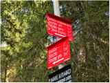 2
2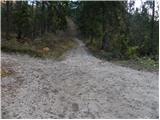 3
3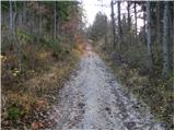 4
4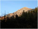 5
5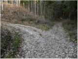 6
6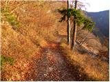 7
7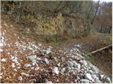 8
8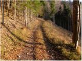 9
9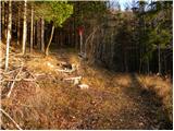 10
10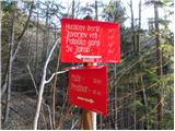 11
11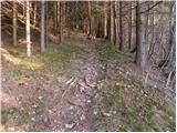 12
12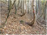 13
13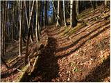 14
14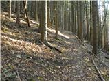 15
15 16
16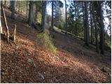 17
17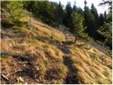 18
18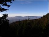 19
19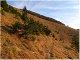 20
20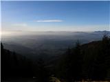 21
21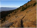 22
22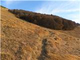 23
23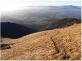 24
24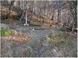 25
25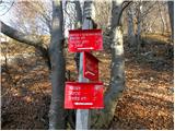 26
26 27
27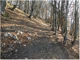 28
28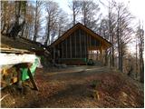 29
29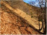 30
30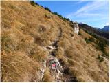 31
31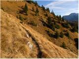 32
32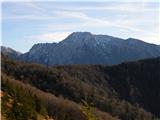 33
33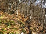 34
34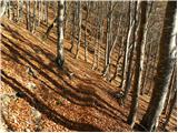 35
35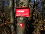 36
36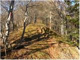 37
37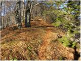 38
38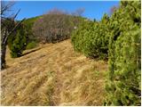 39
39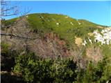 40
40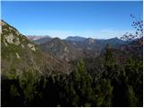 41
41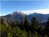 42
42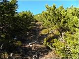 43
43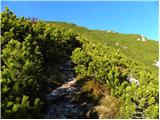 44
44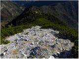 45
45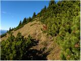 46
46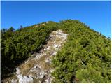 47
47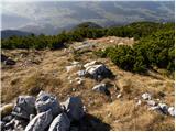 48
48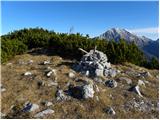 49
49 50
50
Discussion about the trail Mače - Cjanovca (Mačenska pot and on SE ridge)
|
| Parkeljc31. 12. 2010 |
Včeraj izbral to turo, res da malo pozno štartal, ob 11-ih, temu primeren prihod v dolino, v trdi temi ob 17.20 ! Do poti, kjer se združita iz smeri Kokre snega skoraj ni, naprej pa zna bit kar moteč, čeprav ga ni veliko, saj se med rušjem, če ni pomrznjen zelo predira. Tik pod vrhom na nekaterih mestih nevarnost zdrsa, zato zadnje metre premagam s klasičnimi derezami. Vrh dosežem ob 15-ih, čudovit razgled na vse strani, za Srednji vrh mi zmanjka časa, zato jo na hitro ucvrem proti Hudičevem borštu in naprej v dolino, kamor prispem skoraj v trdi temi. Ni odveč vedeti, da je na tej poti velika nevarnost plazov (nekaj jih je bilo še na poti), saj je strmina precejšnja.
|
|
|
|
| golmat20. 02. 2011 |
HRIBOŽERCI, GORE IN HRIBI SO QL  9.2.2011 šel na Cjanovco iz Preddvora čez Potoško goro, Javorjev vrh in naprej na Cjanovco - tura je zelo,zelo lepa,ne preveč naporna in te nagradi z zares lepim pogledom na okoliške vrhove,˝Kranjsko dolino˝,dolino Kokre,Grintovec, Kočno,Kalški greben in .... . V tem času mi je narava postregla s pogledi,ki so samo za BOGOVE. Sigurno bom šel na Cjanovco takoj, ko bo pomlad malo bolj zabredla v naše kraje in bo že tudi cvetja v izobilju. Iz Preddvora pa na vrh sem potreboval cca. 4 ure zmerno počasne hoje. Kdor zna prisluhniti tihi govorici naših planin in gora, ve kaj je QuuuL.
|
|
|
|
| funnyboy6. 06. 2014 |
Ali kdo ve, če je Mačenska pot lepo očiščena ali je še veliko podrtih dreves?
|
|
|
|
| Kobra 16. 06. 2014 |
Pot je lepo očiščena ...
|
|
|
|
| Lisica29. 04. 2015 |
Danes naredila pot iz Mač gor čez Dolge njive na Srednji vrh in bližnjo Cjanovco in spust po zgoraj opisani poti na Hudičev boršt. Zelo lepa krožna pot za nabiranje kondicije.
|
|
|
|
| mojlajf21. 04. 2019 |
Je bil kdo te dni gor, še kaj snega? Hvala za info.
|
|
|
|
| KarmenT21. 04. 2019 |
V petek, 19.4., po Mačenski poti na Cjanovco in Srednji vrh. Čudoviti razgledi na vse strani. Tik pod vrhom Cjanovce nekaj malega ojuženega snega, ki se ga preči brez težav. Prav tako nekaj malega snega naprej proti Srednjemu vrhu. Sestop v smeri planine Dolga njiva, kjer se priključi pot iz Malega Grintovca. Kar nekaj snega, vidna le slaba sled, a sneg ojužen in sestop brez težav. Direktno pot z vrha Srednjega vrha sva očitno spregledala in naredila malo daljšo. Prehodno brez zimske opreme. Zelo lep dan.
|
|
|
|
| tango5. 05. 2022 16:55:13 |
Danes po Mačenski po JV grebenu na Cjanovco, potem na Sr. vrh in namesto direktno na Dolge njive podaljšava po poti proti M. Grintovcu. Na sedlu obrneva nazaj proti Dolgim njivam in dol v Mače. Vsega skupaj 13 km in nekaj čez 1350 višincev. Bilo je lepo, sploh del po grebenu. Od Sr. vrha proti M. Grintovcu še malo snega in nekaj potopov do blatnikov, ampak pod črto, krasna tura to ob še pravem času, ko ni bilo koprene in zato so bili razgledi dobri.
|
|
|