Ljubljanica - Sveta Ana (Butajnova)
Starting point: Ljubljanica (521 m)
| Lat/Lon: | 46,0346°N 14,2424°E |
| |
Time of walking: 35 min
Difficulty: easy marked way
Altitude difference: 165 m
Altitude difference po putu: 165 m
Map: Škofjeloško in Cerkljansko hribovje 1:50.000
Recommended equipment (summer):
Recommended equipment (winter):
Views: 5.458
 | 2 people like this post |
Access to the starting point:
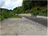
First we drive to Horjul (to get here from Dobrova near Ljubljana or Vrhnika), then we continue driving towards Vrzdenc, Šentjošt and Gorenjska vas. At Vrzdenec, the road starts to climb steeply, and then a little further on leads to a serpentine, in the middle of which the road to Šentjošt and Smrečje branches off to the left. Continue right along the main road, which soon leads to a small pass, at the end of which the road branches off to the right towards the village of Samotorica. Continue straight ahead and the road starts to descend steeply and after a short descent leads to the hamlet of Ljubljanica (lower part of Butajnova), where you reach the next crossroads. As there are no suitable parking spaces in the hamlet, turn right and continue driving towards Polhov Gradec. After a further 100 m, you will see a suitable parking place on the right hand side.
The starting point can also be reached from the route of Polhov Gradec and Gorenjska vas.
Path description:
From the starting point, walk first to the hamlet of Ljubljanica, then continue towards Gorenje village at the crossroads. Only a few metres further along the road, you will see mountain direction signs for Butajnova, Mountain pasture and Setnik, which direct you sharp right onto the ascending asphalt road. Continue climbing along the road for some time, and then the signs direct you to a marked footpath.
From the point where you leave the road, you first ascend the cart track, which then turns into a rather overgrown path, which you quickly follow back to the road. We get on the road just at a small crossroads where the road to Kurja vas branches off to the left, and we continue straight on the ascending road, which quickly leads us to Butajnovo.
Just past the fire house and chapel in Butajnova, a road branches off to the right, and within a minute's walk we reach the church of St Anne in Butajnova.
Pictures:
 1
1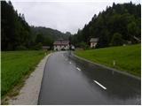 2
2 3
3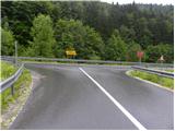 4
4 5
5 6
6 7
7 8
8 9
9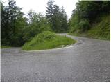 10
10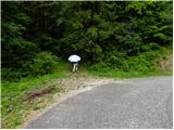 11
11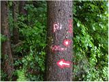 12
12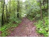 13
13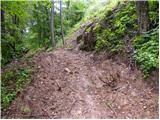 14
14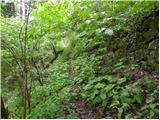 15
15 16
16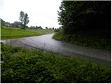 17
17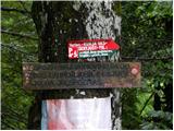 18
18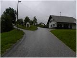 19
19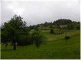 20
20 21
21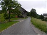 22
22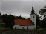 23
23
Discussion about the trail Ljubljanica - Sveta Ana (Butajnova)