Ljubenske Rastke (Vrnivšek) - Smrekovec
Starting point: Ljubenske Rastke (Vrnivšek) (875 m)
| Lat/Lon: | 46,4052°N 14,8816°E |
| |
Time of walking: 2 h
Difficulty: easy marked way
Altitude difference: 702 m
Altitude difference po putu: 712 m
Map: Kamniške in Savinjske Alpe 1:50.000
Recommended equipment (summer):
Recommended equipment (winter): ice axe, crampons
Views: 9.010
 | 1 person likes this post |
Access to the starting point:
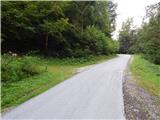
From Mozirje, Gornji Grad or Luč, drive to Ljubno ob Savinji, and from there follow the signs for Smrekovec. Through Ljubno ob Savinji, initially follow the sometimes narrower Road to Rastke, and at junctions between houses follow the signs for Smrekovec. The road widens behind the settlement, then climbs moderately and gradually becomes narrower and steeper until Ljubenske Rastke. Shortly before the NOB memorial, a path branches off to the right, leading past the Atelšek farm. At the memorial, the road makes two serpentine turns, then just after the Naraločnik MHPP, it turns sharp right once more, crosses the Krumpah stream, and then on the left you can already see the mountain markers for Dom na Smrekovcu. Park in a suitable place along the road.
Path description:
At the starting point, the signs for Smrekovec direct us to the left, to cart track, which begins to climb through the forest. The ascent is along cart track, which runs along the slopes above the left bank of the Krumpah stream, which is overgrown with grass, which is occasionally mown in a narrower strip, as otherwise the grass grows quite high. While walking along cart track, on the right you can see pipes carrying water for the needs of the nearby small hydroelectric power station, and a little higher up you reach a water intake. At the water intake, the marked path also reaches a stream bed, which it then follows. The rather slippery path runs completely alongside the stream, crosses it a little further on and climbs steeply to the right of the stream. The steepness quickly eases as you reach a forest road, which you follow to the left, and follow it to its end, or to the point where it becomes a climbing cart track. The cart track climbs again along the stream, and then, as you approach the nearby waterfall, cross the stream (the climb out of the stream bed is not entirely easy, as you have to use your hands to climb out) and continue on the other side along the marked forest path. There is a slightly longer cross-climb, where you cross a few torrents, and occasionally the path leads you under cliffs. Higher up, the path takes a sharp right turn, first climbing over a steep slope, then the slope flattens out and the cart track widens, but becomes more overgrown. This part is also occasionally mown in a narrower strip to make the passage through the overgrown cart track easier, except that the part through the younger spruces is not mown, but this part is not long.
A little further on we cross a dirt road which crosses most of the southern part of the Smrekov Mountains, and we continue along cart track in the direction of Smrekovec.
Before the nearby wooden hut, turn left, and after it, turn right twice, again in the direction of Smrekovec. A little further on, cross another small stream, then climb moderately in a few minutes. When you reach the macadam road, follow it to the nearby Dom na Smrekovcu.
From Dom na Smrekovcu we continue towards the top of Smrekovec, where the path first leads us over a short lookout from which we open a view towards the central Kamnik Savinja Alps, then passes into a rare forest, where after a short climb we reach a marked crossroads, where we continue to the right (straight Komen, Meadow. . . ). From the crossroads onwards, the forest thins out further, and then the completely uncultivated part leads us slightly to the right, where, with views that reach far and wide, we reach the pyramid at the top of Smrekovec without much difficulty. Starting point - Dom na Smrekovcu 1:30, Dom na Smrekovcu - Smrekovec 30 minutes.

We can extend the trip to the following destinations: Krnes,
Komen
Pictures:
 1
1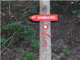 2
2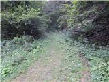 3
3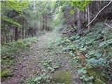 4
4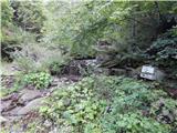 5
5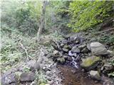 6
6 7
7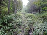 8
8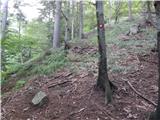 9
9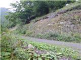 10
10 11
11 12
12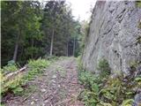 13
13 14
14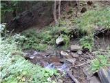 15
15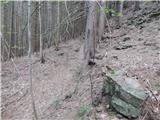 16
16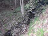 17
17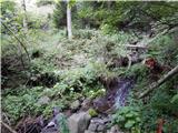 18
18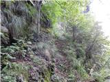 19
19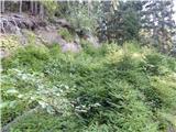 20
20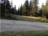 21
21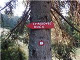 22
22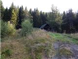 23
23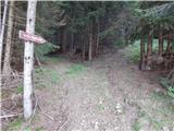 24
24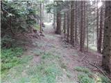 25
25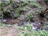 26
26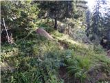 27
27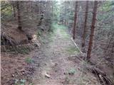 28
28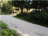 29
29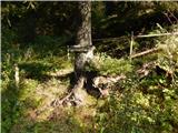 30
30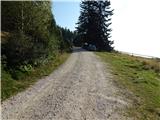 31
31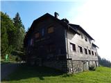 32
32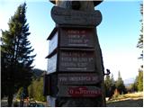 33
33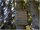 34
34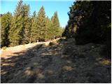 35
35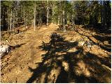 36
36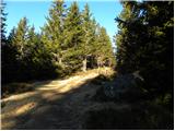 37
37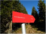 38
38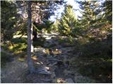 39
39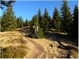 40
40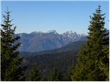 41
41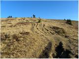 42
42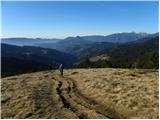 43
43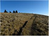 44
44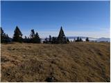 45
45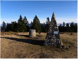 46
46 47
47
Discussion about the trail Ljubenske Rastke (Vrnivšek) - Smrekovec
|
| Bomboncek5. 07. 2019 |
Pot je bila junija od zajetja dalje neprehodna, same koprive in repuh. Nujno potrebujete dolge hlače. Drugače pa zaradi goste zaraščenosti sploh ne vidiš kje hodiš. Midva sva na koncu obrnila in šla z avtom do Atelskega sedla.
|
|
|
|
| Stamp9. 07. 2023 22:35:18 |
Istina. Teško prohodno, ja išao sa kratkim hlačama  Pun plikova od kopriva i pun krpelja (klopcov) .. Staza kao takva se ne može zvati "Laka Markirana .." Isto je i sa spuštanjem bilo preko Atelskog sedla i Atelšeka - skoro pa neprohodno na djelu gdje se skineš sa makadama.. Sve slike, karta, opis puta i link na GPS track na : https://photos.app.goo.gl/NWGegMjavHd3qq9a8
|
|
|
|
| Nejko1239. 09. 2025 00:04:19 |
Kakšna je pot? Je prehodna?
|
|
|