Ljubenske Rastke (Kumprej) - Smrekovec
Starting point: Ljubenske Rastke (Kumprej) (782 m)
| Lat/Lon: | 46,3993°N 14,8729°E |
| |
Time of walking: 2 h 10 min
Difficulty: easy marked way
Altitude difference: 795 m
Altitude difference po putu: 803 m
Map: Kamniške in Savinjske Alpe 1:50.000
Recommended equipment (summer):
Recommended equipment (winter): ice axe, crampons
Views: 5.270
 | 1 person likes this post |
Access to the starting point:
From Mozirje, Gornji Grad or Luč, drive to Ljubno ob Savinji, and from there follow the signs for Smrekovec. Through Ljubno ob Savinji, initially follow the sometimes narrower Road to Rastke, and at junctions between houses follow the signs for Smrekovec. The road widens behind the settlement, then climbs moderately and gradually becomes narrower and steeper until Ljubenske Rastke. Shortly before the NOB memorial, a path branches off to the right, leading past the Atelšek farm. Park in a suitable place on the roadside between the marked trail and the NOB memorial.
Path description:
A little lower than the NOB memorial, the markers for the Atelšek and Dom na Smrekovcu farm direct us to the right, initially slightly downhill, on to a worse road, which quickly descends to the Krumpah stream, crossed over a wooden bridge. Shortly after the small bridge, a short road branches off to the left to a nearby house, and we continue straight on here, turning sharp left at the next fork in the track. There is a cross-climb to the left, and then a serpentine to the right. After the serpentine, the track gradually becomes more overgrown, and when you reach the lower edge of the nearby hayfield, continue sharp left. When the forest ends, continue along an undistinguished grassy ridge where there is no path, but higher up at the chapel you will come across signs. After the chapel you reach the farm Atelšek, which you pass on the left, where there is an access road. From the road, turn slightly right onto a marked track, which crosses an asphalt road just ahead. On the other side of the road, first climb over a view slope, then the path enters the woods and climbs cart track diagonally to the right. When you reach another dirt road a little further on, cross it to the right (if you continue straight ahead you will soon see old markings - an old trail that reaches the road leading to Dom na Smrekovcu higher up), where you follow a waymarked trail with newer markings alongside the old ones. Higher up, reach the road leading to Dom na Smrekovcu and follow it to the left. A few minutes higher, the above-mentioned old path joins us from the left, and the road after this leads to a crossroads where we continue along the right road (slightly left Kugovnik and Ramšak). From the right road, along which we continue our journey, the road to Stari Stani on Golte soon branches off to the right, and the wider road soon leads us to Atelsko sedlo, where the marked path to Golte branches off to the right.
Continue straight ahead, following the road which passes to the other side of the wooded ridge and which is soon joined by the road from the Kramarica prevala.
Continue along the upper road, which leads past the Smrekov Mountains information board to a small football pitch, one of the highest in the country. Leave the road behind the playground and go to the other side of the fence, where you join the marked path from Beli Vod. From here it is only a short, increasingly scenic, moderate climb to Dom na Smrekovcu.
From Dom na Smrekovcu we continue towards the top of Smrekovec, where the path first leads us through a short lookout from which we open a view towards the central Kamnik Savinja Alps, and then passes into a sparse forest, where after a short climb we reach a marked crossroads, where we continue to the right (straight Komen, Travnik. . . ). From the crossroads onwards, the forest is further thinned, and then, after a completely uncultivated part, it leads us a little more to the right, where, with views that reach far and wide, we reach the pyramid at the top of Smrekovec without much difficulty.
Starting point - Dom na Smrekovcu 1:40, Dom na Smrekovcu - Smrekovec 30 minutes.

We can extend the trip to the following destinations: Krnes,
Komen
Pictures:
 1
1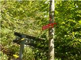 2
2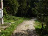 3
3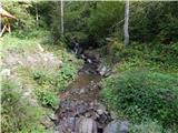 4
4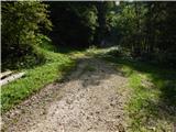 5
5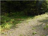 6
6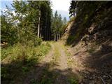 7
7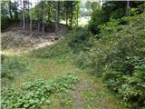 8
8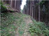 9
9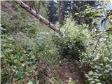 10
10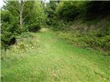 11
11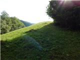 12
12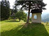 13
13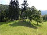 14
14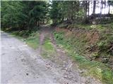 15
15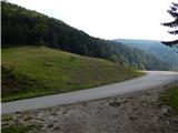 16
16 17
17 18
18 19
19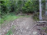 20
20 21
21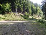 22
22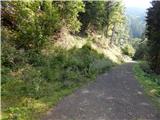 23
23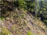 24
24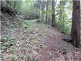 25
25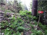 26
26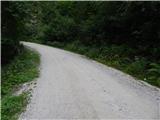 27
27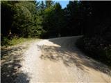 28
28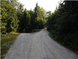 29
29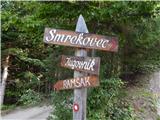 30
30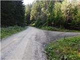 31
31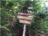 32
32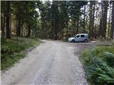 33
33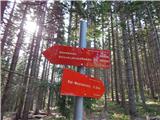 34
34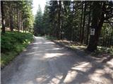 35
35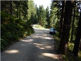 36
36 37
37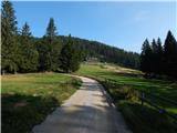 38
38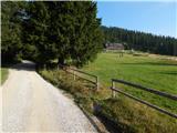 39
39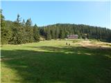 40
40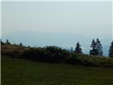 41
41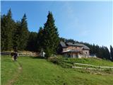 42
42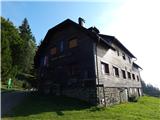 43
43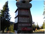 44
44 45
45 46
46 47
47 48
48 49
49 50
50 51
51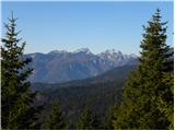 52
52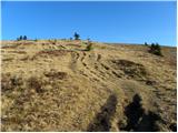 53
53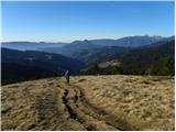 54
54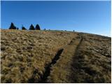 55
55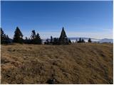 56
56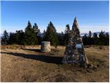 57
57 58
58
Discussion about the trail Ljubenske Rastke (Kumprej) - Smrekovec
|
| mufi11022. 01. 2018 |
Lep pozdrav,jaz sem šel po tej poti ravno včeraj(21.1.2018)in lahko rečem pot je čudovita,primerna za vse starosti ki se le podajo nekam višje v gozd.Res je bila zima in so razmere malo bolj specifične a je normalno prehodno če prav sem se paljal malo višje od opisane poti cirka kilometer,pot je lepo markirana tako da jo najde vsak turist,tako da priporočam ta sprehod.
Varen korak.
|
|
|
|
| Stamp9. 07. 2023 22:38:29 |
Jaaaaako zaraščeno na djelu puta kad se od Kmetije Atelšek dižeš prema makadamu (i dalje po makadamu prema Atelskom sedlu).. Ne preporučam koristiti taj put dok PD ne uredi stazu .. Slike gore dole na linku : https://photos.app.goo.gl/NWGegMjavHd3qq9a8
|
|
|