Ljubelj - Klagenfurter Hutte/Celovška koča (via Vatelca or Skleda)
Starting point: Ljubelj (1058 m)
| Lat/Lon: | 46,4324°N 14,2602°E |
| |
Name of path: via Vatelca or Skleda
Time of walking: 4 h 10 min
Difficulty: partly demanding marked way
Altitude difference: 606 m
Altitude difference po putu: 930 m
Map: Karavanke - osrednji del 1:50.000
Recommended equipment (summer): helmet
Recommended equipment (winter): helmet
Views: 5.060
 | 2 people like this post |
Access to the starting point:
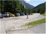
From the Ljubljana - Jesenice motorway, take the Ljubelj exit and follow the road to the border crossing. Just a few metres before the border crossing, the signs for Zelenica direct us to the left and after a further 10 metres the road leads to a parking lot under the Zelenica ski centre.
Path description:
From the parking lot, follow the marked footpath towards Zelenica, Vertatscha and Hochstuhla. The path initially leads along the moderately steep cart track, which climbs through the forest, then turns slightly to the right and leads out of the forest onto the ski slope. The ascent continues along the ski slope, which offers beautiful views of the Begunjščica wall and scree, with the ridge of Ljubeljšice on the right. The trail, which continues on a worse road, takes us only a little higher up to Koča Vrtača, where chairlift Zelenica I ends and chairlift Zelenica II begins. Here the transport and rescue road turns sharp right, and we continue straight on in the direction of Zelenica, following the initially still sloping, then steeper path that climbs up the ski slope. Climbing higher, we pass through a rare lane of dwarf pines and then return to the road. Continue on the minor road, then, as the road turns left, continue right on a steep footpath which returns to the road just below the top station of the single-seater Zelenica II. From here there is a short descent and the path leads to Doma na Zelenica.
Just before the lodge, a path branches off to the left, leading to Begunjščica and Roblek's lodge, and we continue to the left after the lodge and start climbing alongside the Ciciban children's ski lift. Somewhere in the middle of the ski lift we reach a small crossroads, where we continue to the right over the ski slope (straight ahead Koča pri izviru Završnice, Srednji vrh and Hochstuhl - the lower path). On the other side of the Ciciban ski slope the path goes into a narrow lane of a forest, after which you reach the next lift. Cross this ski slope as well, and then, by a small boulder, find the continuation of the marked trail leading to Vertatscha and Hochstuhl. The trail continues along the slopes below the ridge of Na Možeh, then descends slightly and leads to a point where an unmarked trail branches off to the right into the valley of Suhe dwarf pines and Palcu (there is a smaller cairn at the crossroads). Beyond the crossroads, the trail gradually transitions to the slopes of Vertatscha, over which it climbs mostly cross-climbing. Higher up, an unmarked path from Koča pri izviru Završnice joins from the left, and we continue straight on to the next marked crossroads. At the crossroads, the path to Vertatscha branches off slightly to the right, and the upper path continues straight on towards Hochstuhl. Continue along the right-hand path towards Vertatscha, which climbs slightly steeper. Higher up, you reach a grassy slope where the path becomes a little steeper, then turns left to steep slopes. Cross a slightly exposed gully and then climb over steep grasses to the south-western shoulder of Vrtača.
Here the marked path leading to Vertatscha turns sharp right, and we continue straight on the other side of the ridge, where we follow the path down to a nearby scree slope. When we reach the nearby scree, we continue on a slightly less well-trodden but marked mountain path (the path is marked with red lines). The path, which first descends gently and then moderately, and occasionally steeply, along the scree, almost semicircularly bypasses the nearby cirque. The path, which is also exposed to falling stones in several places, stops descending lower down and leads to a short but steep grassy slope. Climb up the steep slope for a few metres and then arrive at the plateau around the Skleda sinkhole (also Vatelca on some maps). Follow a relatively gentle path for a few minutes and then arrive at a small crossroads, where you continue to the right (steeply downhill to the left Hochstuhl). There is a short crossing and the path leads to the crossroads at the Belščica saddle.
From this crossroads, at which there are Austrian mountain direction signs, continue straight down in the direction Celovška koča / Klagenfurter Hütte (right Bielschitza for 20 minutes) along the path, which begins to descend quite steeply. The way forward descends on occasional slightly overgrown scree (mainly some grass) and mostly crosses the slopes below Svačica. A few fixed safety gear help us crossing lower down, and the path gradually lays down behind them and gradually goes down the slope into a smaller valley covered with dwarf pines. There is a short climb up the cart track and the path, which offers beautiful views of the northern walls of Karawanks, quickly leads to the Celovška Hut.

Pictures:
 1
1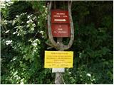 2
2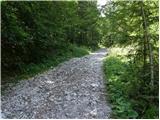 3
3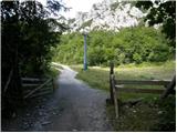 4
4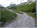 5
5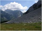 6
6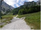 7
7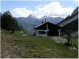 8
8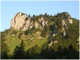 9
9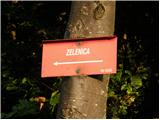 10
10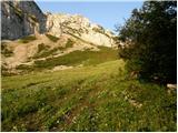 11
11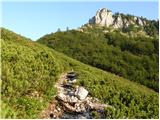 12
12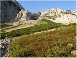 13
13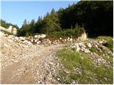 14
14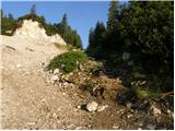 15
15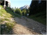 16
16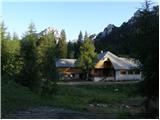 17
17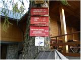 18
18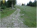 19
19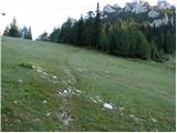 20
20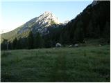 21
21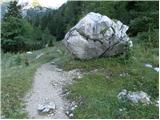 22
22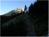 23
23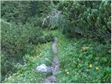 24
24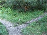 25
25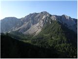 26
26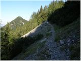 27
27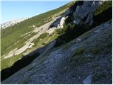 28
28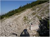 29
29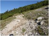 30
30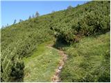 31
31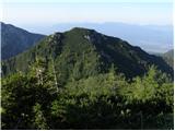 32
32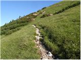 33
33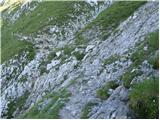 34
34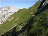 35
35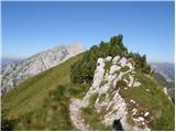 36
36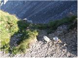 37
37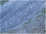 38
38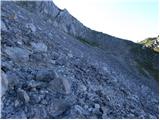 39
39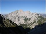 40
40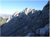 41
41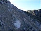 42
42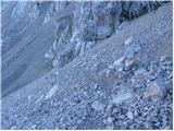 43
43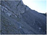 44
44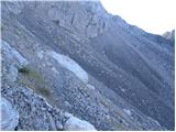 45
45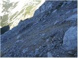 46
46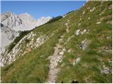 47
47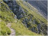 48
48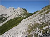 49
49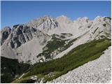 50
50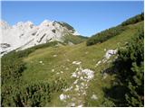 51
51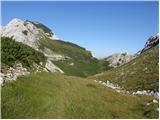 52
52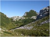 53
53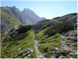 54
54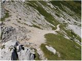 55
55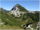 56
56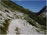 57
57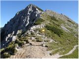 58
58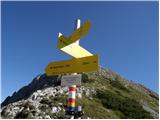 59
59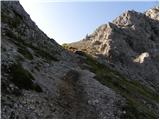 60
60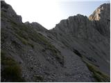 61
61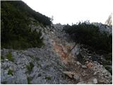 62
62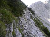 63
63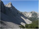 64
64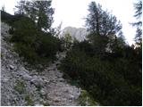 65
65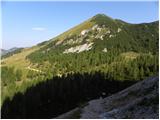 66
66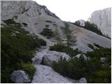 67
67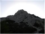 68
68 69
69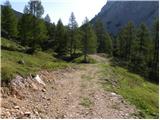 70
70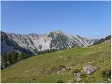 71
71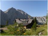 72
72
Discussion about the trail Ljubelj - Klagenfurter Hutte/Celovška koča (via Vatelca or Skleda)