Livške Ravne - Kuk (Kolovrat)
Starting point: Livške Ravne (1115 m)
| Lat/Lon: | 46,1939°N 13,6281°E |
| |
Time of walking: 20 min
Difficulty: easy unmarked way
Altitude difference: 128 m
Altitude difference po putu: 128 m
Map: Julijske Alpe - zahodni del 1:50.000
Recommended equipment (summer):
Recommended equipment (winter):
Views: 12.563
 | 1 person likes this post |
Access to the starting point:
From the road Tolmin - Bovec, at Idrsko, turn onto the road towards the village of Livek. Continue on the ascending road to the village and turn left at the crossroads towards Livški Ravne. From Livški Ravne, drive a little further and then park in a slightly larger parking lot, next to which there is also a table with two benches.
Path description:
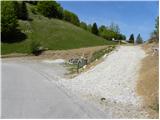
From the parking lot, turn onto a slightly narrower macadam road, which begins to climb moderately over an initially grassy slope towards the top of Kuka. Higher up, the road crosses the lane of a forest and climbs steeply a few times (the steep spots are paved), but it quickly leads us to the summit, in the middle of which there is a large number of antennas, with increasingly beautiful views of the Krnsko mountains and Veneto Slovenia.
Pictures:
 1
1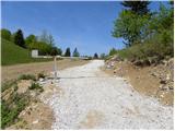 2
2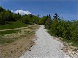 3
3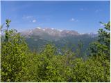 4
4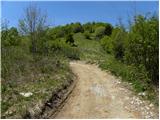 5
5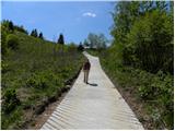 6
6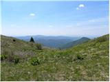 7
7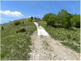 8
8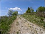 9
9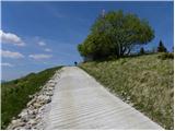 10
10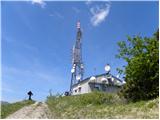 11
11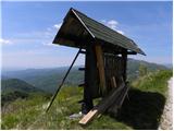 12
12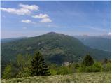 13
13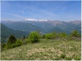 14
14
Discussion about the trail Livške Ravne - Kuk (Kolovrat)
|
| Dg9013. 06. 2017 |
Krasen izlet s čudovitim razgledom na dolino Soče, Krn in Kanin.
|
|
|