Lepena - Veliki Lemež (via Planina Zagreben)
Starting point: Lepena (490 m)
| Lat/Lon: | 46,3037°N 13,6814°E |
| |
Name of path: via Planina Zagreben
Time of walking: 6 h
Difficulty: difficult pathless terrain
Altitude difference: 1552 m
Altitude difference po putu: 1710 m
Map: Julijske Alpe - zahodni del 1:50.000
Recommended equipment (summer):
Recommended equipment (winter): ice axe, crampons
Views: 3.590
 | 3 people like this post |
Access to the starting point:
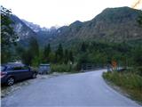
Between Trenta and Bovec, the road to Lepena branches off at the village of Soča. Follow this road, which is fully asphalted, for about three kilometres and then come to a crossroads where the road to the Pretner and Hosner apartments branches off to the right over a bridge. Turn right and park on the roadside in front of the bridge. There is only room for one or two vehicles. There is a slightly larger parking lot about 100 metres further along the main road.
Path description:
From the starting point, cross the bridge and follow the road as it turns left after the bridge. Follow the road until you reach the last house. When the road forks right at the cart track, we continue to the left and descend a little. When you reach the last house, the road ends. Behind the house on the right you will see a narrow lane.
Take the path and after about ten metres you will see a signpost on the side of the path indicating the way to mountain pasture Zagreb. Continue along the path through the forest and you are quickly back at the crossroads. To the right, a path leads to another house, and we continue to the left where we are directed by the sign "Zagreben, Šumnik".
The trail is badly worn for some time, so you should pay attention to the black and red markings that mark the Peace Trail. When two more paths join from the right of the aforementioned house, the path becomes a little better trodden again. The path then passes through the forest along the Šumnik stream for some time. Higher up, the path moves slightly away from the stream, but for a while it still runs parallel to the stream. The trail passes through the forest all the time, so it does not offer much of a view. Later, the path turns right and leads to a crossroads by some ruins.
Here, the path branches off to the left and follows the valley towards the Čez Potoče saddle. We continue to the right and the path quickly leads us through a short clearing to the World War I memorial. It is about 1:30 walk from the starting point.
From the monument, continue to follow the Peace Trail, which is marked with red and black markings. The trail then crosses the slopes to the west and goes around the ridge from the summit of Konj (1279m) to the summit of Brdo (1520m). The slope we cross becomes quite steep and in a short part we are also helped by a cable car. The path also offers beautiful views of the peaks to the north. A little later there are two serpentines on the path and in a right turn we will come to a slightly less visible crossroads.
Here we leave the Peace Trail, which is marked with red and black markings, and turn left onto a less well-trodden path. At the start of this path there is an arrow carved into a tree on the right-hand side. The path then climbs slightly steeper and runs slightly to the left most of the time. A little more care is needed here as the path is not very visible. The path continues to climb and leads us to the deserted and rather overgrown mountain pasture Zagreben. The path leads past the ruins at mountain pasture and then turns right uphill. There is one last climb to the hunting lodge, which can already be seen in front of us.
From the hunting lodge, go back a few tens of metres to the first bend and turn right onto the initially very faint path. The slightly overgrown path, which leads us along bushes and a few trees, runs up the right side of the valley. The bushes and trees then end and the ascent up the slightly more scenic path follows. The path continues to follow the right side of the valley and climbs for some time on scree. Towards the end of the valley, the terrain becomes more grassy and the path becomes less visible again.
Leave the poorly visible track here and turn left onto the trackless path towards the saddle on the south side of Brdo Peak. The slope towards the saddle is quite overgrown with tall grass and nettles, so it is advisable to head left a little higher where the terrain is a little less overgrown.
When you reach the saddle, descend slightly to the other side and cross the slopes towards the Čez Potoče saddle. The saddle is still relatively far away, but can be seen. Continue to cross the slope to the south-east and you will soon come in front of a short lane of forest. The wooded slope, which is slightly steeper, is better avoided on the right, where the terrain is slightly less overgrown. On the other side of the forest, the terrain is littered with many rocks and boulders, often covered with snow.
Then we start to climb steeply again on scree towards the Čez Potoče saddle. As you climb the scree, you can also see a few remnants of the First World War. Higher up, the terrain becomes a bit more grassy and the track is again a bit more visible. There is a short climb and then the Čez Potoče saddle is soon reached.
At the saddle, where a reasonably well-trodden track leads straight down to Planina na Polju, turn left onto a trackless track. In the initial part of the climb, immediately along the ridge on the right. The slope here is covered with grass and is occasionally quite steep, so some caution is needed. Especially in wet conditions, the slopes can be dangerous for slipping. The ridge is briefly retreated a little more to the right, and then the climb back up to the ridge is resumed. Soon you reach a headland with some remains from the First World War. There are also some military tunnels on the eastern side of the headland.
From the summit, descend gently down the still mostly grassy slope, which is a shade less steep in this part. Then climb up the right side of the ridge again to the top of Vogel, which opens up a view towards the top of Veliki Lemež, further up the ridge. From the trail we have a nice view towards Krno and the valley of the Soča River.
From the top of Vogel, continue along the ridge and descend again. There follows some walking along a slightly wider and lower ridge, which leads us under the steeper slopes of the next peak. The grassy ridge here becomes very narrow and is also slightly exposed in places, so some caution is needed when ascending. Continue along the ridge and you will soon reach the next headland.
From the summit, descend the steep slope along the ridge where there is also a slightly less well-trodden path. After a short descent, the path leads us to a notch where we will see on the right side a larger collapse that occurred during the 1998 earthquake.
From the stubble, the ridge becomes narrow again and the track briefly takes us to the left north side of the ridge. There is a short climb up a steep and rather exposed grassy slope, which is quite dangerous for slipping, especially in wet conditions. The ridge is quickly regained and becomes less demanding again. Then it's a climb up a wide grassy slope to the summit.
Descend back down the ridge to the saddle Čez Potoče where you descend left down past Planina na Polju and Krnsko jezero to the Doma v Lepeni. It is about 45min walk back to the starting point.
From the stub below the summit it is also possible to descend along the above-mentioned pass directly towards the lake, but the pass makes the descent a bit more difficult.

Pictures:
 1
1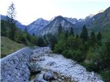 2
2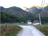 3
3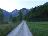 4
4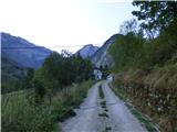 5
5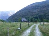 6
6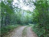 7
7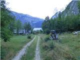 8
8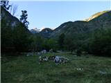 9
9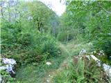 10
10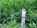 11
11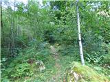 12
12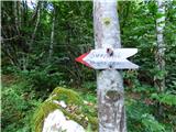 13
13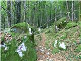 14
14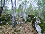 15
15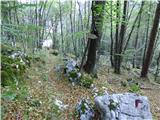 16
16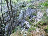 17
17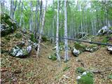 18
18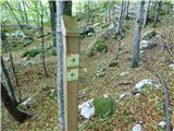 19
19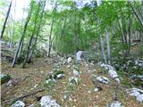 20
20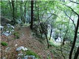 21
21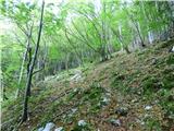 22
22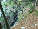 23
23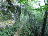 24
24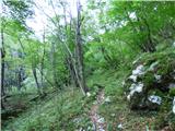 25
25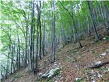 26
26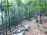 27
27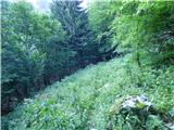 28
28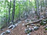 29
29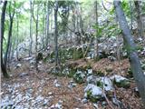 30
30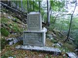 31
31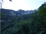 32
32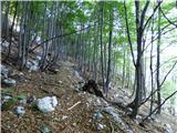 33
33 34
34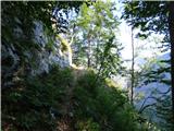 35
35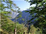 36
36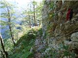 37
37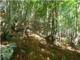 38
38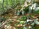 39
39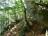 40
40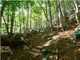 41
41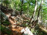 42
42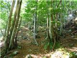 43
43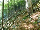 44
44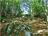 45
45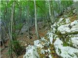 46
46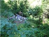 47
47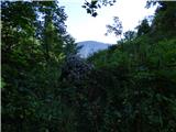 48
48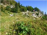 49
49 50
50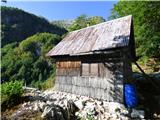 51
51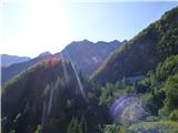 52
52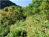 53
53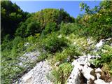 54
54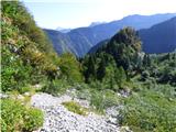 55
55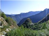 56
56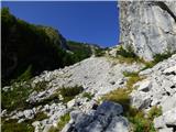 57
57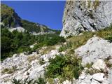 58
58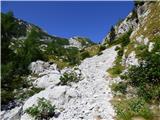 59
59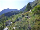 60
60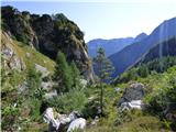 61
61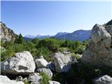 62
62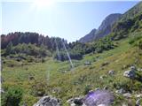 63
63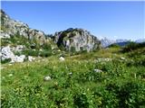 64
64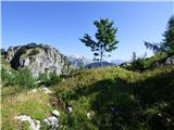 65
65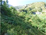 66
66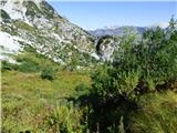 67
67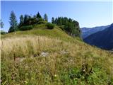 68
68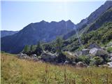 69
69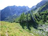 70
70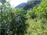 71
71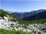 72
72 73
73 74
74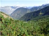 75
75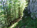 76
76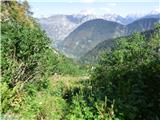 77
77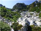 78
78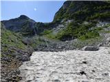 79
79 80
80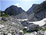 81
81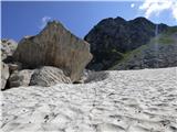 82
82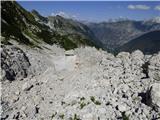 83
83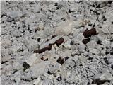 84
84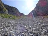 85
85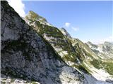 86
86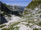 87
87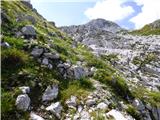 88
88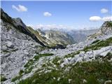 89
89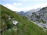 90
90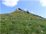 91
91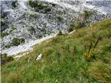 92
92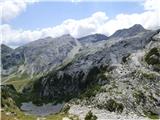 93
93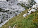 94
94 95
95 96
96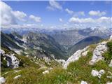 97
97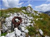 98
98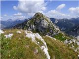 99
99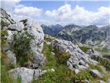 100
100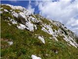 101
101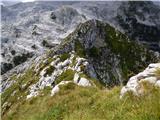 102
102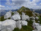 103
103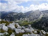 104
104 105
105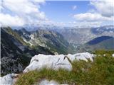 106
106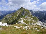 107
107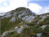 108
108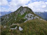 109
109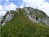 110
110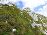 111
111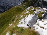 112
112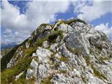 113
113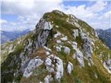 114
114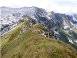 115
115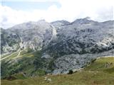 116
116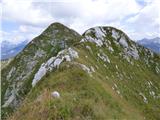 117
117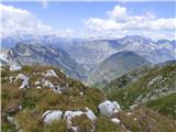 118
118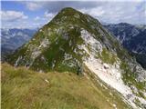 119
119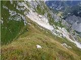 120
120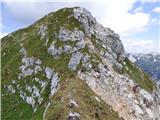 121
121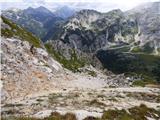 122
122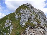 123
123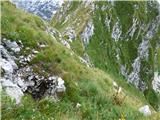 124
124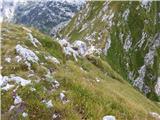 125
125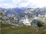 126
126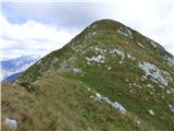 127
127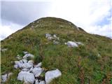 128
128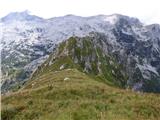 129
129 130
130 131
131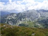 132
132 133
133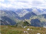 134
134
Discussion about the trail Lepena - Veliki Lemež (via Planina Zagreben)
|
| KarmenT27. 10. 2021 11:46:44 |
Na sliki 134 se z vrha vidi na levi strani Krnsko pogorje in verjetno je tam Krnčica, desno nad dolino pa ne znam poimenovati zaobljenega, poraščenega vrha. Morda kakšna ideja kateri vrh bi to bil?
|
|
|
|
| KarmenT27. 10. 2021 14:58:17 |
Hvala za poslano.  Sem mislila, da je pogled z vrha Velikega Lemeža proti zahodu, v poslanem zemljevidu pa je obkrožen Črni vrh, ki je bolj vzhodno. Tole mi ne gre.
|
|
|
|
| mirank27. 10. 2021 15:47:46 |
Prvi vršič je Debeljak, desno nad Lepeno je Č vrh, levo pa greben Kal-Vršič. Še bolj levo bi bil potem Polovnik pa šele nato greben Krnčice v jz smeri.
|
|
|
|
| KarmenT27. 10. 2021 16:34:29 |
Hvala!
|
|
|
|
| darinka423. 08. 2022 21:38:23 |
Koliko ur hoje je od bosanskega spomenika do vrha Lemeža?
|
|
|
|
| ppegan24. 08. 2022 07:15:09 |
Darinka, piše, da je od izhodišča do spomenika ura in pol, to pomeni, da je potem od spomenika do vrha še 4 ure in pol. Ko boste šli na Lemež, pazite, da bodo trave suhe, saj je drugače nevarno za zdrs. No, gleženj si lahko zviješ tudi na suhih travah, kot je to uspelo meni 
|
|
|
|
| darinka425. 08. 2022 06:57:47 |
Polona . Smo uspeli prehodit celotno pot. Bili smo presenečeni nad dolžino poti. Ure so pokazale 19km in 1800 višincev. Vedno pravim, dokler nisi tam ne veš. Sestopili smo tam ob podoru h Krnskim in potem še kar dosti hoje do Šunika. Itak zadnji del v temi. Poti od Zagrebena do sedla Potoče ni. Zahteven teren. Pod sedlom je ostalo veliko snežišče. Tudi zadnji del od Voglov do Lemeža je kar dolg. Dva gada smo videli v travah. Sicer res tura za tiste z dobro kondicijo.
|
|
|
|
| darinka45. 12. 2022 12:36:20 |
Morbet drugo leto s Krnskih na Debeljak in če se bo dalo na Lemež.
|
|
|