Starting point: Lenzanger (1550 m)
| Lat/Lon: | 47,08142°N 12,98469°E |
| |
Time of walking: 5 h 10 min
Difficulty: difficult marked way
Altitude difference: 1704 m
Altitude difference po putu: 1704 m
Map:
Recommended equipment (summer): helmet, ice axe, crampons
Recommended equipment (winter): helmet, ice axe, crampons
Views: 4.760
 | 3 people like this post |
Access to the starting point:
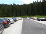
Drive through the Karavanke Tunnel into Austria, then continue along the Turkish Autobahn. We continue through the Katschberg Tunnel and later the Thuringian Tunnel / Tauerntunnel, and follow the motorway to Salzburg (aka Solnograd) only as far as the exit for Bischofshofen, from where we continue on the four-lane road to the aforementioned town. From Bischofshofen, follow the signs for Zell am See through the valley along the Salzach river. At the end of Taxenbach, turn towards Rauris. Continue along the Raurisertal valley through Rauris and Wörth. Then follow the ascending road until you reach the large parking lot of Lenzanger. In the last part of the road there is a toll (9€ - August 2013).
Path description:
From the parking lot, follow the signs "Naturfreundehaus" along the road, which is closed to traffic. The road, which becomes gravel just after the barrier, initially leads through the woods and leads to a crossroads. To the right, the road leads slightly downhill towards the mountain pasture Grießwiesalm, and we continue slightly left along the road towards the Naturfreundehaus hut.
The road then soon leads us out of the forest and along the Scheidbach stream with fine views towards the summit of Hoher Sonnblick. Here you soon reach a crossroads where you continue right over a bridge onto footpath 123 towards the Goldzechscharte and the Hocharn summit. Further along the road the path leads to the Naturfreundehaus hut.
After crossing the bridge, the trail briefly leads through slightly marshy terrain, and then leads through meadows to the south-west. The path then follows the scrub for some time and leads back to the vicinity of the stream. Here the path turns right and starts to climb steeply. A small steel cable helps us at the very beginning. The path then climbs mostly in switchbacks on grassy and occasionally scrubby terrain. Higher up, the scrub ends and the climb continues up grassy slopes, from which we have a good view of the Raurisertal valley and the nearby peaks. The north face of the nearby Hoher Sonnblick is particularly nice. The path on the grassy slopes turns slightly to the left and then crosses several small streams. As you approach the steeper slopes, which in summer are crossed by numerous streams and small waterfalls, the path turns right and climbs a little more steeply. Here you are climbing on rocky terrain to the north-west, and the path is not very visible, so you need to pay a little more attention to the markings. Higher up, the trail then turns slightly to the left and crosses some snowfields that linger well into the summer. The use of snowshoes and snowshoes is recommended when crossing. The trail then turns slightly more to the left and crosses the slopes to the west in a gentle ascent. This path then leads to a ridge near the Nördliche Goldzechscharte notch, where there is also a crossroads. At the crossroads where the view to the west opens up, continue to the right, and to the left the path leads to Goldzechkopf and on to the summit of Hoher Sonnblick. From the crossroads, the trail climbs mostly along the ridge next to the Hocharnkees glacier. In a short section, when the ridge becomes a little steeper, the path leaves the ridge to the right (east) side. Then it's back up to the ridge, from which the views get better and better. When you reach the summit (3203 m), the ridge turns slightly to the right. Continue along the ridge and soon reach the summit on a slightly steeper slope.

Pictures:
 1
1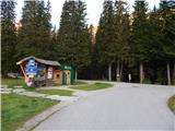 2
2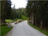 3
3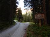 4
4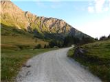 5
5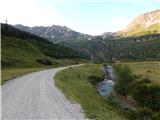 6
6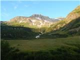 7
7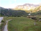 8
8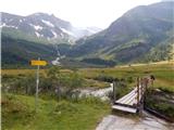 9
9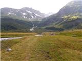 10
10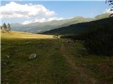 11
11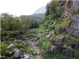 12
12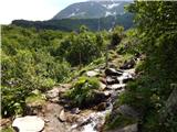 13
13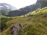 14
14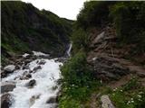 15
15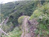 16
16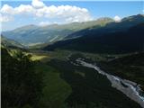 17
17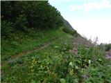 18
18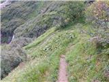 19
19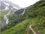 20
20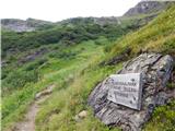 21
21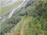 22
22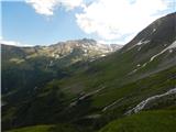 23
23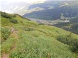 24
24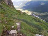 25
25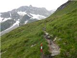 26
26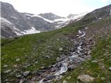 27
27 28
28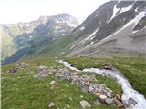 29
29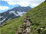 30
30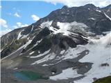 31
31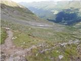 32
32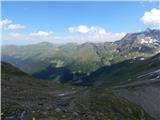 33
33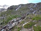 34
34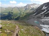 35
35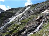 36
36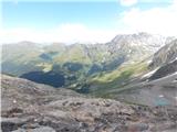 37
37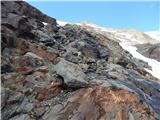 38
38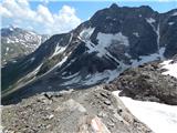 39
39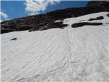 40
40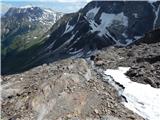 41
41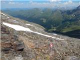 42
42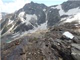 43
43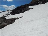 44
44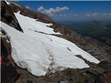 45
45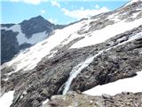 46
46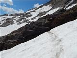 47
47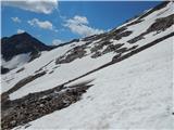 48
48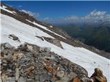 49
49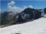 50
50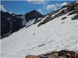 51
51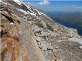 52
52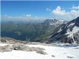 53
53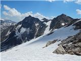 54
54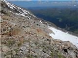 55
55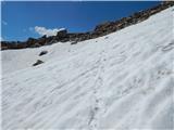 56
56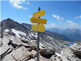 57
57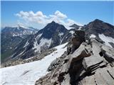 58
58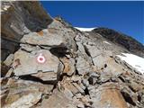 59
59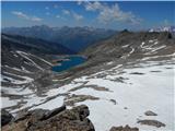 60
60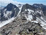 61
61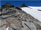 62
62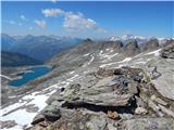 63
63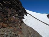 64
64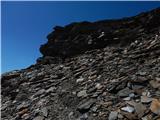 65
65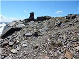 66
66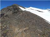 67
67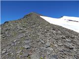 68
68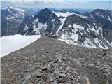 69
69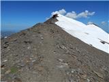 70
70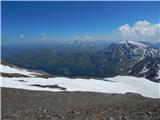 71
71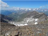 72
72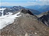 73
73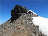 74
74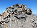 75
75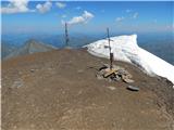 76
76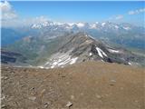 77
77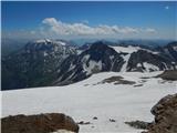 78
78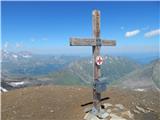 79
79
Discussion about the trail Lenzanger - Hocharn
|
| Robie30. 09. 2018 |
Cesta do zgornjega parkinga - 9EUR / prispela ob 21:30 med tednom in rampa bila dvignjena, pri povratku zjutraj v petek pa plačala pri izhodu, pustijo spat v avtodomu, poleg tudi wc. Pot solidno markirana kolikor lahko je zaradi terena. Sva pa tudi v septembru rabila dereze (za par korakov), čelada pa dobrodošla. Vode pa je v izobilju poleti in jeseni - prve 3 ure veliko ledeniških potokov tako, da nima smisla nositi zaloge za celo pot s parkirišča... 
|
|
|