Lech da Sompunt - Ciampani
Starting point: Lech da Sompunt (1455 m)
| Lat/Lon: | 46,59636°N 11,89473°E |
| |
Time of walking: 3 h 50 min
Difficulty: easy pathless terrain
Altitude difference: 1213 m
Altitude difference po putu: 1230 m
Map: Tabacco 07 1:25.000
Recommended equipment (summer):
Recommended equipment (winter): ice axe, crampons
Views: 688
 | 2 people like this post |
Access to the starting point:
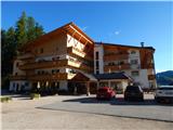
a) Access from Gorenjska: Drive through the Karavanke Tunnel into Austria, then continue to Spittal and on to Lienz (the motorway ends a little after Spittal). We continue along a relatively nice and wide road through the Drava Valley, which leads us into Itali. The road continues past Dobbiaco/Toblach and Brunico/Bruneck. Just after the last-mentioned town, which is passed by a bypass road, we turn left into the Val Badia valley. Continue along the valley to La Villa, where, a few metres after the signpost indicating the village, turn right towards Lake Lech da Sompunt. Follow the ascending road to the Hotel Sompunt, which is located on the shores of the lake.
b)From the coastal side: From Nova Gorica, take the exit for Itali and follow the motorway to Portogruaro, where at the motorway junction turn towards Belluno. Follow the motorway to its end (do not turn towards Belluno) and then continue to Cortina d'Ampezzo. When you arrive in Cortina d'Ampezzo, follow the signs for the Passo Falzarego Alpine Pass. At the Passo Falzarego (2105 m), turn right into the neighbouring Passo Valparola (2192 m), and from there descend into the Val Badia valley. At La Villa turn right towards Brunico/Bruneck. Just a few metres before the sign marking the end of La Villa, turn left towards Lech da Sompunt. Follow the ascending road to the Hotel Sompunt, which is located on the shores of the lake.
Path description:
At the lakeside parking lot, turn left onto the footpath after the signs "Sponata, Ütia de Puez". The path quickly leads to a road where there is a marked crossroads. Turn right and follow the road leading up the ski slope. Continue up the ski slope, from which you will have increasingly beautiful views of the Val Badia valley and the Lavarella mountain group. Higher up, we briefly join a mountain bike track, which we are reminded of by signs along the way. We continue to climb up the ski slope and soon see the Rifugio Sponata hut, which is then only a short climb away.
From the hut, where the view opens up towards Marmolada, we continue for a short time along a sloping macadam road, and then signs direct us right up the ski slope. After a short climb, the marked path leaves the ski slope and then climbs through the forest to the right of the ski slope. The path then leads to a crossroads where we join the path from the upper cable car station. At the marked crossroads, where the mountain bike trail also starts, continue along trail number 5 towards the Rifugio Gherdenacia hut.
Here you enter the Puez-Odle Nature Park and the well-maintained trail begins to climb steeply through increasingly sparse forest. The trail then turns slightly to the left and starts to cross quite steep slopes to the south. As it crosses, the trail initially continues to climb, but later becomes more level and in a few places descends slightly. The path then leads out of the forest to the mountain pasture Munt de Gherdenacia, where the Gherdenacia hut is also located.
At the hut where there are signs, continue westwards following the signs "Ütia de Puez". The path soon begins to climb and turns slightly right into a sparse larch forest and leads to a marked crossroads. The path to the left leads to the Sassongher summit, while we continue straight ahead and keep climbing along the increasingly sparse larch trees. For a short time we then climb gently up a grassy slope, and then we reach a narrow valley where there is another crossroads.
To the left is trail number 15 towards the Puez hut, and we continue up the narrow valley on trail number 11, which also leads to the Puez hut.
We then climb up the valley for some time and occasionally get beautiful views, especially of the Lavarella mountain group. The route here runs north-westwards to a marked crossroads near the summit of Ciampani.
At this crossroads, the left-hand path leads to the Puez hut, the right-hand path leads down to Badia Abtei, and we leave the marked paths and head northwards onto the trackless road. After a short climb, you will soon see the summit, which at first sight may seem difficult to reach because it is surrounded by steep ravines. The climb to the top is not difficult and is quickly reached by following the gentle slope above the ravines.

Pictures:
 1
1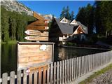 2
2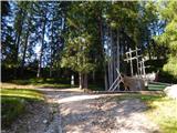 3
3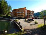 4
4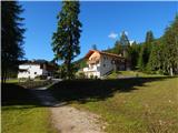 5
5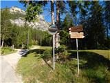 6
6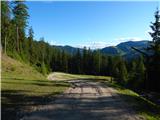 7
7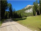 8
8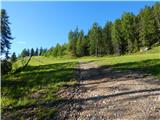 9
9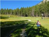 10
10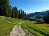 11
11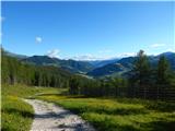 12
12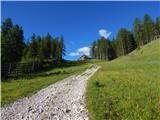 13
13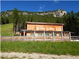 14
14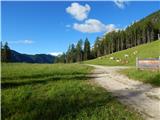 15
15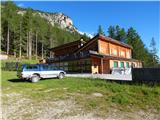 16
16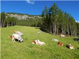 17
17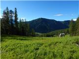 18
18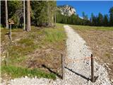 19
19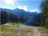 20
20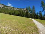 21
21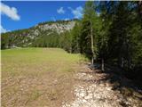 22
22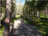 23
23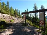 24
24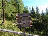 25
25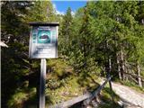 26
26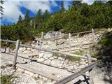 27
27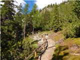 28
28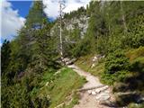 29
29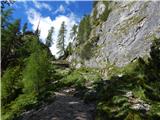 30
30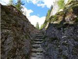 31
31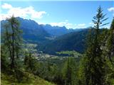 32
32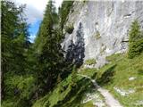 33
33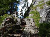 34
34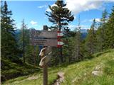 35
35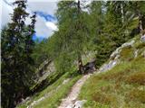 36
36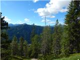 37
37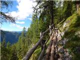 38
38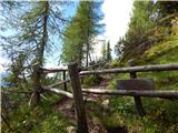 39
39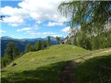 40
40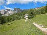 41
41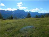 42
42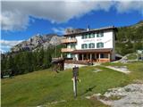 43
43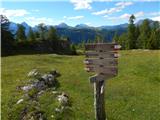 44
44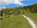 45
45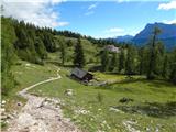 46
46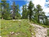 47
47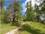 48
48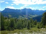 49
49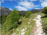 50
50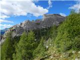 51
51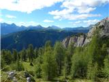 52
52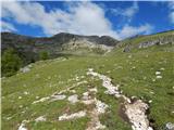 53
53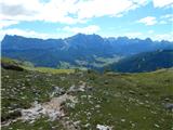 54
54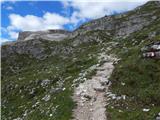 55
55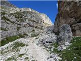 56
56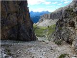 57
57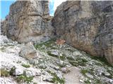 58
58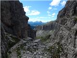 59
59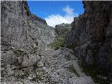 60
60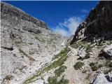 61
61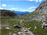 62
62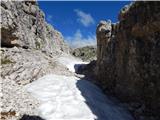 63
63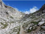 64
64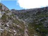 65
65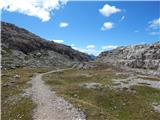 66
66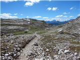 67
67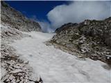 68
68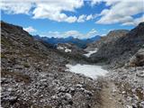 69
69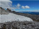 70
70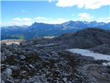 71
71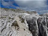 72
72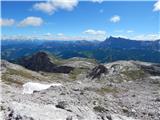 73
73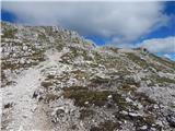 74
74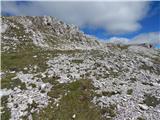 75
75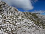 76
76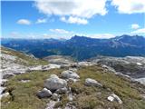 77
77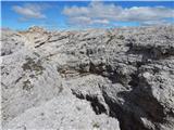 78
78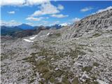 79
79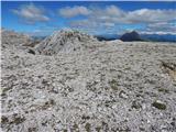 80
80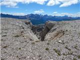 81
81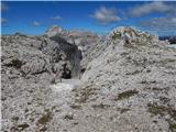 82
82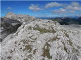 83
83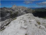 84
84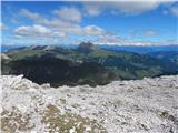 85
85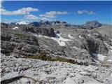 86
86
Discussion about the trail Lech da Sompunt - Ciampani