Laško - Krničarjeva koča na planini Javornik
Starting point: Laško (740 m)
| Lat/Lon: | 46,3256°N 14,3969°E |
| |
Time of walking: 2 h 15 min
Difficulty: easy marked way
Altitude difference: 650 m
Altitude difference po putu: 700 m
Map: Karavanke - osrednji del 1:50.000
Recommended equipment (summer):
Recommended equipment (winter): ice axe, crampons
Views: 7.214
 | 1 person likes this post |
Access to the starting point:
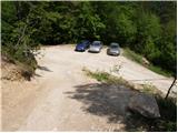
a) From the motorway Ljubljana - Jesenice, take the exit Kranj - East, then continue driving in the direction of Jezersko. When you reach Preddvor, leave the main road and turn left towards the centre of the town, and from there follow the signs for Bašelj. When we arrive in Bašelj, first at the beginning of the left turn in the direction of straight ahead there is a narrower road leading to the parking lot at the log cabin TD Bašelj (in the descriptions the starting point Bašelj), and from the mentioned crossroads we continue along the main road for another 100 m to the next crossroads, where we continue to the right along the road towards the Gamsovemu raje and the hamlet Laško (Laško hamlet). Only about 50 m further on, continue along the left-hand road, which gradually starts to climb moderately. At the hamlet of Laško, turn left again, then the asphalt ends and you continue along a steep macadam road, which you follow to a parking area, at a small crossroads. There are red mountain direction signs at the crossroads.
b) From the motorway Jesenice - Ljubljana, take the exit Kranj - West and continue left at the first junction. Continue through the underpass under the motorway and then to the roundabout, from where you continue in the direction of Golnik. The road continues through Mlaka pri Kranju, and at the end of the village we turn right in the direction of Srakovlje. Then drive through Srakovlje, Spodnja Bela, Srednja Bela, Zgornja Bela (in Zgornja Bela we join the road from Preddvor) to Bašlja, where the main road makes a long left turn, where a narrower road continues in a straight direction, leading to the parking area at the log cabin TD Bašelj (in the descriptions the starting point Bašelj), and from this junction we continue along the main road for another 100 m to the next junction, where we continue right along the road towards Gamsovem raje and the hamlet of Laško. Only about 50 m further on, continue on the left road, which gradually starts to climb moderately. At the hamlet of Laško, turn left again, then the asphalt ends and you continue along a steep macadam road, which you follow to a parking area, at a small crossroads. There are red mountain direction signs at the crossroads.
Path description:
From the parking lot, take the steep cart track towards Lovrenec. The steepness soon gives way and the path leads to a crossroads where the path to the church Sveti Lovrenc branches off to the right. We continue on the lower dirt track, which again climbs steeply and after a 15-minute walk from the car leads us to our home in Lovrenec. At the hut we continue along the path towards Storžič. After a few steps, the path leads us out of the forest and onto the meadows below the church. The church Sveti Lovrenc is reached in a few minutes on foot through the meadow. At the church, we turn slightly right into the wods, where a gently descending dirt track leads us to an undistinguished saddle, where we join the path from a slightly higher starting point. Continue in the route Storžič on the cart track, which climbs gently. After a few minutes, Cart track turns into a footpath which starts to climb steeply through the forest. After about half an hour's walk from where the track ends, you emerge from the forest. Beautiful views of the southern slopes of Storžič open up. The steepness of the trail does not let up for another 30 minutes to the bench at the crossroads. Continue to the left towards Javornik and Poljana (Kališče on the right). The trail continues westwards across the southern slopes of Storžič with a few short descents and ascents. After 20 minutes of crossing, you reach a crossroads in the south-western ravine of Storžič. Planina Javornik is visible to the left and can be reached in a few minutes on a steep grassy slope.

Pictures:
 1
1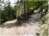 2
2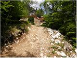 3
3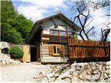 4
4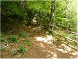 5
5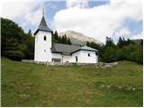 6
6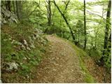 7
7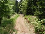 8
8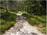 9
9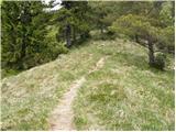 10
10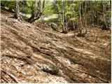 11
11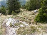 12
12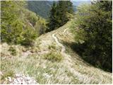 13
13 14
14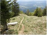 15
15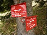 16
16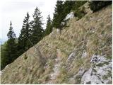 17
17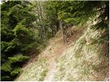 18
18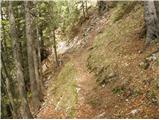 19
19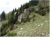 20
20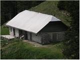 21
21
Discussion about the trail Laško - Krničarjeva koča na planini Javornik