Starting point: Kubed (233 m)
| Lat/Lon: | 45,5197°N 13,8699°E |
| |
Time of walking: 45 min
Difficulty: easy marked way
Altitude difference: 218 m
Altitude difference po putu: 235 m
Map: Slovenska Istra - Čičarija, Brkini in Kras 1:50.000
Recommended equipment (summer):
Recommended equipment (winter):
Views: 11.732
 | 2 people like this post |
Access to the starting point:
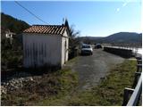
From the motorway Ljubljana - Koper take the exit Črni Kal. From Črni Kal, continue along the old road towards the sea, and we take it only as far as the next slightly larger crossroads, where we turn left towards Border crossing Sočerga. Follow the road to Kubed, where you will see a chapel next to the bus stop and a suitable parking space next to it (the starting point is in the immediate vicinity of the Jakomin Inn).
The starting point can also be reached from the coast via Prade, Pobegi, Čežarji and Sveti Anton.
Path description:
Behind the chapel, you will notice markings on the electricity pylon, which direct you right down to the stream, which you cross and then on the other side you begin to climb first gently and then moderately up the fleecy stacks. The path initially still offers some views of Kubed, but then passes into a pine groove, through which it climbs steeply. Above a short rock step, the path lays down, and we continue to follow the otherwise fairly dense markings carefully, due to the numerous crossroads. Next, the path, which is relatively winding, continues through scrub, and partly through pine groves and through karst meadows, which are quite overgrown in summer. Follow this winding path, which is relatively well marked throughout, all the way to the top of Lačná, which is reached after about 45 minutes' walk from the starting point.
From the top, you can climb to the lookout tower, which offers a beautiful view of Slavnik, Učka, the Gulf of Trieste and, in good weather, all the way to Dolomites and the Julian Alps.

Pictures:
 1
1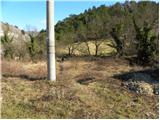 2
2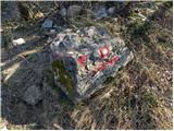 3
3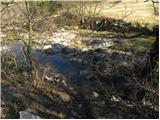 4
4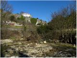 5
5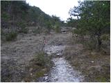 6
6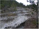 7
7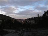 8
8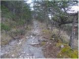 9
9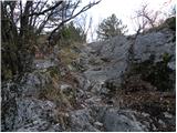 10
10 11
11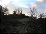 12
12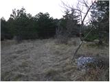 13
13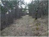 14
14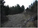 15
15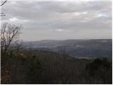 16
16 17
17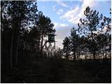 18
18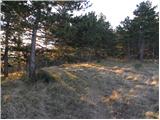 19
19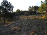 20
20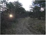 21
21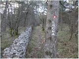 22
22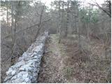 23
23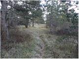 24
24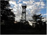 25
25 26
26 27
27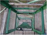 28
28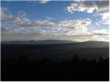 29
29
Discussion about the trail Kubed - Lačna
|
| wolphgang21. 02. 2011 |
a je res, da vodi na lačno tudi ena zelo zahtevna pot? vsaj tako sem nekaj zasledil, pa se ne spominjam več kje
|
|
|
|
| Tadej22. 02. 2011 |
Verjetno misliš zelo zahtevno plezalno pot bratov Ivančičev čez Majino polico na Zjat (vrh nad Kraškim robom, točneje nad Podpečjo). Slika
|
|
|
|
| wolphgang22. 02. 2011 |
aha, verjetno bo ta tista, ki sem mislil. A mi jo zna kdo primerjat s kakšno drugo po zahtevnosti(npr. z Gradiško Turo)
|
|
|
|
| Tadej22. 02. 2011 |
Sicer nisem prepričan, ampak kolikor sem zasledil, je omenjena plezalna pot zaprta. Menda, da zaradi gnezdenja redkih vrst ptic.
|
|
|
|
| janezz6. 05. 2012 |
Če nadaljujete pot v Komare doline in nato do sv. Kvirika in Orlovega gnezda, bodite pozorni na odcep poti na desno. To je bil tudi naš načrt, ampak nas je pot pripeljala v vas Smokvice. Do kolovoza na grebenu smo se prebili kar skozi gozd ...
|
|
|
|
| B27. 05. 2012 |
Ja oglašam se malo kasno. Pot iz Podpeči na Zjat (je bila) zelo zahtevna! Pot pa je zaprta zaradi tega, ker so domačini v spodnjem delu porezali skobe in kline in je sedaj neprehodna... Zaprta je tudi pot skozi steno Štrkljevico (po Majini polici) in to zaradi gnezdenja ptic. Tudi ta pot (je bila) zelo zahtevna, stopi so s strani domačinov zabetonirani in klini populjeni... Na priporočilo DOPS-a pa je opuščena (in ni zaprta) tudi planinska pot mimo orlovega gnezda nad Mlini pri Velem Badinu...
|
|
|
|
| vyjana5. 06. 2020 |
Lehká, dobře značená, většinou po lesní pěšině.
Příjemná procházka.
|
|
|
|
| montura6. 06. 2020 |
jsem rada, že se vam to libilo 
|
|
|