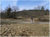
Starting point: Krog (215 m)
| Lat/Lon: | 45,4548°N 13,9269°E |
| |
Time of walking: 1 h 15 min
Difficulty: easy marked way
Altitude difference: 193 m
Altitude difference po putu: 225 m
Map: Slovenska Istra - Čičarija, Brkini in Kras 1:50.000
Recommended equipment (summer):
Recommended equipment (winter):
Views: 7.146
 | 1 person likes this post |
Access to the starting point:
From the motorway Ljubljana - Koper take the exit Črni Kal. From Črni Kal, continue along the old road towards the sea, and we take it only as far as the next slightly larger crossroads, where we turn left towards Border crossing Sočerga. Follow the road past Kubed to the village of Gračišče, where you turn left at the junction in the direction of Rakitovec, Movraž and Smokvica. From Gračišče, drive to the village of Movraž, and turn right in the direction of Dvory. Before the village Dvori we come to the next crossroads, where we take a sharp right (left Dvori), and we follow the road for a few 100 m to the mountain direction signs that we see along the road. Park in a suitable place next to the mountain signs.
Path description:
From the starting point, follow the marked footpath towards the Natural Bridge and St Kvirik. After a few steps, the path leads to an unmarked crossroads, where it splits into an old left path and a new right path.
Walking along the old, albeit more interesting, path, which leads past the Natural Bridge, is not recommended for the preservation of rare bird species, so continue along the right, newly created mountain path. The path continues to climb gently to moderately, crossing bush-covered slopes to the right. A little higher up, we leave the wide path as the markings direct us sharply to the left onto an initially well-traced path that begins to climb steeply. Soon the path is lost among the tall grasses and bushes, and we continue straight up the slope, where we quickly reach the path leading from St Kvirik towards the Vele Badin undermines.
Here, where an old and much more interesting path joins us from the left, we continue to the right and continue our ascent along a well-trodden path that continues along the edge of a partly precipitous ridge. The path then crosses a short lane of forest, and then again passes onto uncultivated slopes, from which we have beautiful views. The way ahead quickly returns to the ridge, which is followed with a few ascents and short descents to a point where a 50 m long path branches off to the left, leading to the nearby Bunker (a small natural window containing the registration book). Here you continue straight ahead and after a short climb you arrive at the RTV converter above Sočerga.
Go around the converter on the right and follow the path as it begins to descend to the nearby church of St Kvirik.

Pictures:
 1
1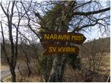 2
2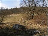 3
3 4
4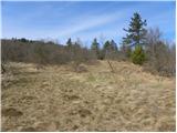 5
5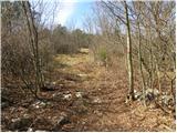 6
6 7
7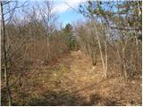 8
8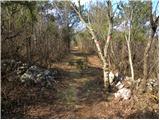 9
9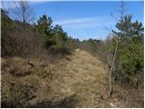 10
10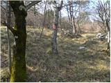 11
11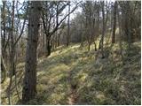 12
12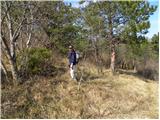 13
13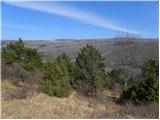 14
14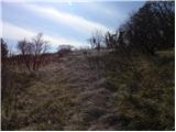 15
15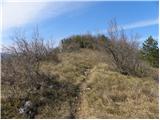 16
16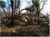 17
17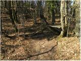 18
18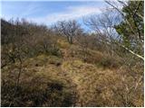 19
19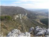 20
20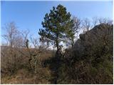 21
21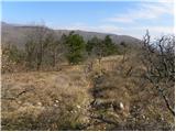 22
22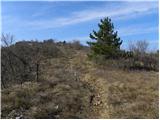 23
23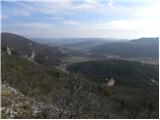 24
24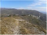 25
25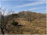 26
26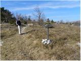 27
27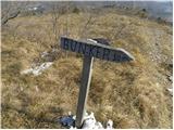 28
28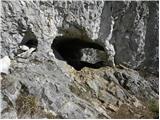 29
29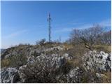 30
30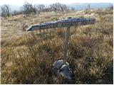 31
31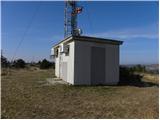 32
32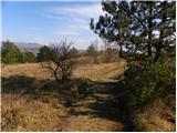 33
33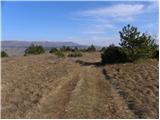 34
34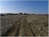 35
35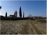 36
36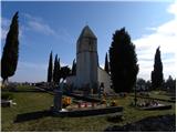 37
37
Discussion about the trail Krog - Sveti Kvirik
|
| VanSims20. 11. 2011 |
Pri dostopu do izhodišča zadnji odcep desno morda laže opazimo, iz smeri Dvorov(kjer obrnemo če smo zgrešili). V tem primeru gremo blago levo tam kjer piše v opisu 'ostro desno'. V prvem ovinku pa tudi ne zapeljemo naravnost na makadam temveč ostro zavijemo na levo t.j. ostanemo na razmahanem asfaltu dokler ne pridemo do smerokazov.
|
|
|