Krnica (bridge over Radovna) - Source of Lipnik
Starting point: Krnica (bridge over Radovna) (620 m)
| Lat/Lon: | 46,3784°N 14,0543°E |
| |
Time of walking: 50 min
Difficulty: easy marked way
Altitude difference: 40 m
Altitude difference po putu: 45 m
Map: TNP 1:50.000
Recommended equipment (summer):
Recommended equipment (winter):
Views: 1.410
 | 1 person likes this post |
Access to the starting point:
a) Take the Bled, then follow the signs for Pokljuka. In the route of Pokljuka, drive to the settlement Cirque, where turn right downhill towards Mojstrana, Zgornja Radovna and Krma. After a short descent, cross the river Radovna over a bridge, turn right after the bridge and park at the information board.
b) Leave the Gorenjska motorway at exit Jesenice East (Lipce), then follow the signs for Spodnje Gorje. Follow the ascent to Kočna, then slowly start descending towards the valley Radovna. After crossing the river Radovna, there is again some climbing, and in Spodnje Gorje, where the road from Bled joins, we continue in the direction of Pokljuka. In the direction of Pokljuka, drive to the settlement Cirque, where turn right downhill in the direction of Mojstrana, Zgornja Radovna and Krma. After a short descent, cross the river Radovna over a bridge, turn right after the bridge and park at the information board.
Path description:
From the starting point, from where a beautiful view of the dam on the river Radovna opens up, continue along the asphalt road in the direction of Mojstrana, Zg. Radovna and Krma. At the end of the settlement Cirque, we enter the Triglav National Park, and we follow the road that runs along the left bank of the Radovna River. At the 2. 5 km road marker we reach the Gorje hydroelectric power station, and a few 10 m further on, signs for the Lipnik spring direct us left onto a side road, which leads us over a bridge to the other side of the river. A little further on, at a small crossroads, continue left to cart track (straight to the Lipnikar homestead), and a few steps further on, cross the Lipnik stream over a small bridge. On the other side of the stream, go right, where you continue for a short distance on cart track, and then the path narrows. Following the less well-trodden path, you will quickly reach an information board and, a little further on, the source of the Lipnik.
Description and pictures refer to the situation in 2019 (May).

Pictures:
 1
1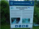 2
2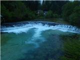 3
3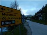 4
4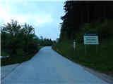 5
5 6
6 7
7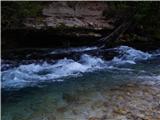 8
8 9
9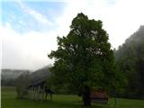 10
10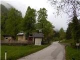 11
11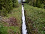 12
12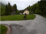 13
13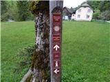 14
14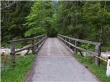 15
15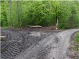 16
16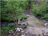 17
17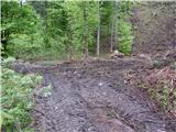 18
18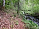 19
19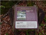 20
20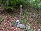 21
21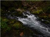 22
22
Discussion about the trail Krnica (bridge over Radovna) - Source of Lipnik