Kočna - Vrše (by ski slope)
Starting point: Kočna (660 m)
| Lat/Lon: | 46,4179°N 14,0831°E |
| |
Name of path: by ski slope
Time of walking: 45 min
Difficulty: easy unmarked way
Altitude difference: 190 m
Altitude difference po putu: 190 m
Map: TNP 1:50.000
Recommended equipment (summer):
Recommended equipment (winter): ice axe, crampons
Views: 2.064
 | 3 people like this post |
Access to the starting point:
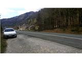
From the motorway Ljubljana - Jesenice take the exit Lipce, where you turn left in the direction of Blejska Dobrava and Spodnje Gorje. Soon after crossing the railway underpass, we are at the next crossroads, where we turn right - Bled, Kočna. The road, serpentine at first, climbs straight westwards and soon reaches the summit or settlement of Kočna in a left turn. Our starting point is on the left side of the road, a few metres before the local sign. Because of the unbroken line, continue past the first houses, where you will see a bus stop on the right. Here we turn around and go back, almost to the bend, before descending back down into the valley. We stop in a gravel parking lot.
Path description:
From the starting point, follow the road back towards the village. After 250 m, a few metres before the bus stop, turn right onto a narrow, asphalted side road on your left, which takes you past a few houses and up a small hill. After a left turn, the road flattens out and loses its asphalt surface, leading to a larger meadow. Continue along cart track, which initially keeps slightly to the left and climbs slightly along the edge of the wood, passing a pasture on the right. Soon you will find yourself on a saddle between two peaks - Žerjavec and Vršami, where there is a crossroads. Here, take a sharp right onto the first (initially rough) path, which climbs uphill (the second is a gentle path to Blejska Dobrava). After a short climb, you will come across a bench and continue along this path, which narrows further and climbs a little steeper towards the summit of Vrš. After the path turns left and the steepness eases, you can enjoy the view of Koroška Bela and Javorniški Rovt. In a short while, we enter a mixed forest, through which, after a short and gentle ascent, the path leads us to the top of the 850 m high Vrše hill. Here, on the left, you will see a path descending to the eastern slope. After descending a few metres towards the valley, another path joins us from the left (a shortcut from the path we took to get to the top), and we continue descending for a short time. We soon come across a fence behind which there is a hunting lodge. A little lower, at a place arranged for this purpose, cross the fence. Near the pleasant hut you can enjoy the view of the Ljubljana basin, part of the Blejska Dobrava, and the Breznik villages of the (so called) Dežele.

Pictures:
 1
1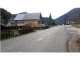 2
2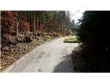 3
3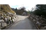 4
4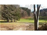 5
5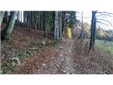 6
6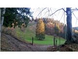 7
7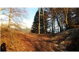 8
8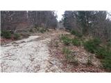 9
9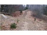 10
10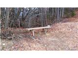 11
11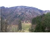 12
12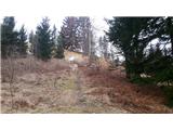 13
13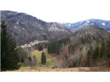 14
14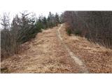 15
15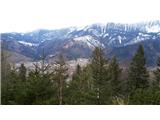 16
16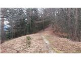 17
17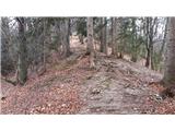 18
18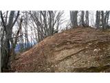 19
19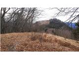 20
20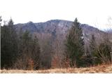 21
21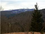 22
22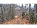 23
23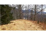 24
24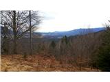 25
25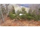 26
26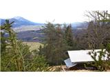 27
27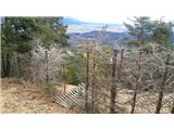 28
28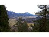 29
29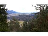 30
30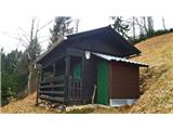 31
31
Discussion about the trail Kočna - Vrše (by ski slope)
|
| Jusk3. 01. 2020 |
Ker ni drugega opisa te poti bom napisal sem..naredil krog Blejska dobrava-Sv.Katarina-okrog Homa do gorjanske strani Vintgarja-po "strmi poti" ,nekje na pol "strme poti" proti Bl.dobravi je neoznačen odcep proti Borštu in Vršam,grem na Vrše in dol proti Bl.dobravi po poti označeni z rumenimi markacijami. Pot okoli Homa blatna,na Vršah in proti Bl.dobravi pa večinoma suha(ponavadi je blatna in mokra). Prijeten pohod in lep (pre)topel dan 
|
|
|