Starting point: Kočna (660 m)
| Lat/Lon: | 46,4179°N 14,0831°E |
| |
Time of walking: 40 min
Difficulty: easy pathless terrain
Altitude difference: 230 m
Altitude difference po putu: 230 m
Map: TNP 1:50.000
Recommended equipment (summer):
Recommended equipment (winter): ice axe, crampons
Views: 2.543
 | 2 people like this post |
Access to the starting point:
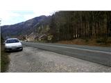
From the motorway Ljubljana - Jesenice take the exit Lipce, where you turn left in the direction of Blejska Dobrava and Spodnje Gorje. Soon after crossing the railway underpass, we are at the next crossroads, where we turn right - Bled, Kočna. The road, serpentine at first, climbs straight westwards and soon reaches the summit or settlement of Kočna in a left turn. Our starting point is on the left side of the road, a few metres before the local sign. Because of the unbroken line, continue past the first houses, where you will see a bus stop on the right. Here we turn around and go back, almost to the bend, before descending back down into the valley. We stop in a gravel parking lot.
Path description:
From where you parked, first cross the road carefully and return along the other side of the road about 20 m downhill. Here you will see a green sign with the inscription "hiking trail 6", where you continue into the forest in the route indicated by this sign. Turn right here and you will soon come across the first signpost, which directs you left uphill to an undistinguished ridge. The path climbs a little more steeply, but soon turns more to the left to the south, and then lays down. For a short time the path even descends slightly, then turns right up the bank and then left over the rocks. From here on, the path leads first briefly out of the forest and then back into a predominantly deciduous forest, where it climbs moderately. After a good 20-minute walk from the starting point, we come across a small signpost along the way with the inscription "Baba 5 min", where we turn right, and after crossing the slope for a few minutes, we arrive in the vicinity of Poljanska Baba, where we can enjoy the view.
From behind Poljanska Baba, continue slightly to the right (north-west direction) along the slope. The almost imperceptible path first descends for a few metres and then crosses the slope for a short distance at an unchanged altitude. Here you encounter obstacles in the form of many fallen trees. Near a fairly wide ravine, the path descends a little further towards the latter and crosses it. If we have somehow managed to detect the path up to this point, we will be able to follow it only a few metres out of the ravine, where it climbs up a rather steep wooded slope, partly covered with grass. As you climb this pathless section, bear slightly to the right towards the top of the forest ridge that you can see ahead. With a bit of luck, towards the top, you may again come across the remains of the path and climb up onto the ridge, where a slightly more obvious path reappears. Turn right and follow the increasingly rocky ridge in an easterly direction, where you will reach the trail's destination in a few minutes - the Kres nad Kočno viewpoint. A few metres below the summit, looking in the direction of the village, you can also see a wooden cross.

Pictures:
 1
1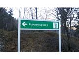 2
2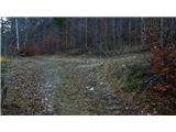 3
3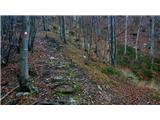 4
4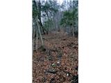 5
5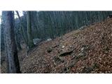 6
6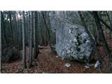 7
7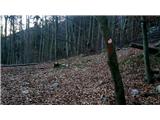 8
8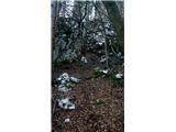 9
9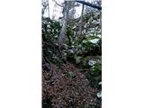 10
10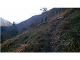 11
11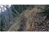 12
12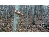 13
13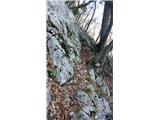 14
14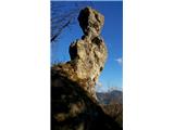 15
15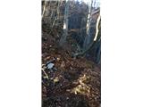 16
16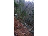 17
17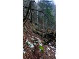 18
18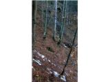 19
19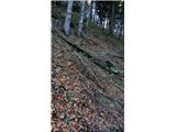 20
20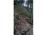 21
21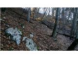 22
22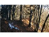 23
23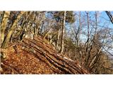 24
24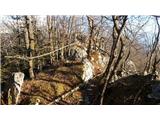 25
25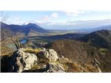 26
26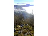 27
27
Discussion about the trail Kočna - Kres nad Kočno