Koča pri Savici - Mahavšček (via Bogatin)
Starting point: Koča pri Savici (653 m)
| Lat/Lon: | 46,2896°N 13,8022°E |
| |
Name of path: via Bogatin
Time of walking: 5 h
Difficulty: partly demanding marked way
Altitude difference: 1355 m
Altitude difference po putu: 1450 m
Map: TNP 1:50.000
Recommended equipment (summer): helmet
Recommended equipment (winter): helmet, ice axe, crampons
Views: 23.775
 | 3 people like this post |
Access to the starting point:
From the Ljubljana - Jesenice motorway, take the Lesce exit and follow the road towards Bled and on to Bohinjska Bistrica. Continue driving towards Bohinjsko jezero (Ribčev laz), at which you will come to a crossroads, where you will continue straight along the left (south) side of the lake in the direction of Ukanec and the Savica waterfall. Follow this increasingly narrow road to the large parking lot at the Savica cottage. There is a charge for parking.
Path description:
From the parking lot, follow the wide footpath towards the Savica waterfall and the Komna home. After a short ascent, the path leads us to a marked crossroads where the tourist path to the right branches off towards the Savica waterfall, and we continue slightly to the left or straight along the wide footpath in the direction of Komna. The path continues to climb for a short time along Savica, and then leads us to the first of the 48 marked serpentines. After an hour and a half of moderate ascent through the forest, the path leads us to the 48 serpentine from which we have a beautiful view of Lake Bohinj. Here the path turns slightly to the right and passes into the valley called Pekel, where it climbs gently for a while, then turns to the right and climbs slightly steeper again. After only a few 10 paces, the path turns left again and continues to climb parallel to the valley. The path, which is steep to moderately steep, gradually turns into a more sparse forest, from which you can soon see the house on Komna. The way forward leads us past a small man-made cave, and higher up, past a natural abyss, which is fenced off to prevent any of the hikers from falling into it. Next, the path climbs a little more and after a few steps of further walking leads us to a crossroads where the path to the right branches off to the Black Lake.
Continue straight ahead on the wide path (mulatjeri), which takes you just a little higher to the next crossroads. Continue again to the left (to the right the cottage at Triglav Lakes) along the path, which climbs a little more steeply and after a few minutes of further walking leads us to the hut at Komna.
From the home, continue right (left Vogel, Tolminski Kuk and mountain pasture Govnjač) along the marked path towards the hut below Bogatin. Next, a pleasant and completely level path leads in 15 minutes' walk to Planina na Kraju, in the middle of which stands the hut Koča pod Bogatinom.
On the other side of Mountain pasture, a path branches off to the right towards Mountain pasture Za Skalo, and we continue straight on along a wide mulatier in the direction of Bogatinsko sedlo and Krn. The path then ascends crosswise over the relatively steep slopes of Srednji vrh, skirting the valley of Gracija on the right. The trail then climbs considerably further to the left, where it approaches the steep slopes of Bogatin. The path then curves to the right and leads to Bogatinsko sedlo, from which a fine view of Krn opens up. At the saddle, continue left (straight down Krn and Krnsko jezero, right Lanževica) along the path, which leads us in a few minutes to the initially unmarked ridge Bogatin. The way forward begins to climb steeply on the very steep and crumbly north-west ridge Bogatin (danger of slipping and falling rocks). Higher up, the ridge narrows a little more, and the path lays down and leads us in a few 10 steps to the top of (Little) Bogatin.
From Bogatin continue along the ridge path, which begins to descend steeply towards the saddle between Bogatin and Mahavščko (due to the considerable steepness, there is a risk of slipping). From the saddle (which can also be reached by the marked path that bypasses the summit of Bogatin on the south-west side, the latter is much easier) continue along the ridge path, which begins to climb again. Higher up, the ridge path retreats to the Bohinj side, where it climbs crosswise over small scree fields. Next, the path returns to the main ridge and, after a few minutes of further walking, leads us to the top of Mahavščka.
Starting point - Dom na Komni 2:30, Dom na Komni - hut Koča pod Bogatinom 15 minutes, hut Koča pod Bogatinom - Bogatinsko sedlo 1:15, Bogatinsko sedlo - Bogatin 30 minutes, Bogatin - Mahavšček 30 minutes.

On the way: Jama ob poti na Komno (1303m),
Odcep k Črnemu jezeru (1411m),
Brezno pod lovsko kočo na Komni (1430m),
Spominska plošča Mateju Koblarju (1481m),
Pri Hubertu (1492m),
Dom na Komni (1520m),
Piramida (1520m),
Koča pod Bogatinom (1513m),
Bogatinsko sedlo (1803m),
Bogatin (1977m),
Sedlo med Bogatinom in Mahavščkom (1909m)
Pictures:
 1
1 2
2 3
3 4
4 5
5 6
6 7
7 8
8 9
9 10
10 11
11 12
12 13
13 14
14 15
15 16
16 17
17 18
18 19
19 20
20 21
21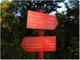 22
22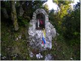 23
23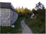 24
24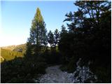 25
25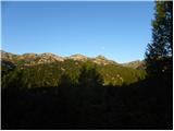 26
26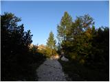 27
27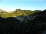 28
28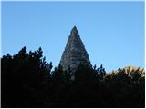 29
29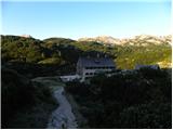 30
30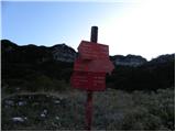 31
31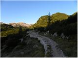 32
32 33
33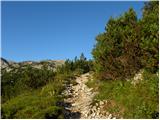 34
34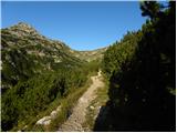 35
35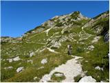 36
36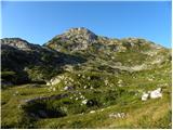 37
37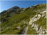 38
38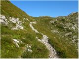 39
39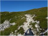 40
40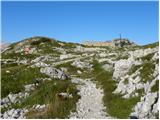 41
41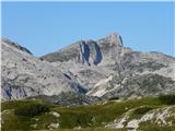 42
42 43
43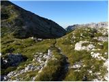 44
44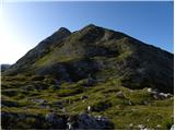 45
45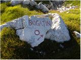 46
46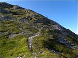 47
47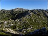 48
48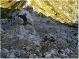 49
49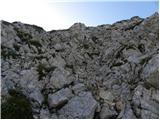 50
50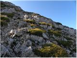 51
51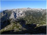 52
52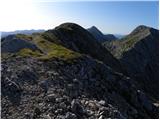 53
53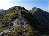 54
54 55
55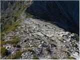 56
56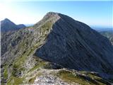 57
57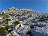 58
58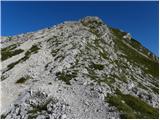 59
59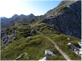 60
60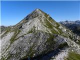 61
61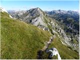 62
62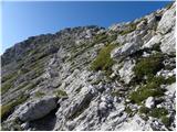 63
63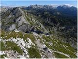 64
64 65
65
Discussion about the trail Koča pri Savici - Mahavšček (via Bogatin)
|
| VanSims13. 06. 2010 |
Čelada pri tej turi je mogoče bolj potrebna do Komne po tistih serpentinah.
Drugače se pa sliši strašno: 48 serpentin. Ampak so čisto položne. Do Bogatinskega sedla je pravzaprav zelo položno in primerno tudi za začetnike.
Potem je pa pot iz Malega Bogatina do sedla med Bogatinoma pa res malo nevarna. Kdor ni vajen je morda lažje da se spusti nazaj do Bogatinskega sedla in potem obide Mali Bogatin in nadaljuje na Mahavšček.
Za spust pa je morda lažja pot čez Govnjač.
|
|
|
|
| katty13. 08. 2012 |
Pot do Domna na Komni je meni bolj prijetna čez Komarčo, saj se kar hitro vzpenjaš, pa še varovala so v odličnem stanju in pot sama je kar čudovita  . Le od Črnega jezera do Komne se res vleče ko čreva  . Od tu naprej sva(smo) sicer imeli kar gosto meglo, tako da nisva imeli nobenih razgledov. Mogoče je res del poti kar precej izpostavljen in strm, za kkšne začetnike z vrtoglavico verjetno neprimeren. Spust čez planino Govnjač pa prava poezija . Priporočam.
|
|
|
|
| Ruzowski23. 06. 2014 |
V soboto opravljena tura (sicer ne iz savice ampak iz Lepene) Lepena-krnska jezera-bogatinsko sedlo-mali bogatin-mahavšček-bogatinsko sedlo-lanževica-sedlo-krnska jezera. Zimska oprema ostala v nahrbtniku, nekaj snežišč, ki se jih da izognit. Mahavšček hladen in v megli, rokavice in kapa še kako pašejo. Lanževica malo po svoje, pravljična samota pri jezeru. Kljub opozorilom , še vedno ljudje brez osnovne opreme, kratke hlačke, sprehajalni čeveljci, prečenje snežišč pod sedlom kljub kopni desni poti..Ob pogledu na cepin pa vprašanje "A si bil na mont blancu"? 
|
|
|
|
| Enka27. 06. 2020 |
A drži, da je spust z Bogatina proti Mahavščku precej težji od spusta nazaj na Bogatinsko sedlo?
|
|
|
|
| Enka27. 06. 2020 |
@A drži, da je spust z Bogatina proti Mahavščku precej težji od spusta nazaj na Bogatinsko sedlo?
Mislim, ali je bistveno bolj zoprn? Grušč, strmina?
|
|
|
|
| Gogl27. 06. 2020 |
Nič posebnega,
od daleč zgleda zoprn od blizu pa je čisto prijazen. Prej se kam spotakneš proti sedlu.
Lp
|
|
|
|
| NVF13. 09. 2020 |
Novi valjasti skrinjici za vpisno knjigo manjka pokrov. Stara kvadrasta vsebuje prepolno vpisno knjigo. Kliče po menjavi. Žiga nisem videl, res pa ga tudi nisem iskal.
|
|
|
|
| smatjaz14. 09. 2020 |
Tudi jaz nisem na vrhu našel žiga, se ga pa dobil v koči pod Bogatinom.
|
|
|