Kneške Ravne - Tolminski Kuk (via Škrbina)
Starting point: Kneške Ravne (720 m)
| Lat/Lon: | 46,2157°N 13,8265°E |
| |
Name of path: via Škrbina
Time of walking: 6 h 15 min
Difficulty: easy unmarked way, partly demanding marked way
Altitude difference: 1365 m
Altitude difference po putu: 1580 m
Map: TNP 1:50.000
Recommended equipment (summer): helmet
Recommended equipment (winter): helmet, ice axe, crampons
Views: 1.140
 | 1 person likes this post |
Access to the starting point:
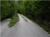
From the Bača pri Modreju - Podbrdo road, in the Kneža settlement, turn onto the road in the direction of Kneške Ravenske. Continue up the road, which continues along the valley of the Kneža stream. The road, which is at first quite slippery and partly macadam, starts to climb steeply higher up, and on the steep part the road is mostly asphalted. Higher up, the road splits, and we take the slightly left road, which is still asphalted and leads to Kneške Ravne (slightly right, a dirt road leading in the direction of mountain pasture in Prodih). We cross the picturesque Prošček stream, and then climb quickly to the parking lot in front of Kneške Ravne, where we park.
Path description:
From the parking lot, where there is an information board about Kneške Raven and the surrounding area, continue uphill, and at the first crossroads, by the NOB (National Liberation) memorial, go straight ahead (on the left, the homestead at Jakop and the homestead at Jakln). The road soon turns left, and the road to the homestead at Francu branches off to the right. Go straight ahead here too, and at the next crossroads go slightly right (the homestead at Pologar to the slight left). The asphalt road splits again, and this time we take the left path (right to reach the homestead at Francu), which loses its asphalt coating and leads us over a pasture fence. We continue up the cart track, which takes us above the orchard, then turns left and takes us through the lane of the forest and over several grazing fences to a crossroads by a small partly stone byte. Go right here, and cart track, higher up, turns left again, and then in a few minutes leads to a hunting observation post. At the hunting observation post, take a sharp right, then immediately left from the worse cart track, straight up the slope. After a short climb, a path appears, mostly climbing transversely through the forest, leading parallel to the edge of the nearby hayfield. Higher up, you reach the ridge between the Ljubinjski Steni and Masovnik, where the track becomes more distinct and takes you to the other, western side of the ridge. The path, along which you can see some old, rather faded markings, later starts to climb crosswise. Higher up, you reach scree scree and within a few minutes you reach a crossroads at the foot of the Ljubinjske rocks.
Continue left towards mountain pasture Razor (right mountain pasture to Prodih and Rut), and the trail leads directly under the cliffs, where there is an increased chance of falling rocks, especially in spring. There is a cross-climb and the path leads into the forest, where it leads past a spring. After the spring, the path climbs steeply and after two serpentines, it flattens out again. A little further on, we cross a grazing fence, and the path leads us out of the forest to the upper part of the mountain pasture Kuk, to an area called Močila, where we pass a few huts on the lower side. After the huts, you reach a carriage road, which you follow to the right (to the left mountain pasture Kuk and the parking lot), and quickly reach a crossroads, where the path to Žabiški Kuk (also called Žabijski Kuk) branches off to the right - the path past Gradič (an old military trail). Continue in the route mountain pasture Razor and follow the folded macadam road crossing the western slopes of Žabišký Kuk. Following the road, which occasionally opens up a beautiful view to the north-west, where we can see Rdeči rob, Vrh nad Peski, Grušnica, Tolminski Migovec and other surrounding mountains, after about 25 minutes of further walking, we arrive at a place where the signs for the mountain lodge direct us to the right, on a path that climbs crosswise above the road. A few minutes' walk later, the path leads to the mountain pasture Razor hut.
From the hut, continue in the direction of Globoko, Vogel, Vrh nad Škrbino. . . along the path which crosses the lane of the forest and then forks on a gently sloping grassy slope.
This time continue straight on in the direction of Vrch nad Škrbino and Dom na Komni (to the right Vogel, Globoko and Črna prst), along a path which turns slightly to the left and continues climbing up a dwarf pines vegetated slope. After a few minutes, the path lays down and then, after a short moderate climb, leads to the next crossroads, north of the nondescript Kopecko peak. Continue left in the direction of Stubble Saddle (right Vrh nad Škrbino - southern route). The route soon afterwards emerges from dwarf pines onto interesting slopes where we will see steep rock slabs on our right, forming an interesting wall for climbers, but not too steep. Here we join the "direct route" from Tolminh Raven on our left, and the way ahead climbs across the scree to the saddle of Škrbina, located at 1910 m.
Once on Škrbina, a beautiful view of the Bohinj side opens up, and at the crossroads we continue left in the direction of Kuka (Vrh nad Škrbino to the right, Dom na Komni straight down and Vogel ski slope). The way ahead begins to climb crossways over steep slabs, and then both the path and the slope are slightly lowered. The path then passes under the shorter face of Kont Peak, and then begins to descend gently over occasional steeper scree. The trail continues on the coastal side, crossing Podrta gora and Mali vrh, before returning to the main ridge of the Lower Bohinj Mountains, which it reaches just at the saddle between Mali vrh and Zeleni vrh. From here, continue in the same direction, except that the path moves from the slopes to a ridge that is exposed in places. Follow the marked path, which occasionally climbs quite steeply, then, with increasingly beautiful views, all the way to the grassy Zeleni vrh. From Zeleni vrh, descend along the marked trail, which begins to descend steeply to the west. The slope down which we are descending quickly narrows and the path leads us to a narrow and slightly exposed ridge. Here the path is laid, and we quickly reach a saddle from which we begin to climb towards Tolminski Kuk. A short steep climb awaits us above the saddle, and then the path switches to a ridge, along and along which we climb to the highest peak of the Lower Bohinj Mountains.
Kneške Ravne - Močila 2:10, Močila - mountain pasture Razor 0:35, mountain pasture Razor - Škrbina 2:00, Škrbina - Zeleni vrh 1:05, Zeleni vrh - Tolminski Kuk 0:25.

We can extend the trip to the following destinations: Podrta gora
Pictures:
 1
1 2
2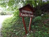 3
3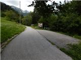 4
4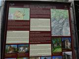 5
5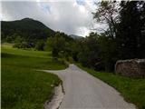 6
6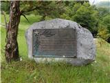 7
7 8
8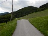 9
9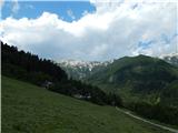 10
10 11
11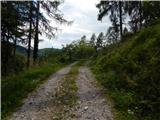 12
12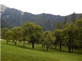 13
13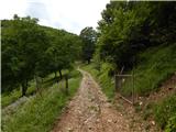 14
14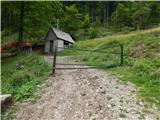 15
15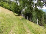 16
16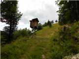 17
17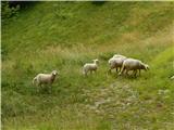 18
18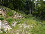 19
19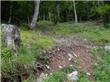 20
20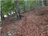 21
21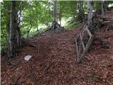 22
22 23
23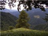 24
24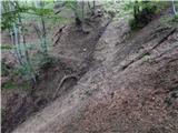 25
25 26
26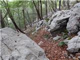 27
27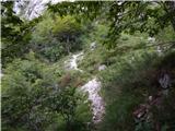 28
28 29
29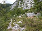 30
30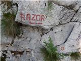 31
31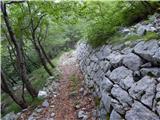 32
32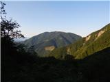 33
33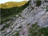 34
34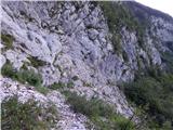 35
35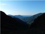 36
36 37
37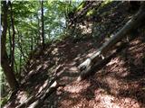 38
38 39
39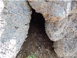 40
40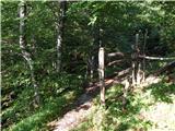 41
41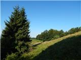 42
42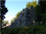 43
43 44
44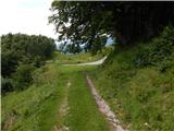 45
45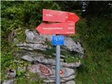 46
46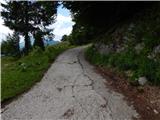 47
47 48
48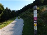 49
49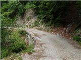 50
50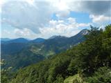 51
51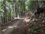 52
52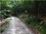 53
53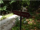 54
54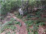 55
55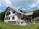 56
56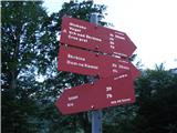 57
57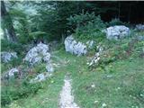 58
58 59
59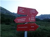 60
60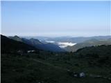 61
61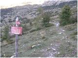 62
62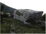 63
63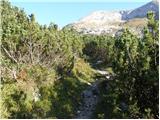 64
64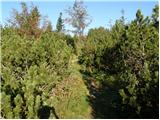 65
65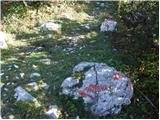 66
66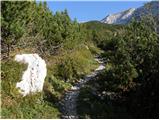 67
67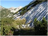 68
68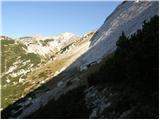 69
69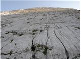 70
70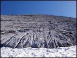 71
71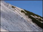 72
72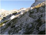 73
73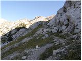 74
74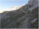 75
75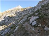 76
76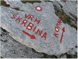 77
77 78
78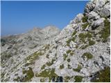 79
79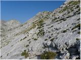 80
80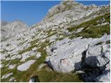 81
81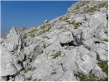 82
82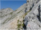 83
83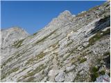 84
84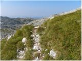 85
85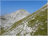 86
86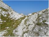 87
87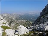 88
88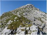 89
89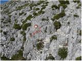 90
90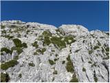 91
91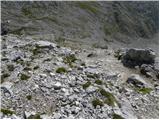 92
92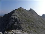 93
93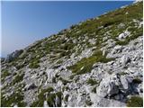 94
94 95
95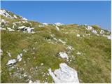 96
96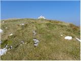 97
97 98
98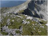 99
99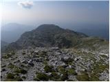 100
100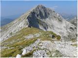 101
101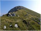 102
102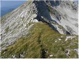 103
103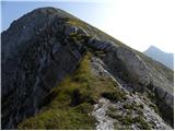 104
104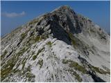 105
105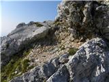 106
106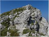 107
107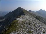 108
108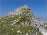 109
109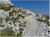 110
110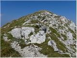 111
111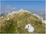 112
112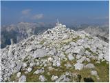 113
113 114
114
Discussion about the trail Kneške Ravne - Tolminski Kuk (via Škrbina)
|
| winni21. 07. 2021 11:12:57 |
Morda kdo ve, zakaj pot mimo Škrbine ni več urejevana in označena (razen povsem obledelih markacij). Jo je prav škoda, ker razen tistega dela pod Zelenim vrhom, ki bi lahko bil varovan z jeklenico ker je kar izpostavljen in zelo krušljiv, je pot zelo zanimiva.
|
|
|