Kneške Ravne - Grušnica (via Planina na Kalu)
Starting point: Kneške Ravne (720 m)
| Lat/Lon: | 46,2157°N 13,8265°E |
| |
Name of path: via Planina na Kalu
Time of walking: 4 h 30 min
Difficulty: easy unmarked way
Altitude difference: 850 m
Altitude difference po putu: 910 m
Map: TNP 1:50.000
Recommended equipment (summer): helmet
Recommended equipment (winter): helmet, ice axe, crampons
Views: 457
 | 1 person likes this post |
Access to the starting point:
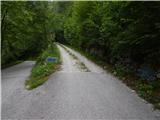
From the Bača pri Modreju - Podbrdo road, in the Kneža settlement, turn onto the road in the direction of Kneške Ravenske. Continue up the road, which continues along the valley of the Kneža stream. The road, which is at first quite slippery and partly macadam, starts to climb steeply higher up, and on the steep part the road is mostly asphalted. Higher up, the road splits, and we take the slightly left road, which is still asphalted and leads to Kneške Ravne (slightly right, a dirt road leading in the direction of mountain pasture in Prodih). We cross the picturesque Prošček stream, and then climb quickly to the parking lot in front of Kneške Ravne, where we park.
Path description:
From the parking lot, where there is an information board about Kneške Raven and the surrounding area, continue uphill, and at the first crossroads, by the NOB (National Liberation) memorial, go straight ahead (on the left, the homestead at Jakop and the homestead at Jakln). The road soon turns left, and the road to the homestead at Francu branches off to the right. Go straight ahead here too, and at the next crossroads go slightly right (the homestead at Pologar to the slight left). The asphalt road splits again, and this time we take the left path (right to reach the homestead at Francu), which loses its asphalt coating and leads us over a pasture fence. We continue up the cart track, which takes us above the orchard, then turns left and takes us through the lane of the forest and over several grazing fences to a crossroads by a small partly stone byte. Go right here, and cart track, higher up, turns left again, and then in a few minutes leads to a hunting observation post. At the hunting observation post, take a sharp right, then immediately left from the worse cart track, straight up the slope. After a short climb, a path appears, mostly climbing transversely through the forest, leading parallel to the edge of the nearby hayfield. Higher up, you reach the ridge between the Ljubinjski Steni and Masovnik, where the track becomes more distinct and takes you to the other, western side of the ridge. The path, along which you can see some old, rather faded markings, later starts to climb crosswise. Higher up, you reach scree scree and within a few minutes you reach a crossroads at the foot of the Ljubinjski Skály (Ljubinjski Skály).
Continue left towards mountain pasture Razor (right mountain pasture to Prodih and Rut), and the trail leads directly under the cliffs, where there is an increased chance of falling rocks, especially in spring. There is a cross-climb and the path leads into the forest, where it leads past a spring. After the spring, the path climbs steeply and after two serpentines, it flattens out again. A little further on, we cross a grazing fence, and the path leads us out of the forest to the upper part of the mountain pasture Kuk, to an area called Močila, where we pass a few huts on the lower side. After the huts, you reach a carriage road, which you follow to the right (to the left mountain pasture Kuk and the parking lot), and quickly reach a crossroads, where the path to Žabiški Kuk (also called Žabijski Kuk) branches off to the right - the path past Gradič (an old military trail). Continue in the route mountain pasture Razor and continue along the folded macadam road that crosses the western slopes of the Žabiška Kuka. Following the road, which occasionally opens up a beautiful view to the north-west, where we can see Rdeči rob, Vrh nad Peski, Grušnica, Tolminski Migovec and other surrounding mountains, after about 25 minutes of further walking, we arrive at a place where the signs for the mountain lodge direct us to the right, on a path that climbs crosswise above the road. A few minutes' walk later, the path leads to the mountain pasture Razor hut.
Go around the hut on the right and then continue in the direction of Tolmin and Krn. There is a slight descent along a partly concrete road, but when the road turns left towards the nearby cheese cottage, we go slightly right on a marked footpath in the direction of mountain pasture on Kal and Krn. There follows an easy walk along the vast and scenic mountain pasture Razor, and the path also turns slightly to the left, so that the path leads us westwards. The gently sloping path initially leads us along the beautiful views of Grušnica and Tolminski Migovec, but when we reach the edge of the mountain pasture, a beautiful view opens up in the direction of Tolmin. From the edge of mountain pasture the path turns right and enters the forest, through which it descends gently at times. A little further on, the path leads to the lower edge of the Kopecko cliffs, followed by a crossing of an alpine valley. On the other side of the valley, the path returns to the forest, and on the left we join the less well-trodden path from Tolminske Raven (the path leading directly from Tolminske Raven to Škrbina), and a little further on we arrive at a well-marked crossroads.
Continue right in the direction of mountain pasture on Kal and Krn (straight Tolminske Ravne and mountain pasture Spodnji Kal) and start climbing steeply, mostly through the forest. After 15 minutes of climbing, we arrive at the next crossroads, where we choose the left path (right Stubble and Top above Stubble). The way ahead is laid and gradually leads us out of the forest. There is a folded cross-climb to the left, and the views from the path get better and better. When lane of dwarf pines ends, we arrive at mountain pasture on Kal, and we walk to the nearby huts. From the saddle, from where we have a nice view towards the valley Tolmin, Vrh nad Peski, and also a nice view of the peaks above Tolminske Ravne, which we have also seen occasionally during the climb, we continue slightly left of the ridge Grušnica, along a nice traceable path. After a short traverse, we reach the east ridge of Grušnica, from where we have a nice view to the south. Here the trail turns slightly to the right, and within a few minutes of increasingly scenic walking, we reach an overlooking peak, from which we have a fine view of the surrounding mountains.
Starting point - Močila 2:10, Močila - mountain pasture Razor 0:35, mountain pasture Razor - mountain pasture on Kal 1:30, mountain pasture on Kal - Grušnica 0:15.
Description and figures refer to the situation in 2018 (July) and 2016 (April).

Pictures:
 1
1 2
2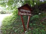 3
3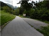 4
4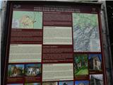 5
5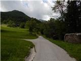 6
6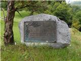 7
7 8
8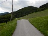 9
9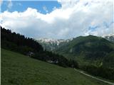 10
10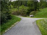 11
11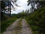 12
12 13
13 14
14 15
15 16
16 17
17 18
18 19
19 20
20 21
21 22
22 23
23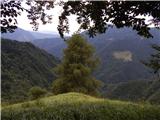 24
24 25
25 26
26 27
27 28
28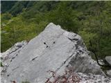 29
29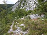 30
30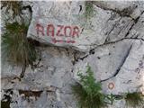 31
31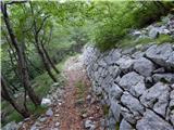 32
32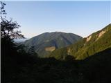 33
33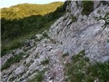 34
34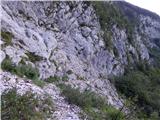 35
35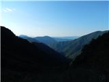 36
36 37
37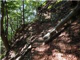 38
38 39
39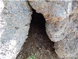 40
40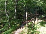 41
41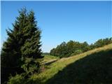 42
42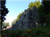 43
43 44
44 45
45 46
46 47
47 48
48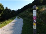 49
49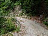 50
50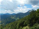 51
51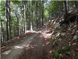 52
52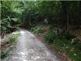 53
53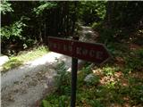 54
54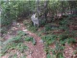 55
55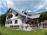 56
56 57
57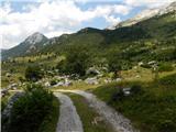 58
58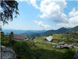 59
59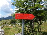 60
60 61
61 62
62 63
63 64
64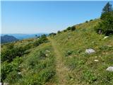 65
65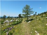 66
66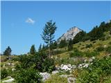 67
67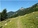 68
68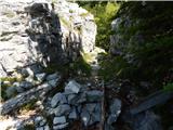 69
69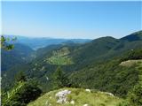 70
70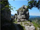 71
71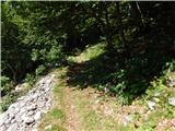 72
72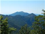 73
73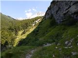 74
74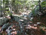 75
75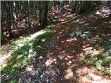 76
76 77
77 78
78 79
79 80
80 81
81 82
82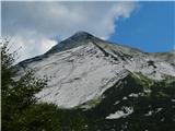 83
83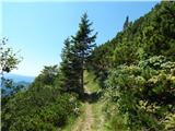 84
84 85
85 86
86 87
87 88
88 89
89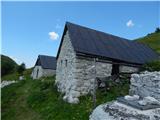 90
90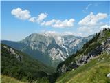 91
91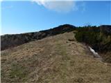 92
92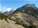 93
93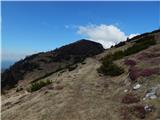 94
94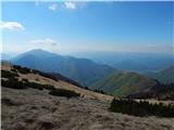 95
95 96
96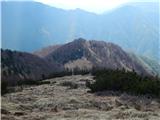 97
97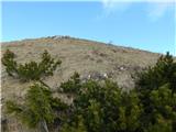 98
98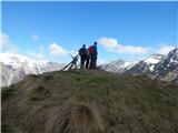 99
99 100
100
Discussion about the trail Kneške Ravne - Grušnica (via Planina na Kalu)