Kajfežev rob - Kamniški vrh
Starting point: Kajfežev rob (900 m)
| Lat/Lon: | 46,2949°N 14,5825°E |
| |
Time of walking: 1 h 15 min
Difficulty: easy unmarked way
Altitude difference: 359 m
Altitude difference po putu: 359 m
Map: Kamniške in Savinjske Alpe 1:50.000
Recommended equipment (summer):
Recommended equipment (winter): ice axe, crampons
Views: 17.212
 | 1 person likes this post |
Access to the starting point:
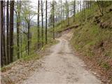
Drive into Kamnik and follow the road towards the Kamnik Bistrica valley. Just a few tens of metres before the bottom station of the pendulum at Velika planina, a forest road branches off to the left down into the Korošice valley. Take this road, which first descends, then crosses a bridge and leads us a little further on to a crossroads, where we continue straight on. Just a little further on, we come to the next crossroads, where we continue sharp left, cross a small wooden bridge and continue climbing on the sometimes rather bad macadam road. Follow this road, which crosses a number of avalanche-prone slopes, for 2 to 3 km and then park in one of the roadside car parks.
Path description:
From the parking lot, continue along the road, which continues to cross avalanche-prone (part of the road was carried away by an avalanche on 3 May 2009) and occasionally scenic slopes. A little further on, the road, which climbs only considerably, leads us into a dense forest, and here we become alert, because in a small clearing (see Fig. 5) we will notice an old hunting trail, which heads left from the road into the forest.
Take this path, which begins to climb moderately and then steeply through the forest. Higher up, you will come to a small crossroads, where you will come out on an unmarked cross-trail. Follow the trail to the left, and crossing a slightly steeper slope leads to the next crossroads, where you continue to the sharp right. Follow this occasionally slightly less visible path to the saddle between Kamniški vrh on the left and Planjava on the right.
At the saddle, take the marked path and follow it to the left towards Kamniški vrh, which is just over 10 minutes away. The path from the saddle onwards climbs a wide ridge, which offers beautiful views to the right (south) side.
From the top you can continue along the trail a little further to a nice viewpoint at which there is also a small bivouac.

Pictures:
 1
1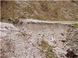 2
2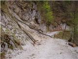 3
3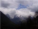 4
4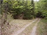 5
5 6
6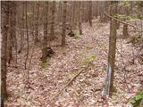 7
7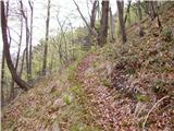 8
8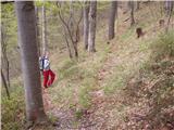 9
9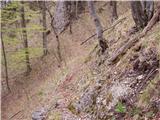 10
10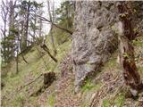 11
11 12
12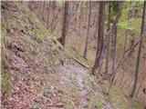 13
13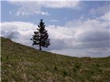 14
14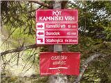 15
15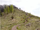 16
16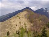 17
17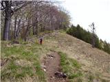 18
18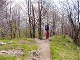 19
19 20
20
Discussion about the trail Kajfežev rob - Kamniški vrh