Starting point: Jesenovec (485 m)
| Lat/Lon: | 46,21°N 14,1261°E |
| |
Time of walking: 1 h 30 min
Difficulty: partly demanding marked way
Altitude difference: 526 m
Altitude difference po putu: 535 m
Map: Škofjeloško in Cerkljansko hribovje 1:50.000
Recommended equipment (summer):
Recommended equipment (winter): ice axe, crampons
Views: 4.967
 | 1 person likes this post |
Access to the starting point:
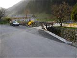
First, drive to Škofja Loka, then continue to Železniki and on to Zale Log. Shortly after Železniki (before Zali Log), you will come to a small crossroads where the road to the hamlet of Jesenovec branches off to the right over a bridge. On the bridge there is also a slightly larger mountain sign for Ratitovec. Park on the other side of the bridge, in a suitable place at the confluence of the Plenšak stream and the Selščice river (Selška Sora).
Path description:
From the starting point, continue along the asphalted road, which climbs gently along the Plenšak stream. After a few 10 m, the signs direct us to the right between two houses, behind which the path climbs very steeply over a short grassy slope. The path soon passes into the forest, where it turns left and then climbs steeply and, especially in the wet, dangerously slippery slopes. The poorly trodden and leaf-covered path crosses two ravines higher up, over which, due to the destroyed path, the passage is quite difficult and consequently also prone to slipping. The path continues for some time crossing steep slopes, but then these are only slightly lowered. The path, which continues to climb relatively steeply, leads us higher up to the next slightly more difficult crossing, where we cross a rock rib on a slightly exposed shelf. After this, the path turns to the right and begins to climb even steeper a little further. Higher up, the path turns left and visibly flattens out, crossing the last exposed spot. Next, a moderately steep path quickly leads us to a worse forest road, which leads us past a hunting lodge, which we bypass on the right side leads to extensive grassy hayfields, from which we open a beautiful view of Ratitovec. A short descent follows and the path leads us to an asphalt road, which we then climb in a few minutes to the Church of Our Lady Help of Christians in Prtovč.
From the church, you can walk to the nearby Mohorič Marica Tourist Farm.

Pictures:
 1
1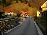 2
2 3
3 4
4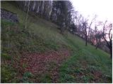 5
5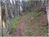 6
6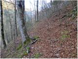 7
7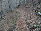 8
8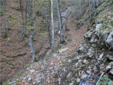 9
9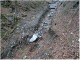 10
10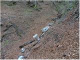 11
11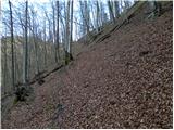 12
12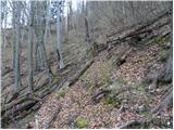 13
13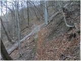 14
14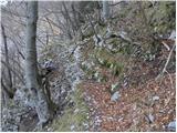 15
15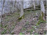 16
16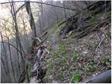 17
17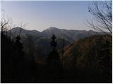 18
18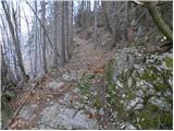 19
19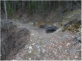 20
20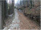 21
21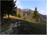 22
22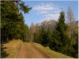 23
23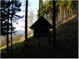 24
24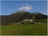 25
25 26
26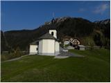 27
27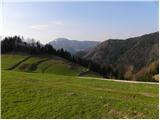 28
28
Discussion about the trail Jesenovec - Prtovč
|
| franci6512. 01. 2020 |
Markirana planinska pot je neprehodna zaradi sečnje dreves. Debla so odstranili, vse veje pa pustili in zaprli pot. Potrebno je veliko telovadbe, da se planinec prebije skozi neprehoden odsek.
|
|
|
|
| GregorC12. 01. 2020 |
Ta pot je trenutno (januar 2020) sploh zaprta zaradi sečnje in spravila lesa!
|
|
|
|
| ločanka11. 06. 2023 18:48:06 |
Pot ni več zaprta, sledu sečnje praktično ni. Je pa začetek poti malo prestavljen in sicer stopiš na pot takoj pri parkirišču, urejene so lesene stopničke, na odcep te opozorita tudi dve tabli.
|
|
|