Jesenice (Ukova) - Španov vrh
Starting point: Jesenice (Ukova) (600 m)
| Lat/Lon: | 46,4362°N 14,0648°E |
| |
Time of walking: 2 h
Difficulty: easy unmarked way
Altitude difference: 734 m
Altitude difference po putu: 736 m
Map: Karavanke - osrednji del 1 : 50.000
Recommended equipment (summer):
Recommended equipment (winter): ice axe, crampons
Views: 8.825
 | 4 people like this post |
Access to the starting point:
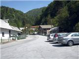
From the motorway Ljubljana - Jesenice take the exit Lipce, where you turn right towards Jesenice. At the Slovenski Javornik settlement, turn left at the traffic light junction towards the town centre. At the second traffic lights (by the gymnasium), turn right back towards Tomšičeva cesta, passing the primary school on the left. After the school, cross the pedestrian crossing and immediately turn into the first (narrower) street on the left. After going up it for 10 metres, you will see a marked parking area on the right. This is our starting point.
Path description:
From the parking lot, continue along the road uphill, and after 10 m you will see the Ukova summer bathing site on the left and the road on the right, which branches off uphill to the north into the forest.
Take the latter and follow it for a short distance, i. e. to the right-hand bend before which there is a fenced water reservoir on the same side. On the other - left - side, take the path that intersects the double curve of the road you have left. Here you will come across the first markings of the path Ukova - Dom Pristava. Cross the road again quickly and take the path as it begins to climb northwards. As it starts to turn left, it joins the cart track, by which you will see a signpost. Here, bear right along cart track, which leads quickly to a small bridge over the Ukova stream. As soon as we have crossed, we see a path on the left leading up northwards. Stepping onto it, you leave the marked path and see a bench by the stream on the right. After a few steps uphill, the path appears to end in a stream bed, but in fact it turns sharp left at this point, steeply uphill. As we gain metres, we hear to our right the sound of the left branch of the Ukova stream, which occasionally meanders deep below us. After a while, as the path widens a little, the steepness eases, and we come across a small sign (a cross) on a tree on the path on our left. Soon afterwards, when we notice a small waterfall and a larger rock on our right, the path leads us to the vicinity of an old water reservoir, past which our path continues in the same direction. Slightly higher up, we are met by two small, old and therefore less reliable wooden bridges. Shortly after the second one, before the marked path leads us back to the main stream bed, we turn left uphill by a small stream. On partly waterlogged terrain, the path soon leads us again to the vicinity of the main stream, along which we climb up to a forest road in the immediate vicinity of Jesenišký Rovt on our right, which we can also visit in passing. Once on the road, follow it to the left, which soon leads to the fortified forest road Prihodi - Križovec. Turn right and walk along it for 10 - 15 minutes, then on its left-hand side you will see cart track, which turns sharp left uphill through a short lane of forest. Once on it, it quickly leads to an open glade, where after a few 10 m it turns first right and soon (near the weekend house) also left. After that, we overlok the right fork and continue on cart track across the livade in the route NW. At a very long right turn, you will see a left turn-off, where you turn in a different - easterly - direction. After crossing a short lane of wods, we find ourselves again in an open meadow or pasture, where the path turns left in a northerly direction. Our cart track is almost lost in the pasture, and in the same direction we see another cart track or path climbing uphill. As we approached it, we crossed the marked path Smučarski dom Črni Vrh - Dom Pristava. Following this cart track, although it soon gets lost, we reach the saddle on the ski slope below the summit itself, or the upper station of the Španov Vrh chairlift, which is on our right, just a few minutes' walk uphill.

Pictures:
 1
1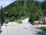 2
2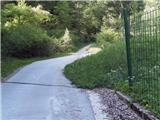 3
3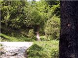 4
4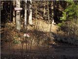 5
5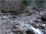 6
6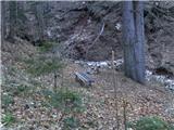 7
7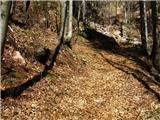 8
8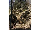 9
9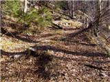 10
10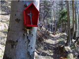 11
11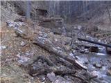 12
12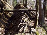 13
13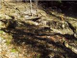 14
14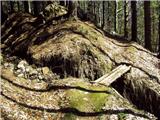 15
15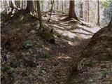 16
16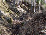 17
17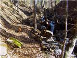 18
18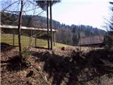 19
19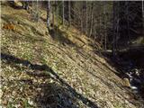 20
20 21
21 22
22 23
23 24
24 25
25 26
26 27
27 28
28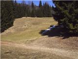 29
29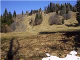 30
30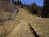 31
31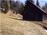 32
32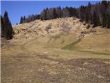 33
33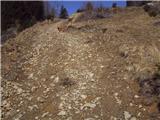 34
34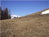 35
35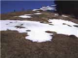 36
36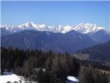 37
37 38
38
Discussion about the trail Jesenice (Ukova) - Španov vrh
|
| milenula2. 01. 2011 |
Danes smo se udeležili izleta nekaj članov PD Šmarna gora iz Lj.Zelo slikovita in zanimiva tura,zlasti smo občudovali zamrznjene figure vode v potoku Ukova.
S pomočjo res dobrega opisa poti smo pot z lahkoto opravili.Žal je bilo vreme megleno,tako da z obljubljenimi razgledi ni bilo nič.Pridemo spet,ko bo lepše vreme.
|
|
|
|
| heinz24. 03. 2017 |
Danes mineva natanko 5 let odkar sta ta dva mostička "obnovljena". Zgodilo se je 24.3.2012. ko je potekala čistilna akcija v okolici Jesenic.
|
|
|
|
| Majdag24. 03. 2017 |
..Že dolgo me ni bilo tam gori. A se to lahko popravi v opisu poti? 
|
|
|
|
| heinz2. 04. 2017 |
Popravki opisov so v rokah administratorja. Sicer pa je tudi iz gornjih komentarjev razvidna ta (mala) sprememba stanja poti..
Vse lepo na poteh Majda!
|
|
|
|
| Majdag2. 04. 2017 |
Vse lepo tudi tebi Heinz.
|
|
|
|
| Jusk3. 12. 2019 |
Luštna pot,danes večinoma suha,samo tu in tam malo blatna..sicer sem šel samo do Jeseniškega rovta,potem pa po cesti nazaj del poti proti Prihodom in dol skozi gozd na Pejce in Jesenice. Malo pred Jeseniškim rovtom je voda odnesla del poti,ampak je pot vseeno prehodna
|
|
|
|
| Jusk4. 12. 2019 |
Do vodnega zajetja na sliki 13 gre še ena pot,pot v tem opisu se začne po prvem mostičku čez Ukovo na sliki 7,druga pot pa se začne okoli 20,30metrov naprej ko prečkamo drugi mostiček,pri drevesu ko je gor markacija za pot na Jelenkamen in Pristavo se opazi neoznačeno pot. Ta pot gre po trasi cevovoda od zajetja na sliki 13,je pa bolj zaraščena in strma,občasno tudi težje sledljiva. Orientiramo se lahko tudi po cevi ki tu in tam pride na plano
|
|
|
|
| Jusk9. 05. 2020 |
Danes pot Ukova-planina Dole-Lenčkov špik-Španov vrh. Malo pod planino Dole kar nekaj narcis,tudi Španov vrh je že malo pobeljen,še bolj pa bo kar kmalu nazaj sem šel čez Planino pod Golico v Plavški rovt kjer je še kar dosti narcis,dol proti Hrušici in po kolesarski stezi do izhodišča. Dobra krožna pot Lp
|
|
|
|
| Jusk6. 11. 2020 |
pa spet turca po moji različici poti pred pl.Dole danes zelo blatno in spolzko,drsalnica  naprej pa vse ok,na Španov vrh po neoznačeni poti okoli. nazaj dol na Prihode in Rudno pot. Lp
|
|
|