Jesenice (Ukova) - Dom Pristava v Javorniškem Rovtu (via Jelenkamen)
Starting point: Jesenice (Ukova) (600 m)
| Lat/Lon: | 46,4362°N 14,0648°E |
| |
Name of path: via Jelenkamen
Time of walking: 2 h
Difficulty: partly demanding marked way
Altitude difference: 375 m
Altitude difference po putu: 500 m
Map: Karavanke - osrednji del 1:50.000
Recommended equipment (summer):
Recommended equipment (winter): ice axe, crampons
Views: 9.126
 | 2 people like this post |
Access to the starting point:
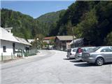
From the motorway Ljubljana - Jesenice take the exit Lipce, where you turn right towards Jesenice. In the village of Javornik, turn left at the traffic lights towards the town centre. At the second traffic-lighted junction (by the gymnasium), turn right back towards Tomšičeva cesta, passing the primary school on the left. After the school, cross the pedestrian crossing and immediately turn into the first (narrower) street on the left. After going up it for 10 metres, you will see a marked parking area on the right. This is our starting point.
Path description:
From the parking lot, continue along the road uphill, and after 10 m you will see the Ukova summer bathing site on the left and the road on the right, which branches off uphill to the north into the forest.
Take the latter and follow it for a short distance, i. e. to the right-hand bend before which there is a fenced water reservoir on the same side. On the other - left - side, take the path that intersects the double curve of the road you have left. Here you will come across the first markings. Cross the road again quickly and take the path which starts to climb northwards. As it starts to turn left, it joins cart track, at which point we see a signpost. Here, turn right along cart track, which quickly leads to the first small bridge (the Ukova stream), over which you immediately reach the second one. After this, the path or cart track goes right uphill and then increasingly left in an easterly direction. There follows some time climbing up and along the winding cart track, keeping to the main - left - path all the time. When the incline eases, you will see a signpost on the right "Chapel" and a small rise called Kalvarija, on which there is a chapel and a bench. We continue straight on along cart track, which turns into a path turning left. After some 10 m you will come across a small water reservoir and the sign "Pristava". Cross the (often dry) stream here and turn right to the east (left - steeply uphill to the north, the path passes through Dole). Soon the path reaches a short ridge where it turns left. After climbing for a few minutes more, you emerge from the forest to a partial view of the valley, but it doesn't last long. When you see a bench on the left, the path turns sharp left (almost back to the north-west) and climbs only moderately. Soon, however, the markings direct us uphill, straight north and then increasingly right to the east, and we reach the first viewpoint towards the Ljubljana basin (the ridge).
From here the path goes left uphill and then right again towards the second (main) viewpoint, which is located 50 m to the right of the marked path on the rocks with a bench. From this ridge, the path climbs steadily uphill to the left, heading north, and soon you will come across the first steel cable. After 20 m of the guarded path, the steepness first eases and then the path climbs one last time towards the summit, which can be reached in a few minutes. From here continue along the broad summit ridge in a north/north-west direction. After a while, when the path descends a little, it leads to a marked crossroads, where you continue to the right (unmarked path through Dole on the left). Follow the straight forest path along the southern to eastern slope of the peak called Lenčkov špik. After about 10 minutes walk, you will reach a marshy livado and the path starts to descend.
Soon at the crossroads you will come across a neat signpost with the inscriptions "Pristava, Jelenkamen". Here, go right down towards the well-gromed cart track, which takes you in the route to the left down towards the settlement on the edge of Javorniški rovt. In the settlement, following the asphalt road, which first goes downhill and then uphill, you will reach a crossroads with hiking signposts, where you continue to the right. When the road descends a little, you will come to a crossroads with parking lots and containers. Here, cross the macadam road straight ahead and get on the path (Zoisov park), which soon leads you to the Mountain Home on Pristavi via a right turn.

Pictures:
 1
1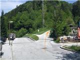 2
2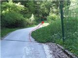 3
3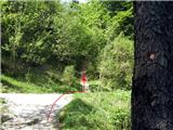 4
4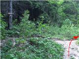 5
5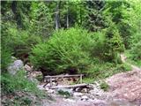 6
6 7
7 8
8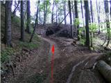 9
9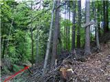 10
10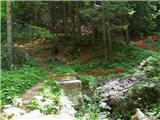 11
11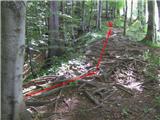 12
12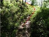 13
13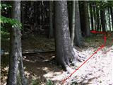 14
14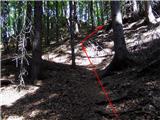 15
15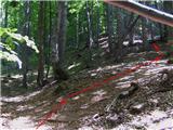 16
16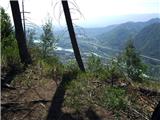 17
17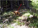 18
18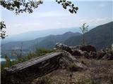 19
19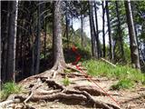 20
20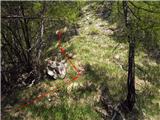 21
21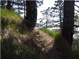 22
22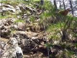 23
23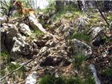 24
24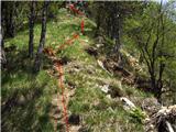 25
25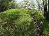 26
26 27
27 28
28 29
29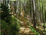 30
30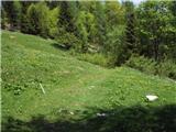 31
31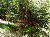 32
32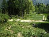 33
33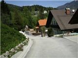 34
34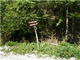 35
35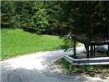 36
36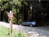 37
37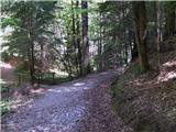 38
38 39
39
Discussion about the trail Jesenice (Ukova) - Dom Pristava v Javorniškem Rovtu (via Jelenkamen)
|
| heinz12. 05. 2009 |
Na prvi pogled nekoliko zakomplicirana pot je v resnici prav prijetno enostavna in razgibana. Priporočam v maju, ko cvetijo narcise! Nazaj se lahko spustimo po cesti v Trebež, nato levo proti Tomšičevi oz. izhodišču. Druga varianta povratka pa je skozi v opisu omenjen rovt "Dole" (pot se nazaj priključi pri Kalvariji)
|
|
|