Starting point: Jeršiče (650 m)
| Lat/Lon: | 45,7748°N 14,2305°E |
| |
Time of walking: 2 h 40 min
Difficulty: easy marked way
Altitude difference: 456 m
Altitude difference po putu: 525 m
Map: Snežnik 1:50.000
Recommended equipment (summer):
Recommended equipment (winter): crampons
Views: 7.391
 | 2 people like this post |
Access to the starting point:
a) From the motorway Koper - Ljubljana, take the exit Postojna and then drive towards the centre of Postojna. In the above-mentioned place you will see signs for Pečna reber and the railway station, which will direct you to the right, and then about 200 m before the railway station turn left (the junction is not marked) onto the road, which will soon take you over the motorway. On the other side of the motorway we come to a crossroads where the road to Stara vas branches off to the right, and we continue in the direction of Javornik and Svete Trojice. A little further on, by the NOB monument, the road to Pečni ribra branches off to the left, and we park here in a suitable place.
b) From the Ljubljana - Koper motorway, take the Unec exit, then continue towards Unec and Cerknica. At Unec, leave the main road towards Cerknica and turn right in the direction of Postojna. Continue along a slightly narrower road which runs parallel to the motorway. After a few kilometres, when you pass through the underpass and reach the other side of the motorway, continue straight ahead at the first junction. Once back on the original side of the motorway, turn left at the junctions towards Pečná Ribra and Svete Trojice. When you soon reach a crossroads where the road to Pečná ribra branches off to the left and the road to Sveta Trojica continues to the right, you will see the NOB (National Liberation) Memorial between the two roads. Park in a suitable place near the crossroads.
Path description:
This route is officially closed until further notice, for safety reasons, as it passes through a military training ground (10. 4. 2018)-
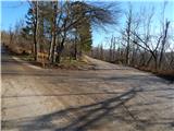
From the junction by the NOB memorial, continue along the lower right road in the direction of Javornik and Sveta Trojica (left Pečna rib). A few steps further along the road, we see a sign that we will continue along the forest road, but we walk along it for only a minute or two, and then arrive at the next junction, where an admittedly a little ambiguous sign for Sveta Trojica directs us to the lower right road. The fairly frequent markings along the way quickly confirm that we are on the right road. The way forward leads us slightly downhill, while we bypass first a small abandoned building, then a larger clearing, where we continue straight ahead to a slightly larger abandoned military facility. Behind this building, the path passes into a more dense forest, which was badly affected by the hailstorm at the beginning of 2014. The marked trail, along which we also see some signs for Sveta Trojica, gradually begins to climb gently and leads us into a military area where crossing is forbidden during exercises and is also life-threatening. The road, which has since turned into cart track, then leads us past a well-maintained wooden hut, and a little further on it begins to climb crosswise up a moderately steep slope. The first views of Nanos open up in a small clearing, and a little further on, when we emerge from the forest onto a larger grassy slope, towards the surrounding hills, including Sveta Trojica, the summit of which we have already been able to see during our ascent.
At the part where we enter the grassy slope, we also see signs indicating that we have entered the area of the targets (life-threatening), which is not difficult to see by looking at the heavily damaged ground from grenades or other explosive devices.
In this part, where a lone birch tree stood at the time of the description, we encounter a major orientation loop, as we see markings on a stone, under tall grasses, which direct us from a well-traced path down to the right onto an initially not very visible path that begins to descend towards the foot of Pozek Hill (826 m). After a descent of a few 10 metres, we catch a grassy cart track, which we follow down to another, slightly rockier cart track, which we follow down to the left. There is some more descending through extensive meadows adorned with numerous birch trees. When the path flattens out at a lower point, at the unmarked Vratca pass, at a crossroads where you reach a wider macadam road, continue left, as indicated by an arrow or marker on a tree. Following the flat road, you will reach the next crossroads in a few minutes, where you will continue along the right-hand road in the direction of Svete Trojice. The road, which again starts to climb moderately, quickly leads to Hunting cottage Trešnja ravan, which is located a few steps off the road to the left. Continue along the road to the next crossroads, where you go right for a few minutes, and at the next crossroads you go straight on to the marked cart track, which climbs a little steeper. Higher up, at a turning point, cross another forest road, then follow the still-marked path up a relatively steep stony cart track. After about 15 minutes the steepness eases and the path leads to a small saddle between Lonica on the left and Sveta Trojica on the right.
Here you reach a minor forest road, which you follow to the right, and in a few minutes, with increasingly beautiful views, you climb to a viewpoint with a church and a viewing platform.
Description and pictures refer to the situation in 2014 (December).

Pictures:
 1
1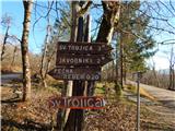 2
2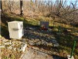 3
3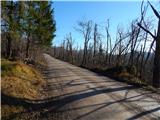 4
4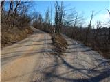 5
5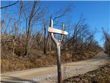 6
6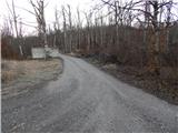 7
7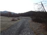 8
8 9
9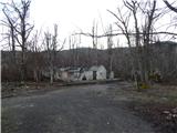 10
10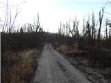 11
11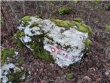 12
12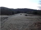 13
13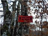 14
14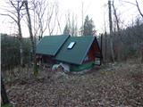 15
15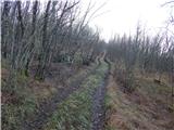 16
16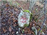 17
17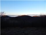 18
18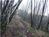 19
19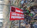 20
20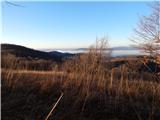 21
21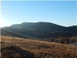 22
22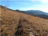 23
23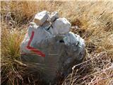 24
24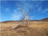 25
25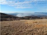 26
26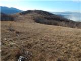 27
27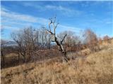 28
28 29
29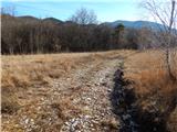 30
30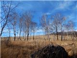 31
31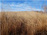 32
32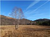 33
33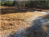 34
34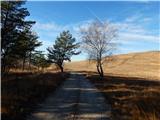 35
35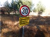 36
36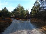 37
37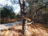 38
38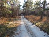 39
39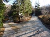 40
40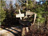 41
41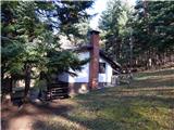 42
42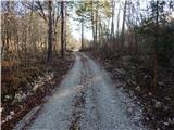 43
43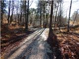 44
44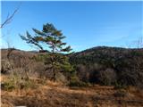 45
45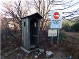 46
46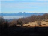 47
47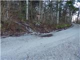 48
48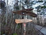 49
49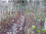 50
50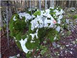 51
51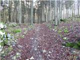 52
52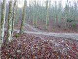 53
53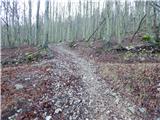 54
54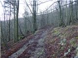 55
55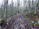 56
56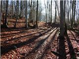 57
57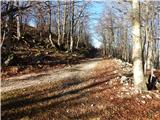 58
58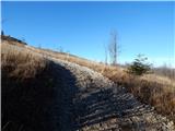 59
59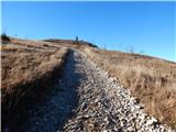 60
60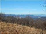 61
61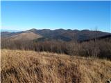 62
62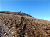 63
63 64
64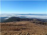 65
65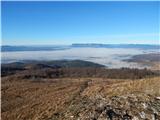 66
66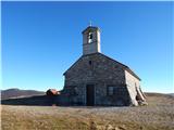 67
67 68
68
Discussion about the trail Jeršiče - Sveta Trojica
|
| nusa4. 01. 2015 |
Danes sem prehodila opisano pot,ki je zelo lepo označena.Večina poti je bilo zasnežene,da se je lepo hodilo,saj je na začetku kar nekaj gozdne makedamske poti.Priporočam pohodnikom,ki imajo radi samotne poti,saj nisem srečala nobenega.Na vrhu pa prelepi razgledi in rahel vetrič.
|
|
|
|
| tavzentroza23. 10. 2016 |
Pot prehodila danes, pot je samotna, srečala sem samo enega tekača, res za tiste ,ki želijo hoditi v tišini.POt trenutno ustreza gornjemu opisu.Priporočam hojo med vikendi,ko ni vojaških aktivnosti.
|
|
|
|
| sikvatro1. 06. 2017 |
Danes prehodil to pot. Potrebno bi bilo obnoviti markacije. Zahvaljujoč gornjemu opisu poti sem jo prehodil brez težav. Tudi jaz nisem srečal niti enega pohodnika. Užival sem v spomladanskem cvetju in lepem razgledu na vrhu.
|
|
|
|
| PDPostojna10. 04. 2018 |
Pot je uradno zaprta, zaradi varnosti ker vodi čez vojaški poligon.
PD Postojna
|
|
|
|
| Lapuh20711. 08. 2021 08:46:32 |
Včeraj smo se odpravili na ta vrh, ampak povsem iz drugačne smeri, kot so opisane tukaj. In ni nam bilo žal. Od Cerkniškega jezera (vas Otok) smo se najprej zapeljali v bližino Debelega kamna, že globoko v Javornikih, od tam pa nato odkorakali po gozdnih cestah v smeri proti Sveti trojici. Lepa, gladka pot pod senčnato streho košatih dreves, malo gor in malo dol. Pa s pogledom na zemljevidu, saj je križišč veliko in kar nekaj jih ni (več) označenih. Ko se je skozi presledke med krošnjami v dolini pod nami že dalo slutiti vojaško vežbališče, ki smo se mu iz te smeri povsem izognili, je z desne navzgor našo cesto prečkala markirana steza. Krenili smo po njej v levo navzgor, končno malo bolj strmo, in kmalu smo bili na razglednem vrhu. Prijetna pot za te vroče dni, pa še malin smo se nazobali do sitega. Medveda pa nismo srečali.
|
|
|