Jamce - Sinji vrh (eastern path via Škraplje)
Starting point: Jamce (318 m)
| Lat/Lon: | 45,8838°N 13,9386°E |
| |
Name of path: eastern path via Škraplje
Time of walking: 2 h 55 min
Difficulty: easy marked way
Altitude difference: 684 m
Altitude difference po putu: 735 m
Map: Goriška - izletniška karta 1:50.000
Recommended equipment (summer):
Recommended equipment (winter): ice axe, crampons
Views: 1.440
 | 1 person likes this post |
Access to the starting point:
a) First drive to Ajdovščina, then continue driving to Col. After a short climb, Ajdovščina ends, and we continue cross-climbing along the road that rises above the Vipava valley. Just 50 metres before the 5 km marker, you will see a suitable parking spot on the right hand side of the road.
b) From Godovič or Kalce near Logatec, take the Col, and from there continue towards Ajdovščina. At the 5 km marker, the footpath described above begins, and you can park about 50 metres further on in a suitable space on the opposite side of the road.
Path description:
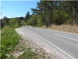
At the 5 km road marker, note the beginning of cart track, which branches off the main road into the bank. The path initially follows cart track, then before a small torrential stream, a forest path branches off to the right, which after a few steps turns left and crosses the aforementioned intermittent spring. On the other side, the path climbs a little more, and a slightly wider path joins from the left. Continue slightly to the right, following the path, which quickly leads out of the forest to a slightly larger clearing, where the path partly disappears. Continue straight up through the clearing, then when the path returns to the forest it becomes traceable and visible again. In the forest the path turns slightly to the left and returns to cart track, and after a few minutes we reach a place where we join another, a little better-beaten cart track, where another path from the main road Ajdovščina - Col joins us.
Continue straight ahead, then at a slight leveling off, turn slightly right onto the slightly ascending cart track, from which you soon turn right onto a gradually steeper path (at the latter crossroads you can also continue straight ahead on a less steep path). Follow the steeper path for a few minutes, then join the marked path from Ajdovščina. Continue straight ahead for a few minutes. Follow the steeper path, then join the marked path from Ajdovščina.
Continue to the right, and at a nearby marked crossroads turn right again in the direction of Podrta gora. The way forward climbs in a few serpentines to the cliffs of Podrta gora, where it turns right, and then, with beautiful views of the Vipava valley, leads us to the registration box and the stamp of Podrta gora.
From the registration box, continue along the marked path, which leads into a small valley and to a nearby marked crossroads, where you continue to the left in the direction of the Edge Trail (to the right Kovk along the Edge Trail). Continue along the edge of the plateau along the ridge of Podrta gora. From the highest point of Podrta gora there is a short descent and the path leads into a small valley where, at a less well-marked crossroads, there is the next registration box, which is fixed near the plague sign.
Before the sign, continue right (straight marked path along the edge, also Sinji vrh over Črne stene) in the direction of Sinji vrh, and then immediately after the sign, left on a beaten but no longer marked path. There is a short, easy traverse downhill to a slightly larger meadow, where the track disappears. Cross the meadow and continue across to the right, quickly reaching an abandoned house. Just before the house, cross the road and we continue to the courtyard of the house, passing the house on the right. After the house, you will come out onto a road, which you will follow as it begins to turn to the left. After a few minutes, we reach a wider macadam road, which is the marked Angelska Gora trail, and we follow it to the right (Sinji vrh West trail on the left). Soon the road becomes asphalted and leads us past a few houses. There is a moderate climb for a few minutes and then we reach the main road Col - Predmeja. Continue left in the direction Predmeja, along the road that first leads past the NOB memorial, and a few 10 metres further on past the chapel. After the chapel, the road climbs more visibly and enters the forest. Higher up, the road bends to the left and leads to a natural landmark, namely the scrapers along the path, which is also commemorated by an information board. There is a short descent, and then the signs for the Angelska Gora trail direct you slightly to the left onto the trail, which continues through the forest. At the few small crossroads that follow, follow the Angel Mountain trail signs (yellow-orange sunflowers) carefully. After a few minutes of gentle to moderate ascent, the trail climbs steeply and leads out of the forest onto the grassy slopes below Sinji vrh. Here the path continues gently to the right and, with ever more beautiful views towards the plateau of Trnov Forest, quickly leads us to the scenic peak, on which there is a small concrete cross.
From the top, you can descend in 3 minutes to the nearby Pension Sinji vrh.
Starting point - Podrta gora 1:20, Podrta gora - Sinji vrh 1:35.
Description and pictures refer to the situation in 2015 (April).

Pictures:
 1
1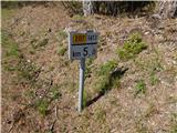 2
2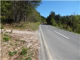 3
3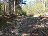 4
4 5
5 6
6 7
7 8
8 9
9 10
10 11
11 12
12 13
13 14
14 15
15 16
16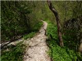 17
17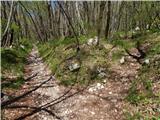 18
18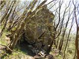 19
19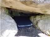 20
20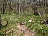 21
21 22
22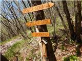 23
23 24
24 25
25 26
26 27
27 28
28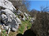 29
29 30
30 31
31 32
32 33
33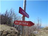 34
34 35
35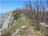 36
36 37
37 38
38 39
39 40
40 41
41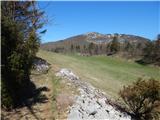 42
42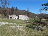 43
43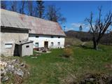 44
44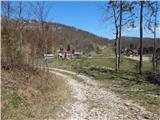 45
45 46
46 47
47 48
48 49
49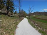 50
50 51
51 52
52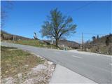 53
53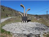 54
54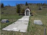 55
55 56
56 57
57 58
58 59
59 60
60 61
61 62
62 63
63 64
64 65
65 66
66 67
67 68
68 69
69 70
70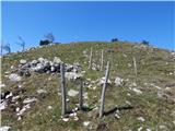 71
71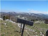 72
72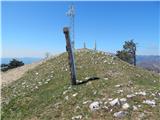 73
73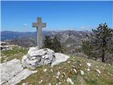 74
74 75
75
Discussion about the trail Jamce - Sinji vrh (eastern path via Škraplje)