Iverje - Dom v Kamniški Bistrici (Koželjeva pot)
Starting point: Iverje (458 m)
| Lat/Lon: | 46,2797°N 14,614°E |
| |
Name of path: Koželjeva pot
Time of walking: 2 h 45 min
Difficulty: partly demanding marked way
Altitude difference: 142 m
Altitude difference po putu: 200 m
Map: Kamniške in Savinjske Alpe 1:50.000
Recommended equipment (summer):
Recommended equipment (winter): ice axe, crampons
Views: 42.486
 | 1 person likes this post |
Access to the starting point:
First, we drive to Kamnik, then continue in the direction of Kamnik Bistrica. In Stahovica (you can also get here via the Črnivec or Volovjek Pass), turn left or right if you are coming from Črnivec or Volovjek and follow the road along the valley of the Kamnik Bistrica. Shortly after the large quarry, which you can see on the left, you will see signs for the Koželje Trail along the road, which will direct you to the left over a wooden bridge. Just after the bridge, or a few 10 m further on, park in one of several small parking lots along the road.
Path description:
From the starting point, continue along the macadam road, which continues along the left side or right bank of the Kamniška Bistrica river. The road soon narrows slightly and begins to climb moderately. After a few minutes it turns sharp left, and we follow it only as far as the beginning of the bend mentioned above, where the signs for the Kamniško Bistrica along the Koželjeva cesta direct us onto a narrower and occasionally slightly steeper path. The way forward soon switches to steep and, especially in the wet, dangerous slopes. After crossing the slopes for some time, the path descends gently and leads to cart track, after which it continues for some time. Cart track soon turns into a footpath, which then crosses some more rather steep slopes. The path then turns left and ascends steep steps. There is a short descent and the path leads to a macadam road leading to the Korošica valley. The road is only crossed, as the signs direct you into the forest, where after a few metres you cross the Korošica stream over a wooden bridge. The way forward continues along the riverbed of the clear Kamniška Bistrica and for some time climbs only slightly. The path leads past a large boulder and after a while leads to the source of the Predaselj trough. Here, the marked path turns left and begins to climb steeply along the right bank of the aforementioned troughs. The path, which is also exposed in a few places, leads us quickly to a wooden bridge with a beautiful view of the troughs. Cross the small bridge and step onto the right side (left bank) of the Kamniška Bistrica for the first time, and then climb up the exposed but guarded path with a fence. After a few 10 steps, the steepness eases and the path leads to the next macadam road.
Here you can see the upper part of the troughs from the bridge, but otherwise continue on the marked path that continues along the right side of the Kamniška Bistrica (parallel to "our" path, another path continues along the left side, which can lead you to the Home in Kamniška Bistrica). The path continues through the forest and a little higher up, it gets quite close to the asphalt road. Continue along the marked footpath, which again turns slightly to the left and after a few minutes of further walking leads to the Little Spring. The path then slowly turns to the right, where after a few minutes of moderate ascent it joins the road leading to the Dom v Kamniški Bistrica. Once on the road, you will soon cross the Kamniško Bistrica River over a bridge, and then you will see the Dom v Kamniški Bistrici in front of you.

Pictures:
 1
1 2
2 3
3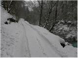 4
4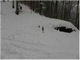 5
5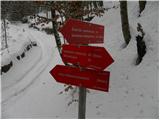 6
6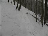 7
7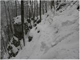 8
8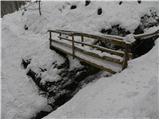 9
9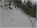 10
10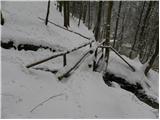 11
11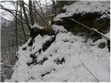 12
12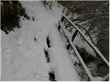 13
13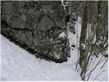 14
14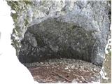 15
15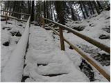 16
16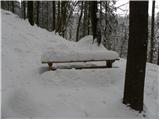 17
17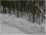 18
18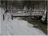 19
19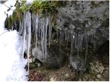 20
20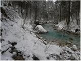 21
21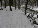 22
22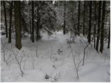 23
23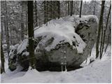 24
24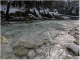 25
25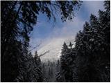 26
26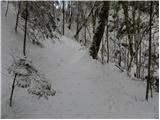 27
27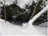 28
28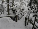 29
29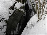 30
30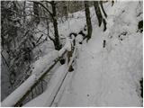 31
31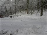 32
32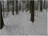 33
33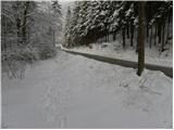 34
34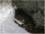 35
35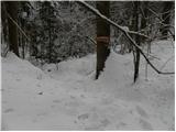 36
36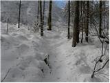 37
37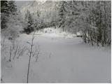 38
38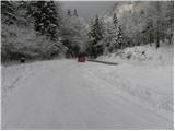 39
39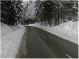 40
40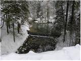 41
41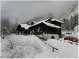 42
42
Discussion about the trail Iverje - Dom v Kamniški Bistrici (Koželjeva pot)
|
| EUGEN14. 05. 2010 |
Z ženo in psičko smo v nedeljo prehodili to zanimivo pot, odlični štruklji v koči in nadaljevali pot do spominskega parka ,kjer smo prižgali svečo Tomažu.
Vrnitev po zgornji Koželjevi poti.
Kljub občasnem deževju je bil lep izlet.
|
|
|
|
| pohodnik387. 06. 2012 |
Včeraj v sredo 6.6.2012 prehodil tole pot zanimiva, mirna,malo že potrebna obnove vsaj mostički so bolj "bogi" veliko motivov za fotografe....in ravnoprava ko vreme ni za vrhove gora. Več pa tukaj-slike in GPS sled na tej POVEZAVI
|
|
|
|
| katty7. 06. 2012 |
Hja, očitno bo tole samotno potko tud treba prehodit. Je pa tko, take poti so res najbolj dobrodošle takrat, ko je vreme bolj turobno in razmere-vreme, vzpona kam višje ne omogočajo. Sicer pa super slike.
|
|
|
|
| pohodnik388. 06. 2012 |
Krajši video s tega pohajanja ob Kamniški Bistrici VIDEO
|
|
|
|
| LidijaJesih8. 07. 2012 |
Prijetna, kar 15km v obe smeri se je nabere, tudi v teh temperaturah zelo znosna. Polno skritih kotičkov, lep umik za vroč dan . Skriva marsikaj, kar je očem iz avta skrito. Po nevemkolikokratnem obisku teh koncev (z avtom najman do Doma v K. Bistrici seve), danes odkrila čito nove dimenzije teh krajev. Potem se mi pa zdi, da kaj poznam. Phhhh... 
|
|
|
|
| garmont28. 03. 2015 |
Spodnji del poti od izhodišča v vasici Iverje do ceste v dolino Korošice, ki jo prečimo, je zaradi podrtega drevja (in na enem delu odnešene poti v dolžini 10m ) neprehoden in je do daljnega zaprt.
|
|
|
|
| Žan11. 10. 2015 |
Prvi del poti je še vedno prehoden samo po rezervni varianti, ki je sicer urejena in označena, ampak je precej dolgočasna saj pelje večinoma po gozdnih cestah daleč od reke. Kdor bi rad okusil bistvo te zanimive poti, se jo lahko brez slabe vesti loti na polovici. Pri spodnji postaji žičnice za Veliko planino je betonski most in takoj za mostom se na desni že zavije na stezo. Od tu naprej je res za vsakim ovinkom kakšna zanimivost, recimo ostanki gradbišča nesojene hidroelektrarne, gostilna pri Juriju, da samega Predaslja sploh ne omenjam.
|
|
|
|
| ljubitelj gora23. 04. 2016 |
17.4 sm se delno po tej poti vračal in je še vedno vse podrto. Gre pa kakšnih 200 višinskih metrov kolovozna pot.
|
|
|
|
| rmitja18. 06. 2017 |
17.6. sva prehodila pot od konca kamnoloma do Bistrice. Kot je napisal Žan spodnji del lahko še vedno mirno izpustite. Pot je zelo slabo označena, zaraščena in na nekaj delih zelo zoprna (nevarna). Na tem delu poti lahko poberete zgolj kakšno malo zoprno okuženo živalco (klop  ). Drugače pa prijeten izlet za vroče poletne dni.
|
|
|
|
| sirt118. 06. 2017 |
Koželjeva pot ob Kamniški Bistrici Prikaži potek odseka
Skrbnik: PLANINSKO DRUŠTVO KAMNIK
Področje: Kamniško Bistriški
Odsek: E0002, Lahka pot, D = 2328 m
Razcep ob BistriciMost pod žičnico
21. 02. 2014
Pot je v delu in do nadaljnjega zaprta.
|
|
|
|
| ločanka4. 08. 2019 |
Pot odprta, so pa klopice in nekateri mostički že precej ubogi, prosijo za malo obnove . Zelo lepo je poiskati malo bližnjic do vode, kjer so postanki kar nujni . Najlepša pa soteska Predaselj, fino pa je pot podaljšati do spominskega parka. Saj drugače običajno za kaj takega ni časa . Priporočam ob lepem sončnem dnevu, da voda zasveti v svojem sijaju, sicer pa je pot vseskozi po gozdu, primerno torej za vroče dni, ko lahko drugih idej zmanjka.
|
|
|
|
| orchigu8. 08. 2024 23:17:07 |
Pot je bila v lanskih poplavah zelo poskodovana. V celoti naj bi bila obnovljena do sredine letosnjega avgusta, na strani obcine in pd Kamnik pa je obvestilo, da je pot ponovno odprta. No... ce ni lih vceri na novo spet ne vem kaj odneslo, pot definitivno ni okej. Po kakih 15-20min hoje iz tega izhodisca poti enostavno zmanjka - se vidi, kje jo je odnesla hudourniska voda oz se je splazilo. Sama sem polna upanja z zelo previdnim korakom sla malenkost raziskat, a dolgo nisem vztrajala - zemlja se zelo posuva in nevarnost zdrsa/padca je res velika. Na izhodiscu sem srecala skupino, ki je pot skusala prehoditi z druge strani, od nihajke, kjer sicer se visi neko staro obvestilo o zaprtosti poti (na tem izhodiscu ni bilo nicesar), pa so rekli, da tudi ni zares prehodna. Skoda, danes nas je bilo kar nekaj, ki smo si zazeleli ta izlet, ostali pa razocarani. 
|
|
|
|
| Tadej9. 08. 2024 12:11:38 |
Posredujem del obvestila, ki sem ga prejel. Opisana pot je še vedno zaprta.
"Na samem PD Kamnik, kot tudi TIC Kamnik je izključno govora o tem, da je Koželjeva pot uradno zaprta. Tudi ob današnjem klicu na PD Kamnik so potrdili samo zaporo. Da ne bo po nepotrebnem prihajalo v teh vročih dneh, ki spet prihajajo do neljubih pripetljajev, saj ogromno ljudi-pohodnikov išče tudi ohladitev ob rekah. Čeprav je uradno zaprta celotna Koželjeva, pa je možno prehoditi pot od Žičnice do Kam. Bistrice. Morda je prišlo do nesporazuma, saj je bila Koželjeva pot izbrana za naj planinsko pot 2024, kar pa ne pomeni, da je odprta."
|
|
|
|
| orchigu13. 08. 2024 07:49:54 |
Hvala za komentar. Sama nisem klicala, ker sem obvestila vzela resno - vidim, da jih zdaj na PD spletki vec ni glede na to, da nisem bila edina s to izkusnjo, bi vseeno rekla, da zal ni dovolj jasno in glasno skomunicirano, da je pot zaprta. Tudi na izhodiscih obvestila ne bi bila odvec. No ja, vcasih se pac zafrknemo in je treba obrnit.
|
|
|
|
| meta5016. 08. 2024 10:39:24 |
Pozdravljeni!
orchigu- Pišem v imenu PD Kamnik.
Obvestilo, ki ste ga prebrali je iz leta 2017, kar je bilo tudi razvidno.
Da v bodoče nebi nebi prihajalo do podobnih neljubih dogodkov je bil iz spletne stani izbrisan.
Hvala za razumevanje .
|
|
|