Hunting cottage Budanje - Kraguljc
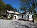
Starting point: Hunting cottage Budanje (420 m)
| Lat/Lon: | 45,8793°N 13,9589°E |
| |
Time of walking: 1 h 25 min
Difficulty: easy marked way
Altitude difference: 477 m
Altitude difference po putu: 515 m
Map: Goriška - izletniška karta 1:50.000
Recommended equipment (summer):
Recommended equipment (winter): ice axe, crampons
Views: 2.225
 | 1 person likes this post |
Access to the starting point:
a) First drive to Ajdovščina, then continue to Col. After a short climb, Ajdovščina ends and we continue cross-climbing along the road that rises above the Vipava valley. A few 100 metres after the 3. 5 km road marker, you will come to a small crossroads where a short road closed with a barrier branches off to the right, leading to the nearby Hunting Hut Budanje. Park at the junction on the right hand side of the road, or about 50 metres further on at a suitable roadside spot on the other side of the road.
b) Drive to Vipava, from where you continue driving towards the village of Vrhpolje. From Vrhpolje continue towards Col, Sanabor and Bela and continue along the ascending road, which leads higher up to a small crossroads, where you continue left (to the right of the village Bela and Sanabor). The road climbs uphill, with many serpentines, to a point where it joins the main Ajdovščina - Col road, and we follow it down to the left. After about 500 metres of driving on the main road, we reach the start of the marked trail leading to Kovk and Sinji vrh. At the starting point there is a wooden mountain marker for Kovk, and there is also a suitable place to park nearby. On the other side of the road, about 50 metres further on, there is a turn-off to the nearby Hunting Hut Budanje, where it is also possible to park along the road.
c) From Godovič or Kalce near Logatec, take Col, and from there continue towards Ajdovščina. At the road marker about 4 km you will see a small parking area on the right and signs for the Kovk footpath. On the other side of the road, about 50 metres further on, there is a turn-off to the nearby Hunting Hut Budanje, where it is also possible to park on the roadside.
Path description:
From the starting point, follow the footpath towards Kovka. The trail goes immediately into the forest through which it begins to climb, first moderately, but soon quite steeply. After a good 30-minute walk, you will reach a lookout point with a beautiful view of Nanos, the Vipava valley and the slopes above.
The way ahead is transiently completely laid, and then gradually begins to climb steeply again. We continue to climb through the forest for some time, and then we gradually pass the "wishing bell" and arrive in a more sparse forest and a little further on to a bench, a cross and a registration box at Sončnici.
From the signing-in box, continue straight for another 10 metres and then you will arrive in a small valley where there is a crossroads.
From the crossroads, turn left (Kovk to the right) and continue along the edge of the plateau on the scenic terrain, which will take you to the Sončnica airstrip in a minute or two.
From the airstrip, follow the marked trail westwards along the edge of the plateau. After a few short ascents and descents, you will quickly reach the summit of Kraguljc, identified by a small concrete stone (trigonometric point) at the top of the mountain.
Starting point - Sončnica 1:10, Sončnica - Kraguljc 15 minutes.
Description and pictures refer to the situation in 2015 (April).

Pictures:
 1
1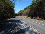 2
2 3
3 4
4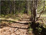 5
5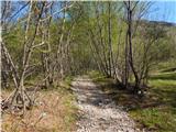 6
6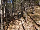 7
7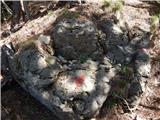 8
8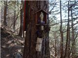 9
9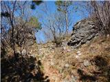 10
10 11
11 12
12 13
13 14
14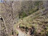 15
15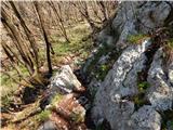 16
16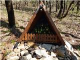 17
17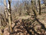 18
18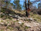 19
19 20
20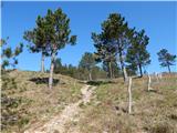 21
21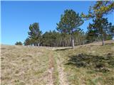 22
22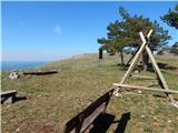 23
23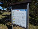 24
24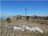 25
25 26
26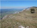 27
27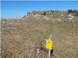 28
28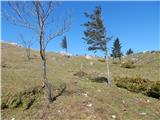 29
29 30
30 31
31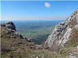 32
32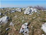 33
33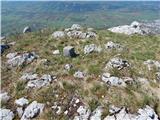 34
34 35
35 36
36
Discussion about the trail Hunting cottage Budanje - Kraguljc