Starting point: Hruševka (520 m)
| Lat/Lon: | 46,2335°N 14,726°E |
| |
Time of walking: 2 h 30 min
Difficulty: easy marked way
Altitude difference: 643 m
Altitude difference po putu: 685 m
Map:
Recommended equipment (summer):
Recommended equipment (winter): ice axe, crampons
Views: 9.447
 | 3 people like this post |
Access to the starting point:
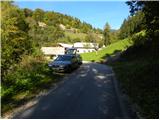
a) First, drive to Kamnik, then continue along the Tuhinj valley. We then drive through Vrhpolje, Soteska, Srednja vas, Loke and Potok. At Potok, the road to the spa Snovik branches off to the left, and we follow the main road for a few 100 m or until we reach a place where the signs for Hruševka direct us left onto a narrower local road. Follow the road up to the centre of the village, where the signs for the St Nicholas Trail point you down to the right. Here the road first descends slightly and then begins to climb gently along the Podbrešek brook. After a short climb, we reach the "last" house in the village, and we park a few 10 m earlier, in a convenient place along the road.
b) From the motorway Maribor - Ljubljana, take the exit Vransko and then continue along the parallel old road towards Ljubljana. At the end of Vransko, you will come to a junction where you turn right towards Tuhinjska dolina. Continue through Motnik, Špitalič, Cirkuše, Laze, Šmartno and Buč. After the village Buč, signs for Hruševka direct you to the right onto a narrow local road. Follow this road up to the centre of the village, where the signs for the footpath to St. Nicholas direct you down to the right. Here the road first descends slightly and then begins to climb gently along the Podbrešek brook. After a short climb, we reach the "last" house in the village, and we park a few 10 m earlier, in a convenient place along the road.
Path description:
From the starting point, turn sharp right in the direction of the footpath to St Nicholas. The path first climbs through the lane of a forest, then leads to the edge of the pastures, from where you have a beautiful view of the surrounding area. The path, at first a little more overgrown, returns to the woods and then passes a log cabin, after which it crosses another lane of scrub. Beyond the scrub, the path widens to cart track, which turns sharp left and leads into a dense forest. Walk along cart track for a short distance, and then the markings direct you to the right on an increasingly steep footpath. This rather steep path, which climbs through the forest all the way, is then followed all the way to the Church of St Nicholas on Gora, from which a beautiful view opens up.
From the church of St Nicholas we continue along the macadam road in the direction of Prevala. The road first starts to descend slightly, and then leads us to a place where a short footpath branches off to the left downhill towards a nearby small well, and we continue to follow the road as it starts to climb gently. After a short climb, the road leads us to a small preval, where a marked footpath branches off to the right towards Prevala. We focus on the above-mentioned path, which descends slightly, then passes to a ridge called V grebenih.
Here the path becomes quite steep and continues along and along the ridge, which is quite steep in places and in some places a little exposed (especially in wet conditions, there is a risk of slipping in some parts). Higher up, the path becomes more steep and leads us from the ridge to the edge of a large and overgrown clearing. Here the path turns left into the forest and descends gently to the nearby forest road, which is followed to the left. Follow the road for some time and then reach a crossroads with a cross in the middle of the road. From the crossroads, follow the marked cart track towards Prevala, which is a 40-minute climb away. Cart track continues to climb relatively steeply through the forest, crosses an old clearing at a higher level, then lays down and leads to a less well-marked crossroads.
At the point where cart track turns left, a marked footpath continues in a straight direction, climbing moderately at first and steeply through the forest. Follow this path, which is also overgrown with raspberries in the last part before Prevala, as far as the Prevala pass, which offers a fine view.

Pictures:
 1
1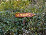 2
2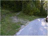 3
3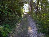 4
4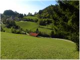 5
5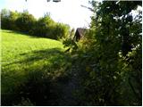 6
6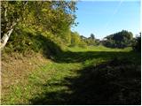 7
7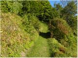 8
8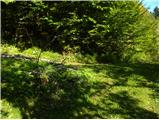 9
9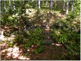 10
10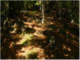 11
11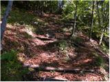 12
12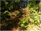 13
13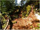 14
14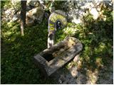 15
15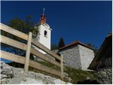 16
16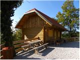 17
17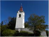 18
18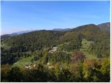 19
19 20
20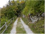 21
21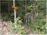 22
22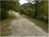 23
23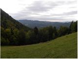 24
24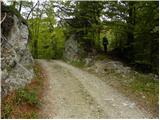 25
25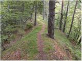 26
26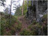 27
27 28
28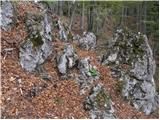 29
29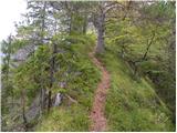 30
30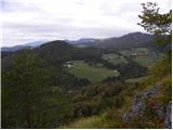 31
31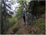 32
32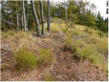 33
33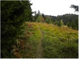 34
34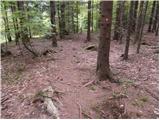 35
35 36
36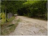 37
37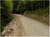 38
38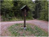 39
39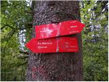 40
40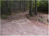 41
41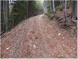 42
42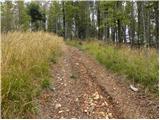 43
43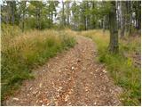 44
44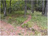 45
45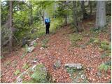 46
46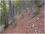 47
47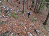 48
48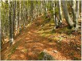 49
49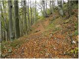 50
50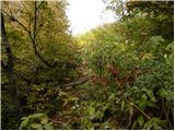 51
51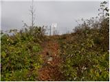 52
52 53
53 54
54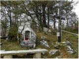 55
55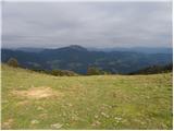 56
56
Discussion about the trail Hruševka - Prevala
|
| krpak29. 07. 2012 |
Danes sva šla s prijateljem peš iz Buča. Pot je krasna, le v zgornjem delu je na poti nekaj podrtih dreves. Tudi vreme na prevali krasno - brez vetra in z Lepenatko pred nosom. Pri pastirju pa se najde tudi kaj za suho grlo.
|
|
|
|
| docepe219. 01. 2015 |
Tu čez se vsako leto na Veliki Šmaren vračamo romarji iz Zagorja od Nove Štifte proti domu oz. Zgornjemu Tuhinju.
Na križu piše letnico postavitve, kapelica je pa bila blagoslovljena leta 2000.
Ob zadnjem prazniku je bil pa postavljen še zvonček.
Še prigoda: Pobi, ki smo šli štemat za kapelico oboroženi z agregatom in ustreznim ročnim orodjem smo lahko prišli še drugi dan, ker je škala tako trda, zato je nadstrešek raje dozidan.
Za vse tri postavitve gre pa največja zasluga gospodu Smrkolj Jožetu iz Izlak.
|
|
|
|
| vilma1719. 06. 2018 |
Pri opisu poti je navedeno:
Od cerkve sv. Miklavža nadaljujemo po makadamski cesti v smeri Prevale.
Od cerkve sv. Miklavža naprej ni nobene makedamske ceste . Samo komaj vidna potka, za katero domačini niso vedeli, da bi vodila na Prevalo.
Prava pot je cca 300 m pred sv. Miklavžem, a se oznaka (puščica brez napisa) vidi šele če se vračate. Cela pot je zelo slabo označena in ni možno priti nikamor brez pomoči mimoidočih. Zadnjih 10 min. poti pa ni bilo možno najti, saj so bile vse možnosti zaraščene do neprehodnosti.
Sama pot je drugače zanimiva, na določenih delih tudi zelo lepa.
|
|
|