Starting point: Hrpelje (480 m)
| Lat/Lon: | 45,6002°N 13,9468°E |
| |
Time of walking: 3 h 30 min
Difficulty: easy marked way
Altitude difference: 548 m
Altitude difference po putu: 650 m
Map: Slovenska Istra - Čičarija, Brkini in Kras 1:50.000
Recommended equipment (summer):
Recommended equipment (winter):
Views: 30.517
 | 3 people like this post |
Access to the starting point:
From the Ljubljana - Koper motorway, take the Kozina exit and follow the road towards Rijeka. At Hrpelje, you will see a sign saying "Gostilna na Vasi", which will direct you to the right to D. Benčiča-B. Follow this road to the inn and turn right. At the end of the village, continue along the macadam road along which you park (follow the marked road).
Path description:
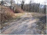
From the starting point, continue along the marked road, which quickly turns into the initially wide cart track. After a few minutes of walking, cart track splits into two parts, and we continue on the right towards Slavnik. The path along cart track surrounded by bushes starts to climb after a while and leads us higher up to a nice viewpoint with a nice bench.
The path then returns to the forest and continues its cross-climb up to a marked crossroads. Here we continue straight in the route Slavnik (right Hrpeljska gora) along the path, which joins the forest road higher up and leads us just a little further to the next crossroads. Continue in the direction of Slavnik (right hunting lodge under Glavica and Hrpeljska gora) along a relatively folded road which, after a few minutes' further walking, leads us to the hunting lodge at Lipa.
Continue walking along the road which, with a few short ascents and descents, leads to a marked crossroads in the immediate vicinity of mountain pasture Jegno. Here continue right in the direction Slavnik (left mountain pasture Jegno 5 minutes) along the slightly rockier cart track, which leads us higher into the forest, where it also climbs more steeply. After a short climb, the path is laid and leads us out of the forest onto grassy slopes surrounded by shrubs (mostly juniper). The path then goes back into the forest, crosses a forest road and leads us to a marked crossroads where the path from Prešnice joins us from the right. Continue left along the wide path, which joins the macadam road higher up. Follow this road for a few minutes and then the signs direct you left on a marked path which will take you in a few minutes to the top of Slavnik, which you can see from where you left the road.

Pictures:
 1
1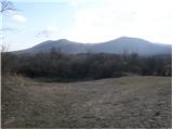 2
2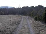 3
3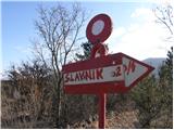 4
4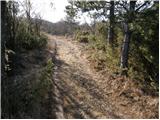 5
5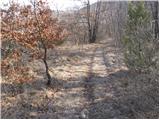 6
6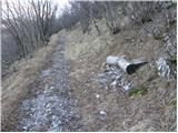 7
7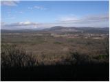 8
8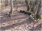 9
9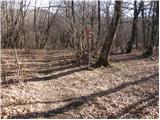 10
10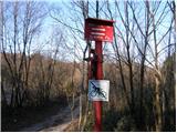 11
11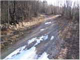 12
12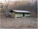 13
13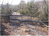 14
14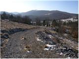 15
15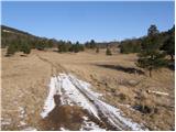 16
16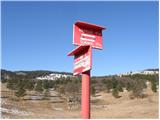 17
17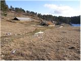 18
18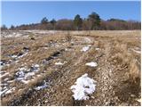 19
19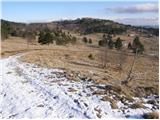 20
20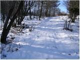 21
21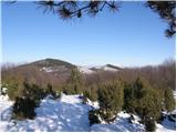 22
22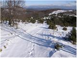 23
23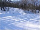 24
24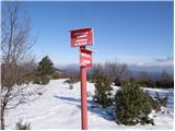 25
25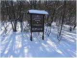 26
26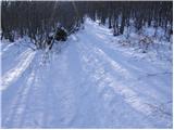 27
27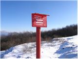 28
28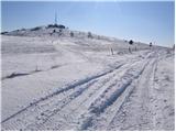 29
29 30
30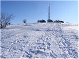 31
31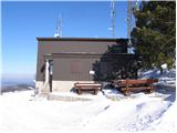 32
32 33
33
Discussion about the trail Hrpelje - Slavnik
|
| m.mojstrovc3. 08. 2009 |
lepa kolesarska tura s spustom v podgorje 
|
|
|
|
| Karletto11. 09. 2010 |
Danes sem potokel vse osebne rekorde. Na Slavnik sem se odpravil iz Sežane  , torej Sežana - Kokoš - Hrpelje - Slavnik - Podgorje. Na poti iz Hrpelj na Slavnik se mi je najboj vtisnilo v spomin tisto razgedišče s klopco in dolinica s kmetijo.
|
|
|
|
| Hribovc8823. 10. 2012 |
Zanima me koliko je od železniške postaje do izhodišča?
Najlepša hvala
|
|
|
|
| Mak11. 03. 2025 17:27:24 |
Jutri grem na Slavnik, obljubljajo vetrovno vreme. Javim kako je bilo.
|
|
|