Hotel Plesnik - Icmanikova planina (via Rkljeva peč)
Starting point: Hotel Plesnik (760 m)
| Lat/Lon: | 46,3946°N 14,63°E |
| |
Name of path: via Rkljeva peč
Time of walking: 2 h 15 min
Difficulty: partly demanding marked way
Altitude difference: 760 m
Altitude difference po putu: 760 m
Map: Kamniške in Savinjske Alpe 1:50.000
Recommended equipment (summer): helmet
Recommended equipment (winter): helmet, ice axe, crampons
Views: 5.818
 | 1 person likes this post |
Access to the starting point:
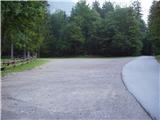
We drive to Luce (to get here from Mozirje or via Kranjski rak) and on to the Logar valley. Shortly after the village Solčava, you will come to a crossroads where the road to Logarska dolina turns left. Turn left towards the Logar valley (pay the toll) and drive to the crossroads, where you continue along the road on the left (slightly to the right of the Rinka waterfall), which you then follow to the large parking lot near the Plesnik hotel (parking in front of the hotel is only allowed for guests).
Path description:
From the parking lot, follow the walking trail, which takes you past the Plesnik Hotel and leads you to the Palenk waterfall in a few minutes. At the waterfall, you will see a mountain sign with the inscription Strelovec and Icmankov stan, which points to the left. The path then immediately climbs steeply up the steep and wet slippery slope, which is at the same time also exposed to falling rocks. The steep path quickly leads to a stream (above the waterfall) where there is a small orientation lop. Here we continue sharp left along a poorly trodden but marked path (the path to the right leads to the waterfalls of the Palenk stream), which continues to climb steeply. Higher up, the steepness eases for a short time, but only because you cross a slightly exposed steep slope below the Rkljevo stove (jeklenica). The path then goes into the forest again and joins the path from Plesnikova mountain pasture higher up.
Continue left along a noticeably less steep path, which leads us to a wooden house with a few small views. From the hut, which is situated in a small clearing with no views, the path returns to the forest, where it then climbs to the edge of Icmanikova planina, where there is a crossroads. From the crossroads you can descend a few tens of metres to the shepherd's hut or climb to the Logarska peč viewpoint, 5 minutes away.

Pictures:
 1
1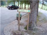 2
2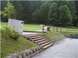 3
3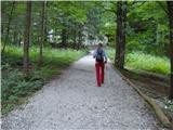 4
4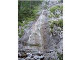 5
5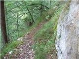 6
6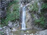 7
7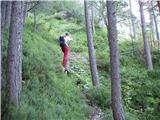 8
8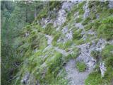 9
9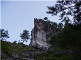 10
10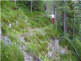 11
11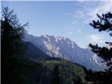 12
12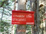 13
13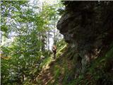 14
14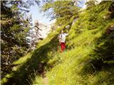 15
15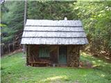 16
16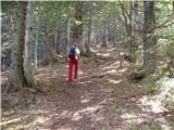 17
17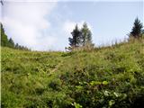 18
18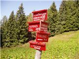 19
19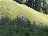 20
20
Discussion about the trail Hotel Plesnik - Icmanikova planina (via Rkljeva peč)
|
| lararal7. 09. 2020 |
Prejšnji teden (Sep 2020) smo se odpravili po tej poti. Pot je izjemno strma, zelo slabo označena, če sploh (Ni smernih tabel in markacije so povsem zbledele) in deloma težko prehodna zaradi padlega drevja in posledic ujme.
Kasneje smo o poti govorili z domačini, ki vzpon po omenjeni poti odsvetujejo in povedali, da se poti namenoma ne ureja več. Predlagam avtorju, da se spremeni opis v neoznačeno stezo.
|
|
|