Hotavlje - Vrhovski grič (via Slajka)
Starting point: Hotavlje (409 m)
| Lat/Lon: | 46,1072°N 14,1176°E |
| |
Name of path: via Slajka
Time of walking: 2 h 30 min
Difficulty: easy marked way
Altitude difference: 549 m
Altitude difference po putu: 600 m
Map: Škofjeloško in Cerkljansko hribovje 1:50.000
Recommended equipment (summer):
Recommended equipment (winter): ice axe, crampons
Views: 470
 | 1 person likes this post |
Access to the starting point:
DeepL logo
DeepL logo Translator
DeepL Pro
For Business
Why DeepL?
API
Plans and pricing
Apps
Start free trial
Login
Menu
Due to high traffic on the free DeepL Translator, the service is limited at the moment and advanced editing functions are not available.
Millions translate with DeepL every day. Popular: Spanish to English, French to English, and Japanese to English.
Translation modes
Translate text
29 languages
Translate files
. pdf, . docx, . pptx
Translate text
Source text
Select source language. Currently selected:
Slovenian
a) Iz Železniki, Kranja ali Medvod se zapeljemo v Škofja Loka, od tam pa z vožnjo nadaljujemo v smeri Gorenje vasi v Poljane dolini in Žirem. Za Gorenjo vasjo, v naselju Hotavlje, pa v križišču za Gostilno Lipan zapustimo glavno cesto proti Žirem in z vožnjo nadaljujemo desno v smeri smučišča Cerkno in vasi Leskovica. Takoj za križiščem parkiramo na primernem mestu ob cesti.
b) Iz Horjul ali Polhovega Gradca se zapeljemo v Lučine, od tam pa se spustimo v Gorenjo vas. V Gorenji vasi nadaljujemo levo proti Žirem, nato pa v Hotavlje v križišču za Gostilno Lipan nadaljujemo desno v smeri smučišča Cerkno in vasi Leskovica. Takoj za križiščem parkiramo na primernem mestu ob cesti.
c) Z Vrhnike, Logatca ali Spodnja Idrija se zapeljemo v Žiri, od tam pa z vožnjo nadaljujemo proti Gorenji vasi in Škofja Loka, mi pa se po glavni cesti peljemo le do kraja Hotavlje, kjer zavijemo levo v smeri smučišča Cerkno in vasi Leskovica. Takoj za križiščem parkiramo na primernem mestu ob cesti.
d) Najprej se zapeljemo v Cerkno, od tam pa z vožnjo nadaljujemo preko prevala Kladje (Podlanišče) proti Sovodnju. Iz Sovodnja z vožnjo nadaljujemo ob potoku Hobovščica, nato pa v nekoliko večjem križišču nadaljujemo levo v smeri Gorenje vasi (desno Žiri). Po glavni cesti proti Škofja Loka se peljemo do kraja Hotavlje, kjer zavijemo levo v smeri smučišča Cerkno in vasi Leskovica. Takoj za križiščem parkiramo na primernem mestu ob cesti.
Translation results
Select target language. Currently selected:
English
a) From Železniki, Kranj or Medvode, drive to Škofja Loka, and from there continue in the direction of Gorenje vasi in the Poljane valley and Žirem. After Gorenja vasja, in Hotavlje, leave the main road towards Žire at the junction after Gostilna Lipan and turn right towards the ski resort Cerkno and the village of Leskovica. Just after the junction, park in a suitable place on the roadside.
b) From Horjul or Polhovy Gradec, drive to Lučine and from there descend to Gorenjska vas. In Gorenjja vas, turn left towards Žire, then at Hotavlje, at the junction after Gostilna Lipan, turn right towards the ski resort Cerkno and the village of Leskovica. Just after the crossroads, park in a suitable place on the roadside.
c) From Vrhnika, Logatec or Spodnja Idrija, drive to Žiri, from there continue to Gorenjska vas and Škofja Loka, and follow the main road only to Hotavlje, where you turn left towards the ski resort Cerkno and the village of Leskovica. Just after the crossroads, park in a suitable place on the roadside.
d) First drive to Cerkno and from there continue over the Kladje (Podlanišče) pass towards Sovodnje. From Sovodnje, drive along the Hobovščica stream, then turn left at a slightly larger junction towards Gorenje vas (right Žiri). Follow the main road towards Škofja Loka to Hotavlje, where you turn left towards the ski resort Cerkno and the village of Leskovica. Just after the crossroads, park in a suitable place on the roadside.
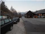
From the starting point, where the vending machine of the farm pr Šupc is located nearby, continue along the road towards the village Železniki and in the direction of the hiking trails to Škofja Loka, Poljane and Slajko. Walk along the roadside for a few minutes, partly on the pavement, and then the signs for Poljane and Slajka direct you to the left (straight ahead Škofja Loka), where you cross the bridge Leskovica, and just after the bridge, at the church of St. Lawrence, continue to the right and gradually start climbing. At first we climb past a few more houses, then the signs direct us sharp left, where we continue for some 10 steps along cart track, and on the hayfield cart track turns into a path, which turns slightly to the right and leads us past one more house. Higher up, we cross some poorer cart tracks, and the markings lead us through the slightly overgrown path lane to an asphalt road, which we only cross. On the other side of the road, you first climb steeply and then continue along a narrower track which continues along a small valley, where the route of the power lines also runs. From the valley, you soon ascend across to the right, where you reach a ridge (here another path joins from the right), and here the path turns to the left. A little further on, cross another track, and when you leave the forest, climb quickly to an asphalt road, which you follow to the right. The tarmac road then leads us past a bench, where the path to Horjul branches off to the right, and we follow the semicircular road to the left to a nearby farm, from which we are only a minute's walk from Lučine.
Dictionary
The dictionary is unavailable for this language pair.
Unlock DeepL’s full potential – Try DeepL Pro for free
Try Pro for 30 days free
You are using the free version of DeepL
Translate up to 5,000 characters
Translate 3 locked documents/month
10 glossary entries
Unlock DeepL Pro features
Maximum data security
Unlimited text translation
Translate and edit more documents
See more features
Translate even faster with DeepL apps
Desktop app image
DeepL for WindowsDownload for free
DeepL for
iOS
and
Android
Download for free
DeepL in the Press
Tech giants Google, Microsoft and Facebook are all applying the lessons of machine learning to translation, but a small company called DeepL has outdone them all and raised the bar for the field.
Its translation tool is just as quick as the outsized competition, but more accurate and nuanced than any we’ve tried.
TechCrunchUSA
DeepL has also outperformed other services, thanks to more "French-sounding" expressions.
Le MondeFrance
Even though the translations from English by Google and Microsoft are quite good, DeepL still surpasses them. We have translated a report from a French daily newspaper - the DeepL result was perfect.
Golem. deGermany
A quick test carried out for the combination English-Italian and vice versa, even without any statistical pretensions, allowed us to confirm that the quality of the translation is really good. Especially from Italian into English.
La StampaItaly
The system recognizes the language quickly and automatically, converting the words into the language you want and trying to add the particular linguistic nuances and expressions.
ABCSpain
Indeed, a few tests show that DeepL Translator offers better translations than Google Translate when it comes to Dutch to English and vice versa.
RTL ZNetherlands
In the first test - from English into Italian - it proved to be very accurate, especially good at grasping the meaning of the sentence, rather than being derailed by a literal translation.
la RepubblicaItaly
Personally, I'm very impressed by what DeepL is able to do and yes, I think it's really great that this new stage in the evolution of machine translation was not achieved with software from Facebook, Microsoft, Apple or Google, but by a German company. We like to make ourselves a little bit small and pretend that there is no one in this country who can stand up to the big players. DeepL is a good example that it is possible.
Mobile GeeksGermany
DeepL from Germany could surpass Google Translate
WIRED's quick test shows that DeepL's results are indeed in no way inferior to those of the high-ranking competitors and, in many cases, even surpass them. The translated texts often read much more fluently; where Google Translate forms completely meaningless word chains, DeepL can at least guess a connection.
WIRED. deGermany
DeepL, an online translator that outperforms Google, Microsoft and Facebook
wwwhat's newLatin America
Language
English
DeepL
Resources
Help Center
Blog
API documentation
Data security
Privacy policy
Terms & Conditions
Product
Free translator
Features
DeepL Pro
Translation API
Desktop app
Mobile app
Chrome extension
Company
Contact Sales
Press
Careers
Publisher
twitter
facebook
linkedin
github
instagram
Path description:
From the starting point, where the vending machine of the farm pr Šupc is located nearby, continue along the road towards the village Leskovica and in the direction of the hiking trails to Blegoš, Ermanovec and Slajko. Walk along the roadside for a few minutes, partly on the pavement, and then the signs for Ermanovec and Slajka direct you to the left (straight ahead Blegoš), where you cross the bridge Kopačnica, and just after the bridge, at the church of St. Lawrence, continue to the right and gradually start climbing. At first we climb past a few more houses, then the signs direct us sharp left, where we continue for some 10 steps along cart track, and on the hayfield cart track turns into a path, which turns slightly to the right and leads us past one more house. Higher up, we cross some poorer cart tracks, and the markings lead us through the slightly overgrown path lane to an asphalt road, which we only cross. On the other side of the road, you first climb steeply and then continue along a narrower track which continues along a small valley, where the route of the power lines also runs. From the valley, you soon ascend across to the right, where you reach a ridge (here another path joins from the right), and here the path turns to the left. A little further on, cross another track, and when you leave the forest, climb quickly to an asphalt road, which you follow to the right. The tarmac road then leads us past a bench, where the path to Vrh Slajke branches off to the right, and we follow the semicircular road to the left to a nearby farm, from which we are only a minute's walk from Dom na Slajki.
From home, we return to the nearby farm, where we bypass the main buildings on the upper side and continue our journey along the dirt road, which turns into a track in the nearby meadow. Then you walk through the lane of a forest and arrive at the grassy slopes of Špik or Vranškovi Hill (both names appear on the maps), which you cross with beautiful views. When you reach a dirt road, follow it downhill (private land on the right), and when the road has been laid, join the wider dirt road, which you reach above the Hom farm.
Continue in the direction of Ermanovec and then walk along the dirt road for some time, which later becomes asphalt. There is some downhill with good views, then from a small crossroads continue slightly right (slightly left to reach St. Paul's Church in Stara Oselica), and from the next crossroads go slightly left (slightly right to Rotovž Farm).

We can extend the trip to the following destinations: Štor
Pictures:
 1
1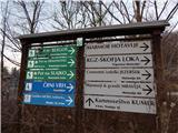 2
2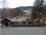 3
3 4
4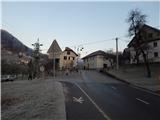 5
5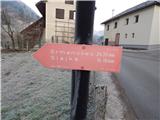 6
6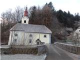 7
7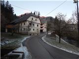 8
8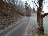 9
9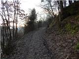 10
10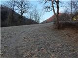 11
11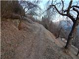 12
12 13
13 14
14 15
15 16
16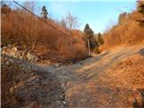 17
17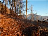 18
18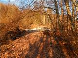 19
19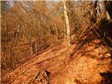 20
20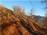 21
21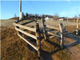 22
22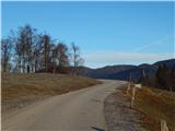 23
23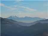 24
24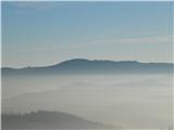 25
25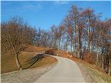 26
26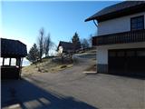 27
27 28
28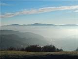 29
29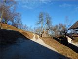 30
30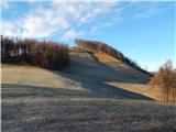 31
31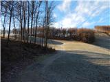 32
32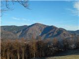 33
33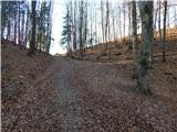 34
34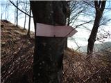 35
35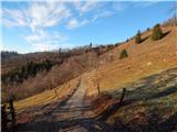 36
36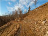 37
37 38
38 39
39 40
40 41
41 42
42 43
43 44
44 45
45 46
46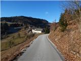 47
47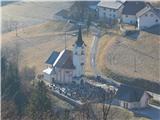 48
48 49
49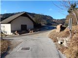 50
50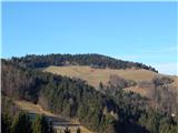 51
51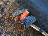 52
52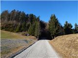 53
53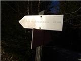 54
54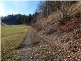 55
55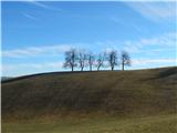 56
56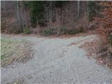 57
57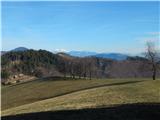 58
58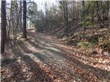 59
59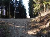 60
60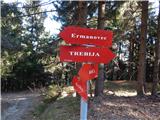 61
61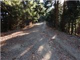 62
62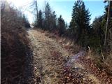 63
63 64
64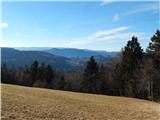 65
65 66
66 67
67 68
68
Discussion about the trail Hotavlje - Vrhovski grič (via Slajka)