Starting point: Hotavlje (409 m)
| Lat/Lon: | 46,1072°N 14,1176°E |
| |
Time of walking: 1 h 15 min
Difficulty: easy marked way
Altitude difference: 380 m
Altitude difference po putu: 380 m
Map: Škofjeloško in Cerkljansko hribovje 1:50.000
Recommended equipment (summer):
Recommended equipment (winter):
Views: 16.771
 | 1 person likes this post |
Access to the starting point:
a) From Železniki, Kranj or Medvode, drive to Škofja Loka, and from there continue in the direction of Gorenje vasi in the Poljane valley and Žirem. After Gorenja vasja, in Hotavlje, leave the main road towards Žire at the junction after Gostilna Lipan and turn right towards the ski resort Cerkno and the village of Leskovica. Just after the junction, park in a suitable place on the roadside.
b) From Horjul or Polhovy Gradec, drive to Lučine and from there descend to Gorenjska vas. In Gorenjja vas, turn left towards Žire, then at Hotavlje, at the junction after Gostilna Lipan, turn right towards the ski resort Cerkno and the village of Leskovica. Just after the crossroads, park in a suitable place on the roadside.
c) From Vrhnika, Logatec or Spodnja Idrija drive to Žiri, from there continue to Gorenjska vas and Škofja Loka, we take the main road only to Hotavlje, where we turn left in the direction of the ski resort Cerkno and the village of Leskovica. Just after the crossroads, park in a suitable place on the roadside.
d) First drive to Cerkno and from there continue over the Kladje (Podlanišče) pass towards Sovodnje. From Sovodnje, drive along the Hobovščica stream, then at a slightly larger junction turn left towards Gorenje vas (right Žiri). Follow the main road towards Škofja Loka to Hotavlje, where turn left towards the ski resort Cerkno and the village of Leskovica. Just after the crossroads, park in a suitable place on the roadside.
Path description:
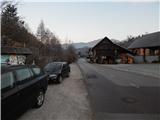
From the starting point, where the vending machine of the farm pr Šupc is located nearby, continue along the road towards the village Leskovica and in the direction of the hiking trails to Blegoš, Ermanovec and Slajko. Walk along the roadside for a few minutes, partly on the pavement, and then the signs for Ermanovec and Slajka direct you to the left (straight ahead Blegoš), where you cross the bridge Kopačnica, and just after the bridge, at the church of St. Lawrence, continue to the right and gradually start climbing. At first we climb past a few more houses, then the signs direct us sharp left, where we continue for some 10 steps along cart track, and on the hayfield cart track turns into a path, which turns slightly to the right and leads us past one more house. Higher up, we cross some porer cart tracks, and the markings lead us through the slightly overgrown path lane to an asphalt road, which we only cross. On the other side of the road, you first climb steeply and then continue along a narrower track which continues along a small valley, where the route of the power lines also runs. From the valley, you soon ascend across to the right, where you reach a ridge (here another path joins from the right), and here the path turns to the left. A little further on, cross another track, and when you leave the forest, climb quickly to an asphalt road, which you follow to the right. The tarmac road then leads us past a bench, where the path to Vrh Slajke branches off to the right, and we follow the semicircular road to the left to a nearby farm, from which we are only a minute's walk from Dom na Slajki.
Description and pictures refer to January 2020.

Pictures:
 1
1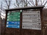 2
2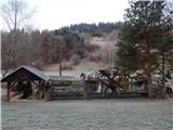 3
3 4
4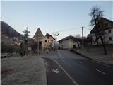 5
5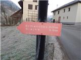 6
6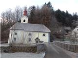 7
7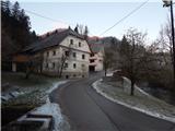 8
8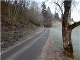 9
9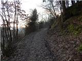 10
10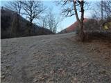 11
11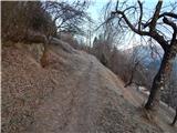 12
12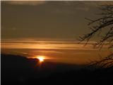 13
13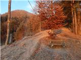 14
14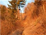 15
15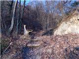 16
16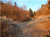 17
17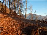 18
18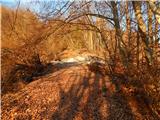 19
19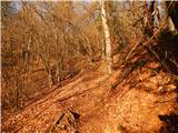 20
20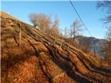 21
21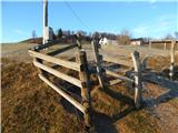 22
22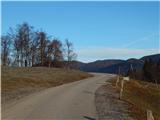 23
23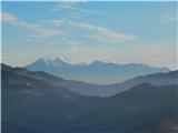 24
24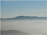 25
25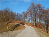 26
26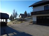 27
27 28
28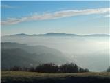 29
29
Discussion about the trail Hotavlje - Dom na Slajki
|
| margu503. 09. 2009 |
Slajka je lepa v vseh letnih časih.Ker je naš krovni hrib je od nas domačinov dobro obiskan.Tudi kadar človek nima napretek časa na Slajko lahko skoči ob vsakem času.Tako je bilo tudi s menoj v torek 1 septembra.Čudovit pozno poletni dan z krasnimi razgledi,sta mi dan popestrila dva orla.Ker takega še nisem nikoli prej videla, na internetu pa mu je podoben samo planinski orel se sprašujem ali je to mogoče.Bil je par,samec je imel na krilih bele kroge iz katerih sta štrleli "zakrici",fascinanten pogled naživali.L.p.MARGU
|
|
|
|
| dejan1007. 09. 2009 |
Lep nedeljski vzpon z družino. Prijeten in ravno prav dolg, čeprav so otroci malo "tečnarili". Verjetno ni bil njihov dan. Padla je odločitev, da pridemo še enkrat pozimi, ko bo sneg (verjtno po cesti). Lp, Dejan iz Škofje Loke.
|
|
|
|
| Ljubljana22. 05. 2016 |
Opis poti je zelo zastarel. Travniki in doline v opisu so zdaj gozd. Pri vzpenjanju od cerkve po asfaltni poti priporočam pozornost na markacije, ki se pojavijo strmo levo v gozd. Slike 3 v naravi ni več. Lep pozdrav.
|
|
|