Grda draga - Mali Snežnik
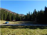
Starting point: Grda draga (1172 m)
| Lat/Lon: | 45,5837°N 14,4144°E |
| |
Time of walking: 1 h 30 min
Difficulty: easy marked way
Altitude difference: 522 m
Altitude difference po putu: 522 m
Map: Snežnik 1:50.000
Recommended equipment (summer):
Recommended equipment (winter): ice axe, crampons
Views: 1.920
 | 1 person likes this post |
Access to the starting point:
a) From Cerknica or Nová vas na Bloki, first drive to Bloška Police and from there continue in the direction of Loš and Babne Polje. At Pudob, turn right in the direction of Snežnik, Ilirska Bistrica, Knežak and the nearby settlement of Kozarišče. In Kozarišče, turn slightly left in the direction of Snežnik and follow the road in the direction of Snežnik at the following junctions. When Kozarišče ends, the asphalt also ends, and we continue to the left in the direction of Mašun and Knežak, just after the bridge over the Malá Obrh. A long drive on a dirt road follows, and after about 19 km from Kozarišče we reach a crossroads where the road from Mašun joins from the right. Here, continue left in the direction Sviščaki, which is about 10 km further on macadam, and at the crossroads follow the signs for Sviščaky. After about 27 km of macadam road, you will reach the hunting lodge in Grda Draga, and about 100 m further on you will reach the mountain and information boards, near which you park.
b) We drive to Pivka, and from there we continue our drive to Knežak. In Knežak, at the marked crossroads, turn left in the direction of Masun and the settlements Bač and Koritnicee. A little further on, go right in the direction of Masun and Koritnice (straight ahead Bač). After Koritnice the road starts to climb more visibly, and then after 18 km from the main crossroads in Knežak it leads to Masun, from where you continue driving right in the direction of Sviščaki, which is approximately 12 km away on a macadam road. 2 km before Sviščaki we arrive at a larger grassy plain called Grda draga, where we first see a hunting lodge, and about 100 m further the start of a marked mountain trail at Snežnik we arrive at the Mountain Home at Sviščaki we park.
c) First drive to Ilirska Bistrica, then continue driving to Sviščaki (the turnoff is in the middle of Ilirska Bistrica and is marked, it may be a little less visible). Initially, the asphalt road is climbed, then after about 12 km of climbing, the asphalt is replaced by macadam. There are about 7 km of macadam, and then you reach a crossroads near the Mountain Home on Sviščaki, where you continue straight towards the nearby Mountain Home on Sviščaki. From the mountain home, continue driving towards Mašun, where after a further 2 km of macadam you will reach Grda Draga, where you will park next to the mountain signs.
Path description:
From the starting point in Grda Draga, follow the footpath in the direction of Snežnik and Snežna Mati Boží. The path first leads us along the edge of the meadow, then, after a small forage field, which we pass on the right, it leads us into the forest, through which we first climb slowly, then moderately, along the cart track. Cart track has a few forks, and we follow the path along which we see the markings. The chapel of Our Lady of the Snows is reached at a higher level and the path continues along cart track, which has a few forks. Also at these crossroads, follow the signs and then cross the forest road, where the path from the starting points Sviščaki and Snežnik Grda jama joins from the right, and the road leading to Pekel continues to the left.
Continue in the direction of Snežnik, following the path which continues through the dense forest. Cross a small clearing at a higher level, then return to the forest, and the path begins to climb steeply to the left. After a few minutes of cross-climbing, you reach a marked crossroads where the path from Mašun joins.
Continue again in the direction of Snežnik, this time on a slightly steeper path that leads past the memorial. Above the memorial, we get our first extensive view, which stretches across the Nanos all the way to the Alps. We continue to climb along the path that leads us through dwarf pines. When the steepness subsides, we reach the old trigonometric point stone, located at the top, or a few steps below the top of Mali Snežnik, from where we can see the view of Veliki Snežnik, Istria, Primorska, Notranjska, etc.
Description and pictures refer to the situation in 2015 (October).

Pictures:
 1
1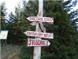 2
2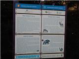 3
3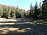 4
4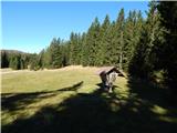 5
5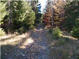 6
6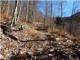 7
7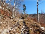 8
8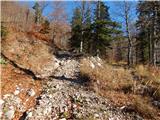 9
9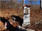 10
10 11
11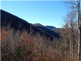 12
12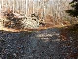 13
13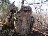 14
14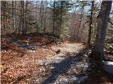 15
15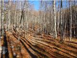 16
16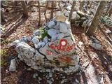 17
17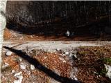 18
18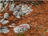 19
19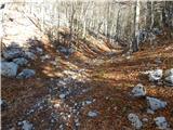 20
20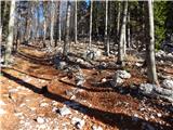 21
21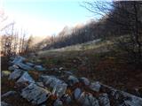 22
22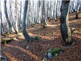 23
23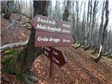 24
24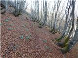 25
25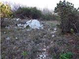 26
26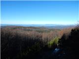 27
27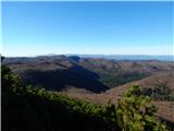 28
28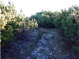 29
29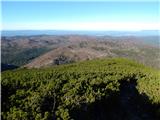 30
30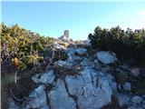 31
31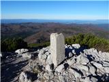 32
32 33
33
Discussion about the trail Grda draga - Mali Snežnik