Grahovše - Bela peč (below rock wall)
Starting point: Grahovše (800 m)
| Lat/Lon: | 46,3664°N 14,3518°E |
| |
Name of path: below rock wall
Time of walking: 2 h 15 min
Difficulty: partly demanding unmarked way
Altitude difference: 793 m
Altitude difference po putu: 795 m
Map: Karavanke - osrednji del 1:50.000
Recommended equipment (summer): helmet
Recommended equipment (winter): helmet, ice axe, crampons
Views: 7.527
 | 3 people like this post |
Access to the starting point:
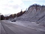
From the Ljubljana - Jesenice motorway, take the Ljubelj exit (Tržič) and then continue towards Ljubelj. Just before the petrol station in Bistrica pri Tržiču, leave the main road and turn right towards Tržiča. Continue through Tržič in the direction of Dolžanove gorge, then turn right at the end of the town in the direction of Lom pod Storžičem and Grahovš. When you arrive in Grahovše, follow the road to the nearby quarry, next to which there is a marked parking area.
Path description:
From the parking lot, continue along the road along which you parked and after a few steps you will come to two crossroads. At the first crossroads, continue straight ahead (there is a village on the right across the bridge) and at the second crossroads you will come to a set of mountain signs.
Here, turn left onto the upper path marked Javornik, Stegovnik and Bela peč. The road starts to climb moderately here and leads us across meadows with views in places. The road then leads to the next crossroads, where you go left again (Rekar farm on the right).
The road then crosses private land with wood and soon afterwards comes to the next crossroads. Here continue on the road to the right in the route mountain pasture Javornik. The road from here on runs almost horizontally for a while, but then starts climbing again and leads us to a small hamlet. Here we continue along the road, which slowly turns to the left. Shortly afterwards, the road makes a right turn and leads to a signpost.
Leave the road here and take the footpath to the sharp left towards Bela Peča (straight ahead - the cottage on Javornik). The path goes immediately into the forest and at first just crosses the slopes. After a few minutes' walk from the road, you will see a wall on the right in front of you. Here you put on your helmet and continue along the path, which starts to climb steeply under the walls of Bela Peć. You climb right up to the edge of the wall where there is a registration box.
From the box, descend three steps back to the signpost, where the sign Bela peč, Trodden Path, points to the right. The path continues to climb the steep scree below the wall. There is a high risk of falling rocks! The path circles the summit in a considerable slope and only a few metres below the summit, more precisely at the fence, joins the path from Konjščice and the Pr Zdravc hut. After that, cross the fence and reach the top in a few steps.

Pictures:
 1
1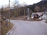 2
2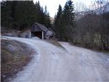 3
3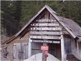 4
4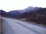 5
5 6
6 7
7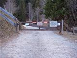 8
8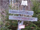 9
9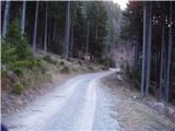 10
10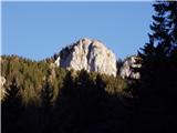 11
11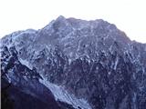 12
12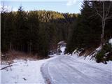 13
13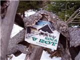 14
14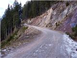 15
15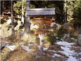 16
16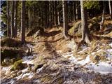 17
17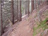 18
18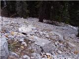 19
19 20
20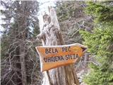 21
21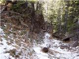 22
22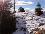 23
23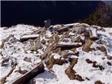 24
24 25
25
Discussion about the trail Grahovše - Bela peč (below rock wall)
|
| Guest14. 01. 2007 |
Zelo lepa razgledna točka in prijeten dostop s sedla Dol.
|
|
|