Gornja Radgona (OŠ Gornja Radgona) - Norički vrh
Starting point: Gornja Radgona (OŠ Gornja Radgona) (225 m)
| Lat/Lon: | 46,67482°N 15,98968°E |
| |
Time of walking: 20 min
Difficulty: easy unmarked way
Altitude difference: 78 m
Altitude difference po putu: 80 m
Map: Turistična karta Štajerska 1:50.000
Recommended equipment (summer):
Recommended equipment (winter):
Views: 300
 | 2 people like this post |
Access to the starting point:
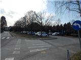
a) Leave the Pomurje motorway at exit Lenart v Slovenskih goricah and follow the road towards Gornja Radgona. When you arrive in Gornja Radgona, turn right in the town centre towards the bus station, the cemetery and the primary school. After the bus station, the road starts to climb and we follow it to a large parking lot between the Gornja Radgona Primary School and the Gornja Radgona Cemetery.
b) Take the road to Radenci, then follow the road to Gornja Radgona, where you take a sharp left in the centre of the town towards the bus station, the primary school and the cemetery. After the bus station, the road starts to climb and we follow it to a large parking lot between the Gornja Radgona Primary School and the Gornja Radgona Cemetery.
Path description:
From the parking lot, continue along the road or pavement and you will quickly arrive in Hercegščak. A little further on, the pavement ends, and we go left towards Policam, where we pass a pond and arrive in the settlement of Norički Vrh. There is a steeper climb, but when the road turns right, we leave it at the sign marking the start of the settlement from the opposite side and continue sharp left on the initially wider cart track. Cart track quickly narrows and climbs between vineyards, where, with good views, you arrive at the foot of Norički vrh. Here the path first turns to the right, and a few steps further on from the bend, a gate is seen in the fence through which you step out onto the scenic peak.
Description and pictures refer to March 2021.
Pictures:
 1
1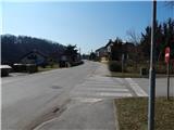 2
2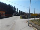 3
3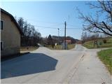 4
4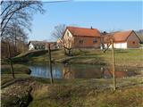 5
5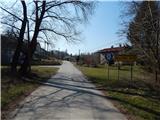 6
6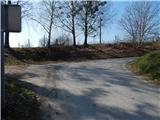 7
7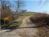 8
8 9
9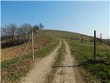 10
10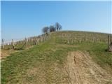 11
11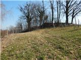 12
12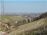 13
13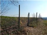 14
14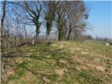 15
15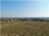 16
16
Discussion about the trail Gornja Radgona (OŠ Gornja Radgona) - Norički vrh