Gorenja vas - Javorč (via Jermanca)
Starting point: Gorenja vas (407 m)
| Lat/Lon: | 46,103°N 14,141°E |
| |
Name of path: via Jermanca
Time of walking: 2 h
Difficulty: easy marked way
Altitude difference: 494 m
Altitude difference po putu: 570 m
Map: Škofjeloško in Cerkljansko hribovje 1:50.000
Recommended equipment (summer):
Recommended equipment (winter):
Views: 6.660
 | 1 person likes this post |
Access to the starting point:
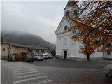
a) From Žiri or Škofja Loka drive to Gorenjska vas, and in Gorenjska vas turn from the roundabout at the Petrol station in the direction of Vrhnika and Horjul. After the bridge over the Poljanska Sora, turn right in the direction of Žirovski Vrh Sv. Antona, and we park a few 100 metres further on in the parking lot next to the parish church of the parish Trata - Gorenja vas.
b) From Horjul or Polhovy Gradec, drive to Lučine, then descend to Gorenjska vas. Before crossing the Poljanska Sora, turn left in the direction of Žirovski Vrh Sv. Anton, and we park a few 100 metres further on in the parking lot next to the parish church of the parish Trata - Gorenja vas.
Path description:
From the parish church, continue along the main road or pavement, then at the primary school the road turns slightly right towards the Lajše settlement. When Gorenja vas ends, the road becomes steeper and the first markings can be seen in Lajše. Above the settlement, continue along the road on the right in the direction of the sandpit Lajše, and a little further on go left to the marked cart track. Continue through the forest, following cart track, which climbs transversely to the left, and higher up reaches a ridge where we join an unmarked, but better trodden path from the settlement of Dobravšce.
The path continues along and along the wooded ridge, and higher up it joins an asphalt road, which you follow upwards. A little further on, you reach a small crossroads, where you continue on a slightly left road in the direction of Kavčič farm, and from the road, go a few 10 steps higher, slightly left on a marked footpath in the direction of Javorč. The way forward leads us through the forest for a few minutes, and when we come out of the forest, we can already see the Jermanca transmitters in front of us, which are only a minute's walk away.
From the registration box at Jermanca, continue straight to the nearby farm Jermanca, where you cross an asphalt road, then follow the left side of the house to a hayfield, which you climb up to the edge of the forest. As you enter the forest, cart track appears and you follow it up to the farm Zaleše, where you reach another asphalt road. Follow the road to the right as it starts to turn to the left. At the end of the bend, just before the asphalt road turns right, we continue slightly left on the macadam road, which continues in a slight ascent along the edge of the forest. As we enter the forest, the road splits and we continue to the left, and after a few minutes of further walking we reach the information board of the rupnik line, where there is a larger unfinished underground structure called Resistance Point Žirovski Vrh.
Continue along the road, and after a short descent, when you reach an asphalt road, turn left downhill to a nearby crossroads.
From the crossroads, go right towards Goleg vrh and the Javorč hunting lodge. There is an easy ascent along the asphalt road, which you follow at the crossroads in the direction of the hunting lodge. Higher up, the path from Dolenja Dobrava first joins us from the left, and a few 10 steps further on, the path from Žiri joins us from the right. Both times, we continue in the direction of Javorč, whose summit and hunting lodge are quickly reached.
Description and pictures refer to the situation in 2017 (November).

Pictures:
 1
1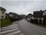 2
2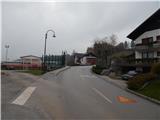 3
3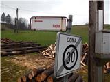 4
4 5
5 6
6 7
7 8
8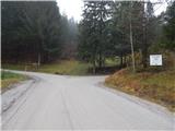 9
9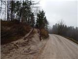 10
10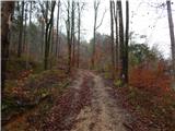 11
11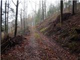 12
12 13
13 14
14 15
15 16
16 17
17 18
18 19
19 20
20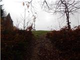 21
21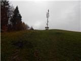 22
22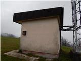 23
23 24
24 25
25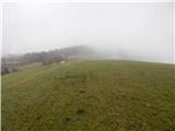 26
26 27
27 28
28 29
29 30
30 31
31 32
32 33
33 34
34 35
35 36
36 37
37 38
38 39
39 40
40 41
41 42
42 43
43 44
44 45
45 46
46 47
47 48
48 49
49 50
50 51
51 52
52 53
53 54
54 55
55 56
56 57
57 58
58 59
59 60
60 61
61 62
62 63
63
Discussion about the trail Gorenja vas - Javorč (via Jermanca)