Gabrje - Limbarska gora (footpath)
Starting point: Gabrje (500 m)
| Lat/Lon: | 46,1477°N 14,773°E |
| |
Name of path: footpath
Time of walking: 45 min
Difficulty: easy marked way
Altitude difference: 273 m
Altitude difference po putu: 273 m
Map: Ljubljana - okolica 1:50.000
Recommended equipment (summer):
Recommended equipment (winter):
Views: 38.854
 | 2 people like this post |
Access to the starting point:
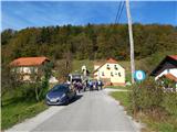
a) From the motorway Ljubljana - Maribor, take the exit Krtina and then continue in the direction of Moravče. At Moravče, turn left in the direction of Limbarska gora and Sveti Mohorje, and at the next junction, where the road to Sveti Mohorje turns left, turn slightly right in the direction of Limbarska Gora. The road then gradually begins to climb, and we follow it through the village of Zalog to the village of Gabrje pod Limbarsko, where the forest ends, and the road lays down, or even descends slightly. When you reach a moderate right turn, where you see a brick chapel on the right, continue left onto the road with speed bumps. A few 10 metres further on, we are at the beginning of the described path at the next chapel. There are no parking spaces at the starting point.
b) From the direction of Zasavje, take the first exit to Izlake and from there continue towards Moravče. When the road starts to descend towards Moravče, pay attention to right turns, as you will leave the main road towards Moravče at the turn-off towards the settlement of Peče. In Peče, turn left at the church, then continue driving through Zgornje Koseze and Mošenik to Gabrje pod Limbarsko goro, where you will reach a small junction opposite a chapel and turn right onto a road with speed bumps. A few 10 metres further on, you will reach the next chapel at the beginning of the route described above. There are no parking spaces at the starting point.
Path description:
The start of the mountain trail is slightly to the left of the chapel, where we can see the mountain markings for Limbarska gora on the electricity pole, which tell us that we have a 45-minute walk to the top. After a few steps, the trail goes into the forest, through which we climb for a few minutes, and then we reach an asphalt road, which we follow to the right, and we walk along it until we reach a left turn. At this bend, the marked path continues straight ahead, initially along a nearby fence. The path, which is at first a little overgrown, soon turns left and begins to climb through the forest. At a higher level, cart track continues through the forest for a short distance, then begins to climb cross-country through a large hayfield. When the crossing ends, you reach a small hamlet (Globočica), where you continue left along the wide cart track or worse road. The road turns right at a higher altitude and then lies slightly further on at the next hamlet. An easy walk past a few houses follows, then continue along the slightly steeper cart track, which turns into an asphalt road higher up, which joins the main asphalt road leading to the top of Limbarska Gora.
Follow the road up past a few more houses, and then, with the views getting better and better, quickly climb up to St Valentine's Church and the guesthouse on Limbarska Gora.

Pictures:
 1
1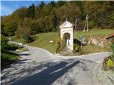 2
2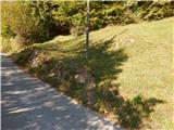 3
3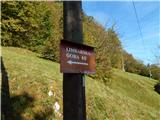 4
4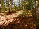 5
5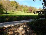 6
6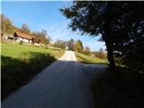 7
7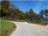 8
8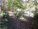 9
9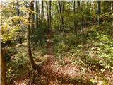 10
10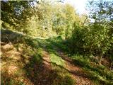 11
11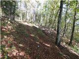 12
12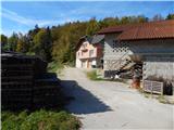 13
13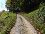 14
14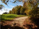 15
15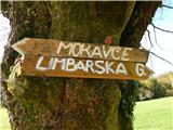 16
16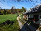 17
17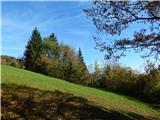 18
18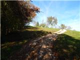 19
19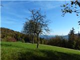 20
20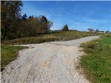 21
21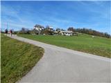 22
22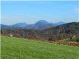 23
23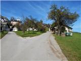 24
24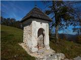 25
25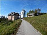 26
26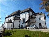 27
27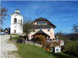 28
28 29
29
Discussion about the trail Gabrje - Limbarska gora (footpath)
|
| kroki29. 01. 2008 |
Ob jasnem in spranem ozračju vidimo prekrasne kamniško-savinjske Alpe in Julijce.
|
|
|
|
| marchy14. 09. 2009 |
Ej, a mogoče pozna kdo pot na Limbarsko goro iz Trojan, baje se tud da prit ? Bi lepo prosu za kratek opis poti če gdo ve, pa hvala vnaprej.
|
|
|
|
| AndrejN15. 09. 2009 |
Iz Trojan kreneš v smeri Ljubljane po glavni cesti. Ko prideš do prevala , ko se cesta začne spuščati zaviješ levo v smeri Zavrh-a. Nadaljuješ po cesti , ki pelje do Dolin. Od tam preko Škal do vasi Borje. Tam prideš do asfaltne ceste in po njej nadaljuješ proti Golčaju. Ta cesta pelje do Blagovice , zato pazi da jo pravi čas zapustiš in greš po makadamu. Na Golčaju je vpisna knjiga, cerkvica in klopca za počitek. Z Golčaja nadaljuješ po potki deloma tudi cesti do asfaltne ceste Limbarska-Moravče. Na križišču zaviješ desno v hrib in po parih minutah vidiš cerkev na Limbarski.
Pot je po celotni dolžini markirana.
Srečno pot !
Andrej
|
|
|
|
| marchy15. 09. 2009 |
Ok, hvala Andrej za pojasnilo, prvi prost vikend jo mahnem na Limbarsko.
|
|
|
|
| al198118. 08. 2010 |
Sem bil že kar nekajkrat ne Limbarski, pa sem se naveličal ene in iste poti :-(
dva dni nazaj sem iz L. Gore hotel priti direkt do Moravč... pa je zelo slabo označeno... A zna kdo opisat kako iz Moravč na vrh?
|
|
|
|
| Gorska rožica19. 08. 2010 |
Meni najljubša pot je skozi Serjuče, pri trgovini Tuš zaviješ na levo v križišču ,se pelješ ali hodiš pribl.2km,mimo šole skozi vas Soteska in zaviješ desno čez mostiček ,kjer je vas Serjuče .Ko je konec asfalta nekje parkiraš na kmetiji,so zelo prijazni domačini.Pot je cela markirana,pelje skoraj ves čas skozi gozd ,le malo pred vrhom greš po jasi in prečkaš cesto,še malo po hribu navzgor ,zadnji kilometer pa gre žal samo po cesti. SREČNO !!
|
|
|
|
| Gorska rožica19. 08. 2010 |
Po večini vsi hodijo pri trgovini Tuš desno ,skozi Zalog, v Gaberju zaviješ levo inv prvem razpotju levo čez Vodice,zaviješ čez gozd na desno...in je baje tudi markirana....jo žal ne kori
stim ,grem po tej smeri vedno samo s kolesom ..lep dan !!
|
|
|