Franz-Josefs-Höhe - Fuscherkarkopf
Starting point: Franz-Josefs-Höhe (2369 m)
| Lat/Lon: | 47,0752°N 12,7516°E |
| |
Time of walking: 3 h 45 min
Difficulty: difficult pathless terrain, difficult marked way
Altitude difference: 962 m
Altitude difference po putu: 980 m
Map:
Recommended equipment (summer): helmet
Recommended equipment (winter): helmet, ice axe, crampons
Views: 4.540
 | 3 people like this post |
Access to the starting point:
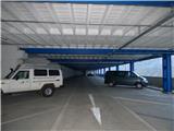
From the Karavanke Tunnel, follow the motorway towards Salzburg to the motorway junction where you turn left towards Spittal. From Spittal, drive towards Lienz. Shortly after the motorway ends, at Möllbrücke, turn right towards Mallnitz and then follow the signs for the Großglockner Alpine road. When you reach the mountain village of Heiligenblut, 1336m high, you only have 17 km of the Grossglockner Hochalpenstrasse, the most famous Alpine panorama road. The toll for this road is €35. 50 per car (August 2017). At a roundabout at about 1900m, turn left towards Kaiser-Franz-Josefs-Höhe and the Pasterze glacier. Follow this road to the end and then park in the garage.
Path description:
From the large viewing platform next to the garage, head into the tunnel and follow the signs for the Gamsgrubenweg. The path then leads through a relatively wide tunnel, which is lit so that you don't need a torch. The tunnel is made up of six sections and displays various things to do with the surrounding area. Once out of the tunnel, continue along a wide and fairly level path to the north-west. From the path, you have a very good view all the way to the Großglockner (Grossglockner) and the Pasterze glacier, which is the largest and longest glacier in the Eastern Alps. The trail to the left then soon branches off towards the glacier. For many years, the Hofmannshütte hut stood near the crossroads. It was built in 1869 and demolished in 2016.
We continue along the scenic route, along which there are several benches and information boards. The path then soon leads to a marked crossroads. At the crossroads, we leave the wide path leading to the Wasserfallwinkel glacier and the Oberwalderhütte hut and head right up towards the summit of Fuscherkarkopf.
From the crossroads, the path climbs steeply and soon leads to a rocky slope, which is secured by a cable car. A few times we climb in the keys along the cableway on a smooth rocky slope, which is not too steep and does not cause any major problems on land. The slope then becomes a little less steep and we continue along the broad southern ridge to the north. A little higher up, the ridge becomes narrower and the ascent becomes a little more difficult. First, with the help of some fixed safety gear, we cross quite steep slopes and then there is a steep but well protected descent into a small notch.
It is also possible to reach the stubble by an easy trackless path, but due to the belaying nature of the path, walking on the trackless path is not desirable, which is also pointed out by a sign along the way. From the stumps there is a short climb along the steel cable then the path leads us along the left side of the ridge for a while. Here we climb up a fairly steep slope, which is not protected so some caution is needed. Later the path turns right again onto the ridge and the slope becomes slightly less steep. The ascent continues along the relatively easy and wide southern ridge. This route continues until the main ridge where the western summit of Fuscherkarkopf is reached.
From the western summit, continue right along the ridge. The ascent becomes a shade more difficult here and follows the ridge throughout. In a few places you can also follow the ridge to the right, but this is not strictly necessary as there is no significant difference in difficulty. The ridge, which is slightly exposed in places, is then followed all the way to the summit.
Descend along the ascent route.

Pictures:
 1
1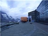 2
2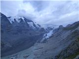 3
3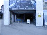 4
4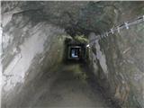 5
5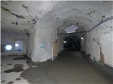 6
6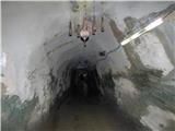 7
7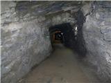 8
8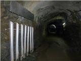 9
9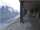 10
10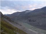 11
11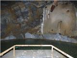 12
12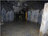 13
13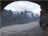 14
14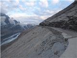 15
15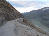 16
16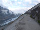 17
17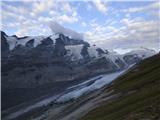 18
18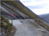 19
19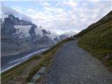 20
20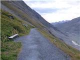 21
21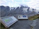 22
22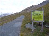 23
23 24
24 25
25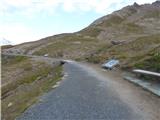 26
26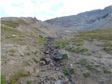 27
27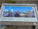 28
28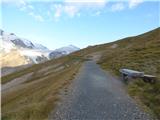 29
29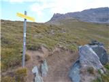 30
30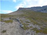 31
31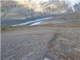 32
32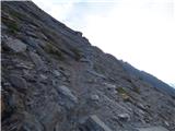 33
33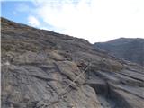 34
34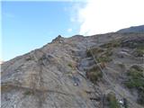 35
35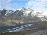 36
36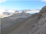 37
37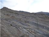 38
38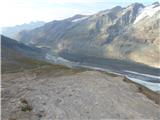 39
39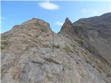 40
40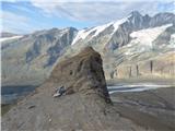 41
41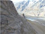 42
42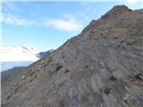 43
43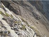 44
44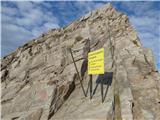 45
45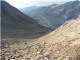 46
46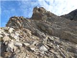 47
47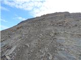 48
48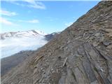 49
49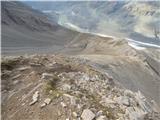 50
50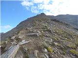 51
51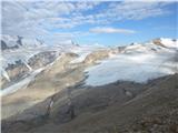 52
52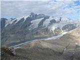 53
53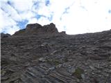 54
54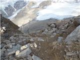 55
55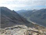 56
56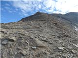 57
57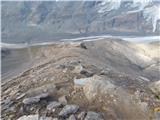 58
58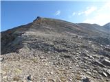 59
59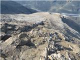 60
60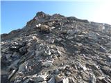 61
61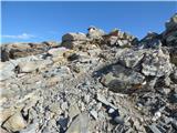 62
62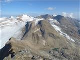 63
63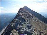 64
64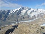 65
65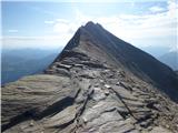 66
66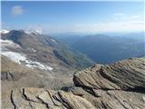 67
67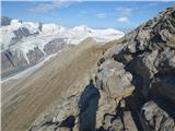 68
68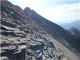 69
69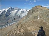 70
70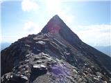 71
71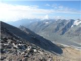 72
72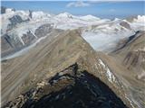 73
73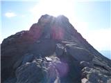 74
74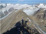 75
75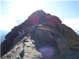 76
76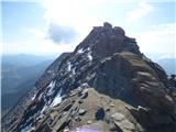 77
77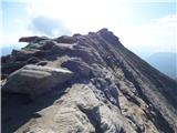 78
78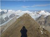 79
79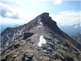 80
80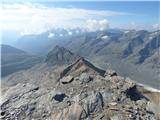 81
81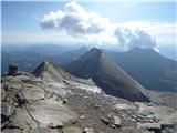 82
82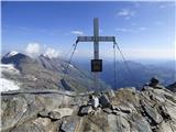 83
83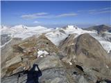 84
84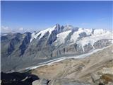 85
85
Discussion about the trail Franz-Josefs-Höhe - Fuscherkarkopf
|
| zorkob23. 09. 2018 |
V petek 21.09.2018 sva bila z ženo na vrhu po opisani poti. Pot je čudovita in razgledna. Spodnji del je speljan po zelo spolzkem (grušč) in slabo označenem terenu. Celotna pot je sicer brez markacij. Pot ni zaznamovana (predel slike 38) z stopinjami, ker hodiš po ploščah, tako, da so ti edini orientir jeklene palice na vsakih cca. 20-30 metrov (slika 38) in je potrebno biti previden kako prečkaš police. Pot je sicer zavarovana z jeklenicami in na splošno ni tehnično zahtevna. Predvsem velja dobro opazovanje kje vodi pot (shojenost) za predel slike 49, da ne zaideš iz poti. Kakšno dodatno varovalo tu tudi ne bi škodilo. Ta predel je kar malo zoprn. Bolj, ko greš proti vrhu, bolj je pot videti shojena zaradi mehkejšega terena in problemov z orientacijo ni več. Hoja po grebenu do vrha je prava poslastica z razgledi! Sestop po isti poti...in toplo priporočam spust po melišču na levi strani (smer navzdol), tam kjer je rumena tabla za vstop v škrbino. Spust po melišču, skoraj mivki  , prihrani veliko časa... Za vzpon sva potrebovala cca.2:45 ure in za spust cca.2h. Čudovita tura z razgledi po Visokih Turah...in na Grossglockner !!  
|
|
|