Ehrwald - Zugspitze (via Gatterl)
Starting point: Ehrwald (1108 m)
| Lat/Lon: | 47,38801°N 10,93843°E |
| |
Name of path: via Gatterl
Time of walking: 7 h 30 min
Difficulty: difficult marked way
Altitude difference: 1854 m
Altitude difference po putu: 2000 m
Map:
Recommended equipment (summer): helmet, self belay set
Recommended equipment (winter): helmet, self belay set, ice axe, crampons
Views: 7.070
 | 2 people like this post |
Access to the starting point:
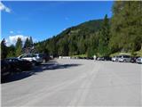
Drive through the Karavanke Tunnel into Austria, then continue to Spittal and on to Lienz (the motorway ends a little after Spittal). We continue along a relatively nice and wide road through the Drava Valley, which leads us into Itali. The road continues past Dobbiaco/Toblach and Brunico/Bruneck. We continue on the main road and then join the motorway towards Austria (direction Brenner, Innsbruck). In Innsbruck, follow the motorway westwards along the Inn River (direction Innsbruck-West at the motorway junction). Leave the motorway at the exit for the Fernpaß Pass. Continue over the pass and when the road starts to descend, turn right towards Ehrwald (there are also signs for Zugspitze at the exit). After passing through Ehrwald, turn right towards the Ehrwalder Almbahn cable car. The road then starts to climb and we keep following the signs for the cable car. Park in one of the car parks at the bottom station of the cable car.
Path description:
At the bottom station of the cable car, first continue right along the road, then after a few dozen metres continue left on the macadam road after the "Ehrwalder Alm" signs.
From the crossroads, the relatively flat road runs along the forest and soon leads to another crossroads. At the crossroads we continue straight on the road, and a more difficult path (Immensteig) branches off to the right towards Lake Seebensee.
The road continues along the ski slope at the edge of the forest and leads past the bottom station of the chairlift and a small hut on the side of the road. At the hut, where the view opens up towards the top of the Westliche Plattspitze, continue slightly left and start to climb a little steeper. The road then leads into the forest and continues to climb quite steeply. Higher up, you reach the left side of the circular cable car and continue climbing through the forest. When you come out of the forest and back onto the ski slope, your path turns right and then follows the right-hand side of the cable car again. The road continues to pass close to the cable car alongside the ski slope. This route, which also offers increasingly beautiful views, soon leads to the hut at mountain pasture Ehrwalder Alm, where the upper station of the circular cable car is also located. The mountain pasture can also be reached by cable car in the summer months.
From the upper cable car station, follow the dirt road, which leads quickly to a crossroads. Continue along the road on the left and straight ahead to the nearby Gasthof Alpenglühn and on to Lake Seebensee and the Coburger Hütte. After only a few dozen metres of walking, you reach another crossroads. This time continue on the dirt road slightly to the right and follow the signs for mountain pasture Hochfeldern Alm.
Continue for some time on a fairly level dirt road, heading eastwards all the way. After about half an hour's walk from mountain pasture Ehrwalder Alm, the path leads to another marked crossroads.
We turn left on the footpath (Max Klotz Steig) towards mountain pasture Hochfeldern Alm, and straight ahead a slightly longer path leads to the same mountain pasture and the path towards the Gaistal valley. From the crossroads, you first climb up the grassy slope next to the ski slope, and then the path leads into the forest. The well-worn path through the forest first climbs slightly steeper and then crosses the slope to the east in a gentle ascent. This path then soon rejoins the dirt road. From here it is only a short climb along the road to the hut at mountain pasture Hochfeldern Alm.
At the cottage, continue left on the footpath past the "Knorrhütte" signs. The path then climbs up the grassy slopes above the cottage and later turns slightly to the right and leads to a crossroads.
At the crossroads, continue right and soon cross the stream. The path then climbs up the grassy slopes crosswise, and higher up, for a while, it also passes through dwarf pines. The scenic route here runs north-eastwards all the way and leads to the saddle Am Brand below the slopes of the summit of Östlicher Gatterlkopf.
At the saddle, the path turns slightly to the left and leads to slightly steeper slopes. The path descends slightly here and crosses the slopes to the north-east. This path then leads to a marked crossroads at the Feldern Jöchl saddle.
At the crossroads, continue left towards the Knorrhütte hut, while to the right the path leads into the Gaistal valley and the mountain pasture Rotmoos Alm.
From the crossroads the path first descends a little further and crosses the slopes below the eastern slopes of the Östlicher Gatterlkopf. There is a short climb up to the Gatterl saddle, where the border between Austria and Germany is also located. The ascent to the saddle is a bit steeper and is helped by a couple of ropes.
From the saddle, descend a little further and you will have a view of the Reintal valley and the Zugspitze peak. The trail then crosses the relatively gentle slopes to the north for some time until it reaches the Knorrhütte hut.
At the hut where there is a crossroads, continue to the left following the signs "Sonnalpin, Zugspitze". From the hut the path starts to climb up the scree to the north-west and leads to the base of the Innere Höllentalspitze. The path then turns slightly to the left and becomes slightly flatter. Here the path runs along the right-hand side of a broad plateau called 'Auf dem Platt'. From the path, you have a good view of the ski area and the peaks above the plateau. The path, which is not too steep, then runs westwards for some time until it reaches a crossroads just in front of the Sonnalpin restaurant.
At the crossroads, continue right and start climbing a little steeper on the scree. The path here passes to the right of the Schneefernerhaus hut, which is also reached by train from Garmisch-Partenkirchen. After climbing up the scree, the path leads to the start of the sheltered part of the route.
The well-protected path here follows a slightly steeper rocky slope and climbs towards the ridge.
When you reach the ridge, the path opens up to a beautiful view to the west. The trail continues along the ridge on the German side and is soon joined on the left by the Stopselziehersteig protected trail on the Austrian side. At the crossroads there is also the abandoned Kammhotel where the top station of the gondola lift used to be.
From the crossroads, continue along the well-protected path along the ridge towards the top of the Zugspitze. The last part of the ascent is then followed by a climb up the steps to the upper gondola stations.
If you want to go to the eastern summit, where the cross stands, continue on the German side past the Münchener Haus hut and take the short sheltered path to the summit. The trail first descends a little and then climbs up a ladder to a ridge where it joins the more difficult sheltered trails on the German side. There is only a short climb up the ridge to the summit, from which you have a view of the Höllentalferner glacier and the ridge towards the Alpspitze summit.

Pictures:
 1
1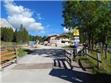 2
2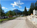 3
3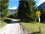 4
4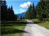 5
5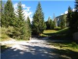 6
6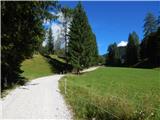 7
7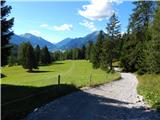 8
8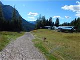 9
9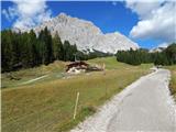 10
10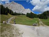 11
11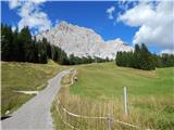 12
12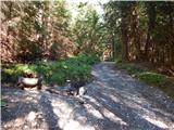 13
13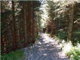 14
14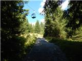 15
15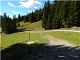 16
16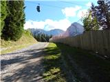 17
17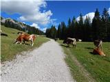 18
18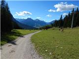 19
19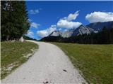 20
20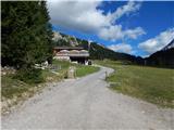 21
21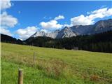 22
22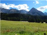 23
23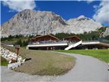 24
24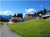 25
25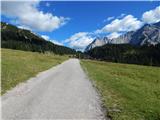 26
26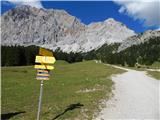 27
27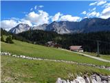 28
28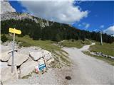 29
29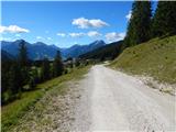 30
30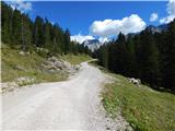 31
31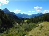 32
32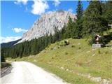 33
33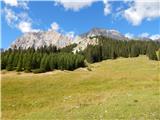 34
34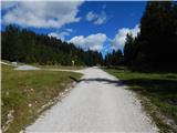 35
35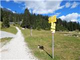 36
36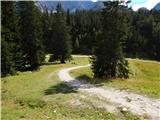 37
37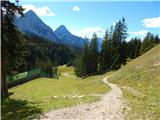 38
38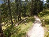 39
39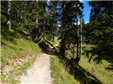 40
40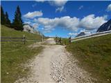 41
41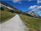 42
42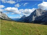 43
43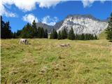 44
44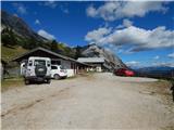 45
45 46
46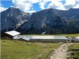 47
47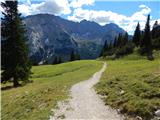 48
48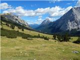 49
49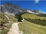 50
50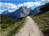 51
51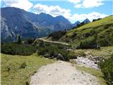 52
52 53
53 54
54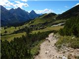 55
55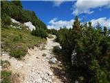 56
56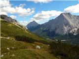 57
57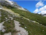 58
58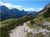 59
59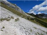 60
60 61
61 62
62 63
63 64
64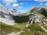 65
65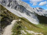 66
66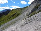 67
67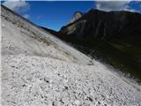 68
68 69
69 70
70 71
71 72
72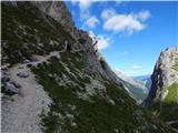 73
73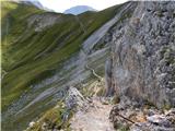 74
74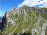 75
75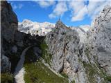 76
76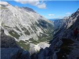 77
77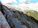 78
78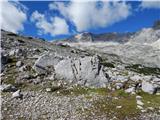 79
79 80
80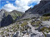 81
81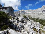 82
82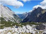 83
83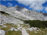 84
84 85
85 86
86 87
87 88
88 89
89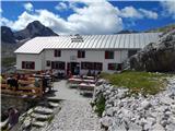 90
90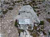 91
91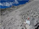 92
92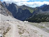 93
93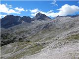 94
94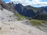 95
95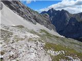 96
96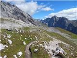 97
97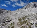 98
98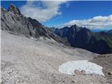 99
99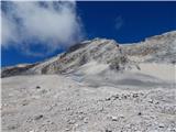 100
100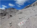 101
101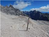 102
102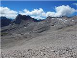 103
103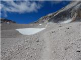 104
104 105
105 106
106 107
107 108
108 109
109 110
110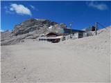 111
111 112
112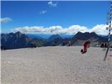 113
113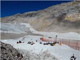 114
114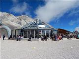 115
115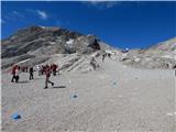 116
116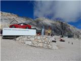 117
117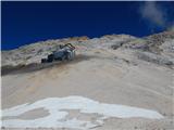 118
118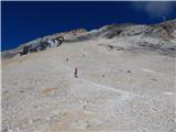 119
119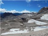 120
120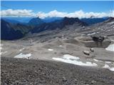 121
121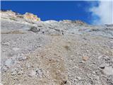 122
122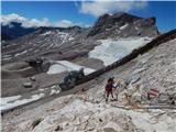 123
123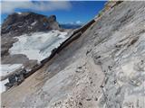 124
124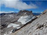 125
125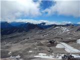 126
126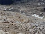 127
127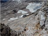 128
128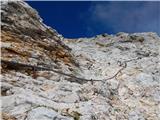 129
129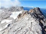 130
130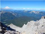 131
131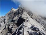 132
132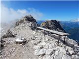 133
133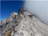 134
134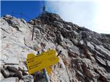 135
135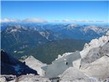 136
136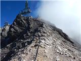 137
137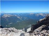 138
138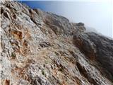 139
139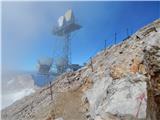 140
140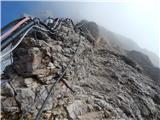 141
141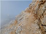 142
142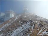 143
143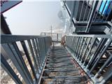 144
144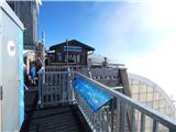 145
145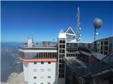 146
146 147
147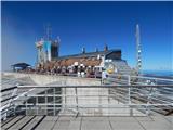 148
148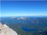 149
149 150
150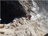 151
151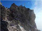 152
152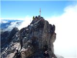 153
153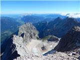 154
154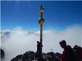 155
155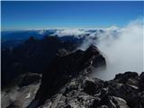 156
156 157
157
Discussion about the trail Ehrwald - Zugspitze (via Gatterl)
|
| acjom9. 08. 2016 |
Je že kdo hodil po tej poti na Zugspitze, kako je s spanjem v koči Knorrhutte, je potrebna rezervacija?  
|
|
|