Dovje - Blažčeva skala (western path)
Starting point: Dovje (760 m)
| Lat/Lon: | 46,4688°N 13,9602°E |
| |
Name of path: western path
Time of walking: 1 h
Difficulty: easy unmarked way
Altitude difference: 331 m
Altitude difference po putu: 335 m
Map: Kranjska Gora 1:30.000
Recommended equipment (summer):
Recommended equipment (winter): ice axe, crampons
Views: 3.230
 | 2 people like this post |
Access to the starting point:
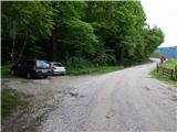
a) Leave the Gorenjska motorway at exit Jesenice West (Hrušica), then continue in the direction of Kranjska Gora. Follow the main road towards Kranjska Gora to the first road turnoff towards Dovjem, and follow the signs for Dovško Baba through the village. After crossing the stream Mlinca, where the MHP (small hydroelectric power plant) is located, park at a suitable place along the road, where there are also mountain direction signs.
b) First drive to Kranjska Gora, then continue to Jesenice. Leave the main road to Jesenice when the signs for Dovje direct you to the left, and follow the signs for Dovško Baba through the village. After crossing the stream Mlinca, where the MHP (small hydroelectric power plant) is located, park at a suitable place along the road, where there are also mountain direction signs.
Path description:
From the starting point, continue along the macadam road in the direction of Jesenice (marked path to Dovško Baba on the left). The road initially climbs cross-country, and during the ascent we occasionally get a nice view of the Julian Alps. Higher up, the road first turns sharp left, then right. At the right-hand bend, leave the road and continue straight on cart track, which climbs cross-country to the left, before reaching a small pass to the right on a beaten track, which then passes a small, partly wooden house on the left-hand side. The path continues through the woods, passing a game feeding area, and after crossing a small stream, bear slightly left. The path then ascends along an unmarked valley to a small pass, where there is a crossroads of unmarked paths.
To the left along the ridge, the track continues, which leads us higher up to the road leading to mountain pasture Dovška Rosenbachsattel, straight down the eastern path to the road, and to the right the track continues, leading to Blažec's Rock.
Continue right and climb quickly to the registration box, bench and cross on Blažec's Rock.
Description and pictures refer to the situation in May 2020.

Pictures:
 1
1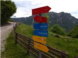 2
2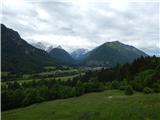 3
3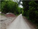 4
4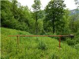 5
5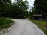 6
6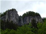 7
7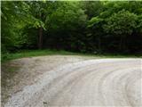 8
8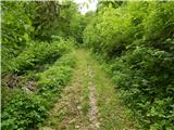 9
9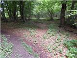 10
10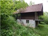 11
11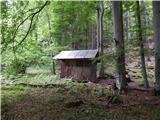 12
12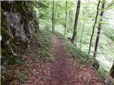 13
13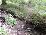 14
14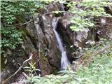 15
15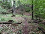 16
16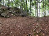 17
17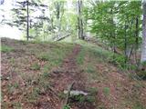 18
18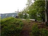 19
19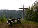 20
20 21
21
Discussion about the trail Dovje - Blažčeva skala (western path)
|
| tango4. 02. 2022 14:53:42 |
Danes sva skočila na Bvažčovo skalo, take so pač oznake na "vzhodni" poti. Iz ceste, ki pelje proti parkirišču, ki je izhodišče za Dovško babo ( ne tisti ob mali HE) ampak končno, sva zavila levo v delu kjer so trije vikendi in " križev pot". Dostop enostaven, na vrhu en, dva, tri, razgledi pa res prekrasni. Za lepši pogled na Julijce se je potrebno sicer z vrha malo spustiti ( SZ smer), v smer iz katere pride zahodna pot.
|
|
|
|
| Majdag25. 05. 2023 15:13:43 |
Bvaščeva skala, krožna pot.... Začeli sva s sestro na ovinku, slika 8. Sestopili pa sva po drugi strani pri križevem potu. Pa po cesti nazaj do avta. Lažji, vsaj meni, je pristop na skalo z ovinka. Občutek na vrhu skale je čudovit in razgledi so krasni. Pot je strma na obe strani. Pri sestopu je bilo še veliko listja in nekaj metrov blatne steze.  https://jelenkamenmajdag.blogspot.com/2023/05/bvasceva-skala.html https://jelenkamenmajdag.blogspot.com/2023/05/bvasceva-skala.html
|
|
|
|
| grega_p20. 03. 2025 16:38:43 |
Po odcepu na sliki 14 se (trenutno) pot skorajda izgubi oz. vabi višje gor na naslednji preval. Tja sem tudi jaz prišel in potem po grebenu navzdol na pravi preval.
Pri spustu sem opazil, da je kar nekaj podrtih bukev in da listje zakriva "odcep" desno čez potok malo pred sliko št.16. Orientacija sicer ni tako težavna, vendar sem vseeno tam malce odmaknil listje in nastavil palice za pravilno smer hoje.
|
|
|