Dom Trilobit - Hochstuhl/Stol
Starting point: Dom Trilobit (939 m)
| Lat/Lon: | 46,4579°N 14,1031°E |
| |
Time of walking: 4 h 30 min
Difficulty: easy marked way
Altitude difference: 1297 m
Altitude difference po putu: 1400 m
Map: Karavanke - osrednji del 1:50.000
Recommended equipment (summer): helmet
Recommended equipment (winter): helmet, ice axe, crampons
Views: 16.414
 | 3 people like this post |
Access to the starting point:
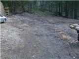
From the motorway Ljubljana - Jesenice take the exit Lipce and turn right towards Jesenice. In the village of Javornik, at the first semaphorised junction, turn right (direction Lj. ) towards Koroška Bela. At the next traffic-light junction turn left, and soon turn left again towards Javornik Rovto. After a few kilometres of uphill driving (when we have already arrived in the village), the macadam road turns sharp left and heads straight towards Dom Trilobit (signposted). After a few 100 m, we reach the lake, along which the road runs, and on the left we see Dom Trolobit. When you pass this building, the road ends in the wods, and here is your starting point.
Path description:
On the left side of the starting point, the slightly ruined cart track leads uphill and you will find the first signpost. After a few minutes we see the cart track branch off to the right towards the mountain pasture of Stamara, and we continue straight on until the point where the path approaches the stream bed. Here cart track turns to the left and ends at the upper source of the Javornik stream or flows out into a forest path. It begins to climb steeply, first straight ahead, then winding through the forest. On the left you will see a monument with a fence, and after a 45-minute walk you will reach another monument (to a hunter) along the path, where there is a completely destroyed bench on the right. The slope eases a little and the path heads north to the left, where it passes through a mixed wood for a while. Here, on the right, we can first observe the Srednice scree scree, and then a view gradually opens up to the east towards the Rida amphitheatre. This can be seen in its entirety after the forest becomes lane of dwarf pines. A few more detours and we are already in the vicinity of mountain pasture Seč, where we come across direction signs on a tree. Bear right in the direction of Weinasch and Stol. The path ascends moderately at first and then soon descends quite steeply towards the scree of the amphitheatre, where it is almost level for a while in a right-circling direction. It climbs for a short distance before leading out of Rida, turning left at the top to the SE. Climbing moderately between dwarf pines, the path now leads to the grassy slope of Belščice, where it first climbs slightly and then almost flattens out. It is then a half-hour walk with a beautiful view towards the Ljubljanska basin, until the turn-off for Weinasch, which is the last one to climb on the left.
At the sign with Weinasch, continue straight ahead, following the markings and directions on the rocks. These lead us slightly to the right, past Vajneževo sedlo on the left, towards Potoški Stol, which is reached after a few minutes' walk. Near the highest point Potoški Stol, the trail turns right (straight towards the sign - the cross), towards the southern edge, where it turns left towards the slightly exposed ridge separating Potoski and Veliki Stol. Once on the ridge, you can observe the landscape on the Austrian and Slovenian sides at the same time, but tread carefully. After a while, you reach the slope of the Veliki Stol, where the path climbs moderately. When you come to the left steep branch, continue straight ahead or right, over a rough scree slope, where you soon join the left branch of the path coming from the direction of Valvazor in the valley between the Little and Big Stol. Turn left here towards the saddle between the two Chairs, where you turn left again and after 10 minutes of further walking you reach the summit.

Pictures:
 1
1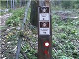 2
2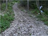 3
3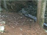 4
4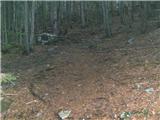 5
5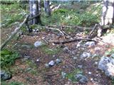 6
6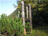 7
7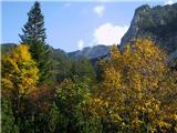 8
8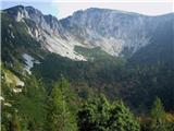 9
9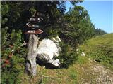 10
10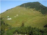 11
11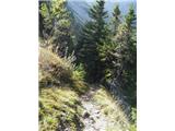 12
12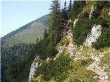 13
13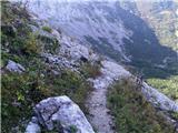 14
14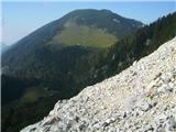 15
15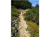 16
16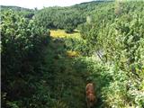 17
17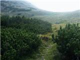 18
18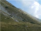 19
19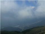 20
20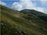 21
21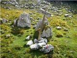 22
22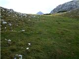 23
23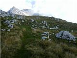 24
24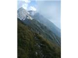 25
25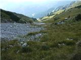 26
26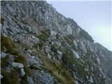 27
27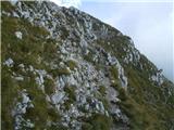 28
28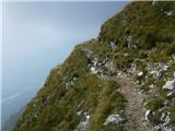 29
29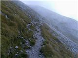 30
30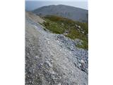 31
31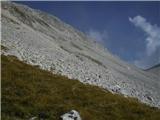 32
32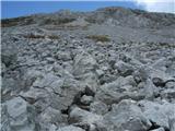 33
33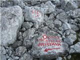 34
34 35
35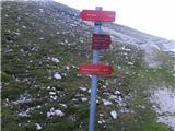 36
36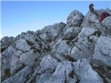 37
37
Discussion about the trail Dom Trilobit - Hochstuhl/Stol
|
| ninooos27. 05. 2012 |
Pot je definirana kot "lahka označena pot", to mi je čisto jasno kaj pomeni, zanima me pa, koliko je dejansko nevarna - marsikakšna izmed gornjih fotk me spravi v dilemo: peljati otroka po tej poti na Stol ali ne? Kakšen namig poznavalcev tega konca? Prosim  , hvala, lp
|
|
|
|
| Irina28. 05. 2012 |
@ninooos,
se strinjam, da nekaj fotografij daje občutek, da je del poti zelo zračen.
Mene bi bil skrbelo to, kako bi otroci zmogli 5 ur hoda po poti, ki je večinoma "čistina" in sonce neusmiljeno greje. Seveda se lahko odpravite na pot zelo, zelo zgodaj. A, se mi postavlja vprašanje, če je to za "mularijo" še užitek ali bolj želja staršev.
|
|
|
|
| heinz28. 05. 2012 |
Irina je pravilno zapisala glede otrok. Hoje po soncu je v vsako smer po (vsaj)3 ure. Drugače pa je pot zgolj nekoliko "zračna" na grebenu med Potoškim Stolom in pobočjem Stola (slike 25 - 29), ki traja cca 1/2 ure. Ta del je najlepši. Glede hoje po takem terenu, gotovo ne bo nikakršnih problemov v kolikor si že bil z otroci na 2000 (Begunjščica, Viševnik ipd).
|
|
|
|
| ninooos28. 05. 2012 |
Hvala za mnenji. Po pravici povedano sama nisem razmišljala o morebitni dolgočasnosti in pripekajočem soncu  ... Gledala sem le alternativen pristop na Stol, saj je otrokoma najbolj dolgočasno ponavljati ture (zadnji 2 leti smo bili gor 4x, vedno z Valvazorja). Hribe obožujeta, ne marata pa predolgih voženj do izhodišča, zato obdelujemo Zgornjo Gorenjsko z vseh strani
|
|
|
|
| ninooos28. 05. 2012 |
Pardon, 3x gor... Izlet s tem izhodiščem ponuja veliko možnosti za skrajšavo ... glavn da je na "vrhu" vpisna knjiga in žig  
|
|
|
|
| heinz28. 05. 2012 |
Sicer pa lahko tudi štartaš iz Potoške planine (studenec Urbas) prek Vajneža. Ta je malce krajša. Poišči opis in kombiniraj s tem.
|
|
|
|
| Irina28. 05. 2012 |
@ ninooos 28.5.2012
Kaj pa Škofjeloško ali Cerkljansko hribovje in Jelovica..... tam so tudi zanimive ture.
|
|
|