Dom Trilobit - Barentaler Kotschna/Struška
Starting point: Dom Trilobit (939 m)
| Lat/Lon: | 46,4579°N 14,1031°E |
| |
Time of walking: 3 h
Difficulty: easy marked way
Altitude difference: 1005 m
Altitude difference po putu: 1050 m
Map: Karavanke - osrednji del 1:50.000
Recommended equipment (summer):
Recommended equipment (winter): ice axe, crampons
Views: 33.959
 | 2 people like this post |
Access to the starting point:
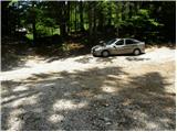
From the motorway Ljubljana - Jesenice take the exit Lipce and follow the road towards Jesenice. When you reach the semaphoreised junction where you join the old road, turn right in the direction of Žirovnice. Follow this road for only a short distance, as at the next slightly larger junction (traffic lights) continue left in the direction of Javorniški Rovt. The road then passes through an underpass (railway) and then turns left (right Koroška Bela). Follow the road, which starts to climb steeply higher, in the direction of Javorniški Rovt, but only until the crossroads, where a sharp left turn to the right (straight) leads to the Trilobit home and the Javornik spring (no buses). A little further on, the road leads to the above-mentioned home and the storage lake at the Javornik hydroelectric power station. Park in the unregulated parking lot behind the lake and the Trilobit home (parking in front of the home is not allowed).
Path description:
From the parking lot, take the cart track towards the nature and mining trail. Cart track immediately starts to climb quite steeply on the left side of the stream that you can hear near you. Soon the path leads to a wooden pole where a signpost for mountain pasture Seča directs us to a slightly left path (to the right the spring of Javornik and mountain pasture Stamare). Cart track then leads to the vicinity of the stream along which it climbs to the spring (one of the springs of the Javornik stream). After the spring, cart track turns into a footpath, which climbs quite steeply in places, through a mostly quite overgrown forest. The path then approaches the wall and turns left before it. There is a less steep climb up to a bench, which is not in the best condition. The path continues to climb through increasingly sparse forest so that we occasionally open up beautiful views of the surrounding area. A little further on, we will see an amphitheatre called Rida on the right (to the right leads an unmarked and rather overgrown path towards Belščić). Our route turns left and after a short, not steep climb we reach the signposts at the beginning of mountain pasture Seč. We turn left towards Kahlkogel and in a few minutes we reach the shepherd's hut at mountain pasture Seč.
From mountain pasture, where you leave the marked trail at Kahlkogel, continue slightly right to a saddle where you see some signs. In the fog it will be difficult to see the saddle. At the saddle, turn left to the west and continue the ascent along the border line between Slovenia and Austria. The way ahead is marked and marked with Austrian markings, which are like a flag (red, white and red). The ascent is partly on grass, where the path is a bit harder to follow, and partly between dwarf pines, where it is partly overgrown. After half an hour's ascent from the saddle, you reach the summit, from which you descend almost 50 metres. After this descent, cross a small valley and, after a few steep steps, climb a ridge which you follow through dwarf pines to a grassy and scenic summit on which stands a cross.
Starting point - Seča 2:00, Seča - Barentaler Kotschna 1:00.

Pictures:
 1
1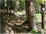 2
2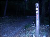 3
3 4
4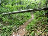 5
5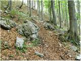 6
6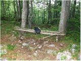 7
7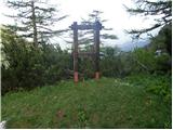 8
8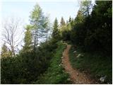 9
9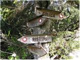 10
10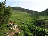 11
11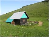 12
12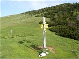 13
13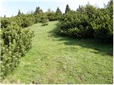 14
14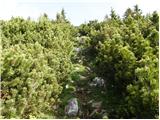 15
15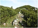 16
16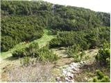 17
17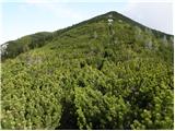 18
18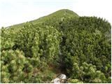 19
19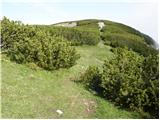 20
20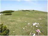 21
21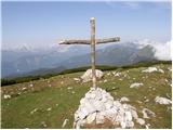 22
22
Discussion about the trail Dom Trilobit - Barentaler Kotschna/Struška
|
| Guest31. 10. 2007 |
Zmerna tura, ki nam nudi izjemne poglede na Julijske Alpe. Priporočam obisk meseca maja, ko je Struška vsa v cvetju.
|
|
|
|
| Guest8. 11. 2007 |
tam je zelo dobro  
|
|
|
|
| Okmodko19. 12. 2009 |
Jaz grem jutri tja. Mogoče se ne vrnem. Srečno.
|
|
|
|
| Natasha22. 01. 2010 |
Delamo plan za leto 2010. In tale bo nas prvi podvig.
Je primeren za snežne razmere? kako je tam s plazenjem? Kdo kaj vec lahko pove?
Hvala ze vnaprej!
|
|
|
|
| heinz22. 01. 2010 |
Po zgoraj opisani smeri ne bo problemov. Struška je precej spihana, tako da tudi za turno smuko ni preveč ugodna. Edino kar nekoliko dvomim je, da je ta pot čez Sečo in naprej po mejni črti (ali po običajni za Golico) kaj dosti shojena, zato bi za izhodišče bolj priporočal Pusti Rovt oz. Križovec.
Za gaženje je snega vseeno kar veliko, pa še ledeno skorjo si dela te dni.
Nevarnost plazov- majhna (tudi uradno 2. st)
|
|
|
|
| klavdipo17. 02. 2010 |
Ali je na tem vrhu tudi žig?
|
|
|
|
| viharnik17. 02. 2010 |
Na vhu Struške je samo konteiner kluba radijskih zvez.Ključe hranijo samo dotični člani,ki se ponavadi vpišejo v knjižico prihodov.
|
|
|
|
| heinz17. 02. 2010 |
Na Struško se podaj v maju ali juniju, ko tam bogato, da nikjer več tako, cvetita avrikelj in encijan, pa boš dobila žig, katerega ti ga za vekomaj nihče več ne bo izbrisal.
|
|
|
|
| grega_p10. 02. 2011 |
Tud jaz sem dobil danes tisti Heinzov žig, gor sem namreč prespal ob kontejnerju.
Štartal ob 6h popoldne izpred CŠOD-a in čez Medji dol, kjer je na trenutke led pomrznjeno (led), višje pri planini Seča pa je sneg že skorjast in je hoja lažja. Luna je svetila celotno pot, pomagale pa so še številne zvezde, za katere ne pomnim, da bi jih kdaj toliko videl. Tako, da svetilka skoraj ni bila potrebna, seveda pa so pomagale tudi gazi predhodnikov. Jasna in mrzla noč, nekaj časa ob prijetnem ognju in zasilnem zavetišču, ko je ugasnil pa prisilna jutranja telovadba in po isti poti ob 4h zjutraj nazaj. VEČ KOT PRIPOROČAM!
Le dobro opremo boste rabili, kakšen nož za borovce (podlaga ali ogenj) in lopato za sneg, če boste kopali snežno luknjo ali samo za obzidje pred vetrom.
|
|
|
|
| heinz10. 02. 2011 |
tvoja izkušnja grega, se mi zdi, dokazuje, da si zelo dobro pripravljen in stvari obvladaš.
gotovo, da to ni za vsakogar. osebno mi je takšno dejanje všeč!
|
|
|
|
| grega_p11. 02. 2011 |
Bolj kot za pripravljenost, gre za željo po tem, da občutim naravo v nočni tišini. Ostalo glede opreme in kondicije pride spontano samo od sebe. Vsak lahko "obvlada", če ni preveč negativnih ?jev v glavi.
Če te slučajno zamika -
gor sem pustil ležišče iz borovcev, snežni obod (ga je potrebno malo zvišati zaradi vetra) in kurišče...
|
|
|
|
| heinz11. 02. 2011 |
Mikavno. Toda z virozo, ki me ravnokar dobro "žge", bi bilo zaenkrat tvegano. Razen, če bi si želel ostati tam gor.. (kot npr moj sokrajan Beg,- oz, ima tam blizu kontejnerja spominsko ploščo) Drugače pa, - bo treba enkrat zadevo sprobati.. 
|
|
|
|
| marezt7. 06. 2012 |
ko prideš na Planino Seča...in se vzpneš naravnost gor...kako se imenuje ta hrib(pred Struško)...?
|
|
|
|
| Majdag31. 05. 2014 |
... Pot prijetna, skozi gozd ni podrtega drevja. Iz planine Seča po stari graničarski poti. Začneš pri obmejnem kamnu 197, končaš pri 216. Na sončnih krajih cveti avrikelj, tudi encijan se najde vmes. Na vrhu je tudi že nekaj rožic, po pobočju proti koči pa nič, je še mrzla zima. Potem so pa zopet rožice, vse že cveti.  
|
|
|
|
| velkavrh13. 06. 2014 |
Bil se letošnjo pomlad že tu in vem, da je res lepo.
|
|
|
|
| miri13. 06. 2014 |
Škoda,ker je okolica doma Trilobit tako zanemarjena.
|
|
|
|
| sirt113. 06. 2014 |
Na more bit drgač,če ga upravlajo z Lublajne(CŠOD Lublajna)!
|
|
|
|
| J.P.7. 11. 2021 10:20:09 |
Pot je trenutno brez posebnosti. Na vrhu lesenega križa ni več, je pa vpisna skrinjica z žigom in en kontejner/bivak. LP
|
|
|
|
| jprim11. 06. 2023 22:49:53 |
Današnje stanje - to ni bivak, temveč telekomunikacijska zadeva, vsaj tako mislim. Vendar bi se dalo na vrhu Struške postaviti kakšno klopco, morda več  , pač tako je pri nas v Sloveniji, ... LP!
|
|
|
|
| Jusk14. 06. 2023 16:58:54 |
Ta kontejner na vrhu je radioamaterska postaja,nekaj takega,vsekakor v zvezi z radioamaterstvom
|
|
|