Dom pod Storžičem - Bela peč (via Javorniški preval)
Starting point: Dom pod Storžičem (1123 m)
| Lat/Lon: | 46,3586°N 14,3906°E |
| |
Name of path: via Javorniški preval
Time of walking: 2 h 5 min
Difficulty: easy marked way
Altitude difference: 460 m
Altitude difference po putu: 565 m
Map: Karavanke - osrednji del 1:50.000
Recommended equipment (summer):
Recommended equipment (winter): ice axe, crampons
Views: 6.172
 | 1 person likes this post |
Access to the starting point:
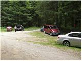
From the Ljubljana - Jesenice motorway, take the Ljubelj exit (Tržič) and then continue towards Ljubelj. Just before the petrol station in Bistrica pri Tržiču, leave the main road and turn right towards Tržiča. Continue through Tržič in the direction of Dolžanove gorge, then turn right at the end of the town in the direction of Lom pod Storžičem and Grahovš. At the end of the village Grahovše the asphalt ends and we continue on the dirt road in the direction of Doma pod Storžičem. Follow the steeper dirt road in the upper part of the road to the parking lot near the Doma pod Storžičem.
Path description:
From the parking lot near Dom pod Storžičem continue on the road to the left in the direction of Javorniško sedlo, mountain pasture Javornik, Jezersko, Pavšlo, Tič, Tržič and the NOB monument. After a few metres of walking the road splits into two parts, and we choose the upper right road (Tič and the NOB monument on the left). We continue along the above-mentioned road, which after about 20 minutes of walking turns into cart track. At the point where the road turns into cart track, we have two options to continue. You can continue the ascent on the steep and rather overgrown footpath, or on the slightly less steep cart track, which is not marked, but in terms of orientation is even slightly easier than the marked footpath. Cart track and the footpath merge higher up and lead to Javorniški preval, where there is a marked crossroads.
Here we continue left (right Kanonir, sharp right Storžič), where after some 10 steps we arrive at the next crossroads. The right path leads to Močnikovo sedlo, and we continue on the left path in the direction mountain pasture Javornik. The trail continues along the wide and gently sloping cart track, which crosses the slopes to the north-west for a while. After a few minutes, the forest thins out and the increasingly scenic route leads to mountain pasture Javornik, which offers a fine view.
From mountain pasture continue left downhill (straight Stegovnik, right Veliki Javornik or Ženiklovec) and follow cart track, which crosses the lane of the forest, down to the nearby forest road. Once on the road, which is reached just at the small crossroads at which the memorial is located, another path joins from the left from the Doma pod Storžičem. Here, continue straight ahead on a gently ascending road, which quickly leads to the nearby Pr Zdravc hut.
From the hut, continue along the road for a short distance and then, at a small pass, turn right onto a marked footpath in the direction of Bela Peća. The way forward begins to climb moderately along the edge of the steep slopes, and then leads us to cart track, which we follow to the left. Cart track ends quickly, and the path changes to steeper slopes, which are traversed to the right. There is a short, slightly exposed passage, after which the slope flattens out. A grazing fence is crossed, and then a gently sloping path leads to the next marked crossroads. At the crossroads, continue left (straight mountain pasture Zgornja and Spodnja Konjščica) in the direction of the Bela peč lookout point. Here, continue through a narrow passage between two trees, then climb quickly to the summit.

Pictures:
 1
1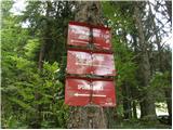 2
2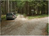 3
3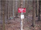 4
4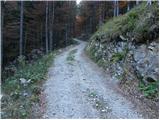 5
5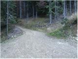 6
6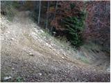 7
7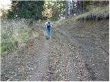 8
8 9
9 10
10 11
11 12
12 13
13 14
14 15
15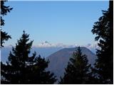 16
16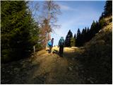 17
17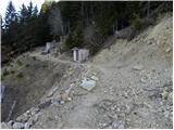 18
18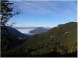 19
19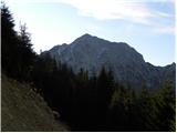 20
20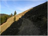 21
21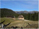 22
22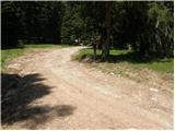 23
23 24
24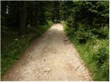 25
25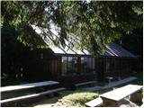 26
26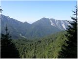 27
27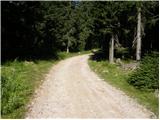 28
28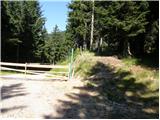 29
29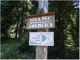 30
30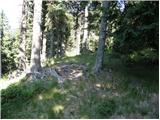 31
31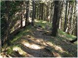 32
32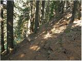 33
33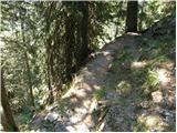 34
34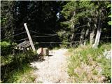 35
35 36
36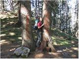 37
37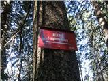 38
38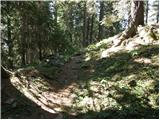 39
39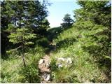 40
40 41
41 42
42
Discussion about the trail Dom pod Storžičem - Bela peč (via Javorniški preval)