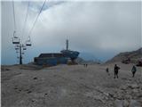
Starting point: D station (2202 m)
| Lat/Lon: | 46,3326°N 13,5384°E |
| |
Time of walking: 2 h 15 min
Difficulty: very difficult pathless terrain
Altitude difference: 204 m
Altitude difference po putu: 425 m
Map: Julijske Alpe - zahodni del 1:50.000
Recommended equipment (summer): helmet
Recommended equipment (winter): helmet, ice axe, crampons
Views: 3.751
 | 2 people like this post |
Access to the starting point:
a) First, drive to Kranjska Gora, then continue over the Vršič Pass or through Itali and then over the Predel Pass to Bovec. When you arrive in Bovec, take the ring road past the centre and then turn right on the other side of the town towards the nearby petrol station. Turn left at the petrol station and ascend to the nearby parking lot at the bottom station of the circular cable car to Kanin. Then buy a ticket and take the cable car to the D station on Kanin.
b) First drive to Tolmin, then continue to Bovec. At the beginning of Bovec, leave the main road and drive straight towards the centre of the town. Drive just 10 metres towards the centre, then turn sharp left at the petrol station onto an ascending road, which quickly leads to the parking lot at the bottom station of the circular cable car. Then buy a ticket and take the cable car to the D station on Kanin.
Path description:
From Station D, first walk uphill to the nearby lower station of the four-seater Prevala, and from there continue to the right in the direction of Prestreljenik and Rombon. The path continues along the four-seater and climbs along the edge of the ski slope. Higher up, you reach Sedlo, where there is an intermediate exit station of the Prevala quad chairlift and where the trail to Prestreljenik (2499 m) branches off to the left.
From the saddle, continue for a short distance on the ski slope descending towards the Prevala saddle, then continue slightly left on the marked footpath, which continues on the left side of the ski slope (it is also possible to continue on the ski slope). The trail, which continues to descend moderately to occasionally steeply, leads past some large potholes and then transitively lays down. The path then turns slightly to the left and gradually changes to steeper slopes, which are slightly exposed in places. Lower down, the path turns sharply to the right and, with the help of a cable car, descends to a crossroads at the Prevala saddle.
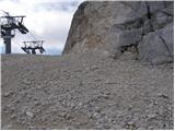
From Prevala, where there is a crossroads of five paths, continue slightly left and start climbing up the ski slope towards the upper station of the Italian gondola. Here, the trail first opens up to a fine view to the west, then to the north where Jôf di Montasio and Viš are clearly visible. As the ski slope turns right, we are joined on the left by route 536 from Nevejski sedlo. There is only a short climb to the top station of the cable car.
At the top station of the gondola, turn left onto an unmarked path that crosses the scree on the northern slopes to the east. The path initially crosses the slopes below the northern face of the Vršiči pod Lopo (Monte Golovec) ridge in a gentle ascent. When you reach the north-western side of the ridge, you can see the Forca sopra Medon to the right. We continue along the path that crosses the slopes to the east. We follow the track, which occasionally climbs a little further, to a notch on the eastern side of the Lopa peak.
Approximately 10 metres before the notch (the first slightly easier passage from the notch on the north side), turn right up towards the ridge. After an initial very short climb, the terrain flattens out a bit and you will see a short gully ahead. There is also some rubble on the slope at this part. Head straight towards the gully. After only a few metres of climbing up the gully, continue left on the ledge.
Once on the shelf, we have two options. We can turn right after a few metres of traversing the ledge, followed by a few metres of climbing to the ridge. If you head right at the right point, the difficulty of the climb does not exceed level 1. Alternatively, you can continue along the ledge to reach the south side of the ridge. On the south side, where the slope is slightly overgrown with grass, continue for a short time on the steep slope below the ridge. When the slope above us becomes a little less steep, turn right onto the ridge.
Continue walking along the ridge and the climb becomes less difficult for a while. The cairns are also helpful when walking along the ridge. A little higher up, we come to a steeper slope again. Keep to the left for the initial part of the steep slope and then, about halfway up, cross a steep slope, partly covered with grass, to the right. Some cairns is also helpful for orientation. There is a short steep climb and then we continue to the left and soon reach the ridge again.
Continue walking along the ridge all the way to the summit. There are a few short steep climbs in the last part of the ridge, but they do not present any major problems.
Descend along the ascent route.
For the less experienced, belaying with a rope is recommended on the more difficult parts.
Station D - Prevala 0:45, Prevala - Lopa 1:30.

Pictures:
 1
1 2
2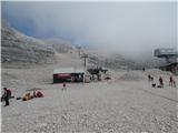 3
3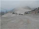 4
4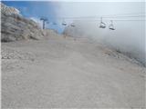 5
5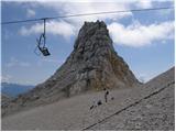 6
67
 8
8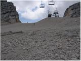 9
9 10
10 11
11 12
12 13
13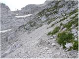 14
14 15
15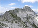 16
16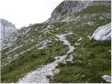 17
17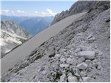 18
18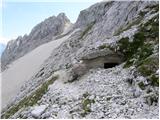 19
19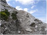 20
20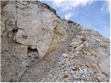 21
21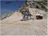 22
22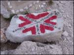 23
23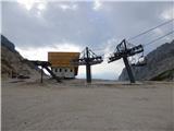 24
24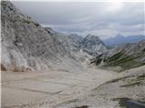 25
25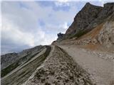 26
26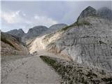 27
27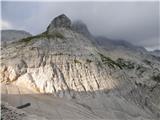 28
28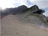 29
29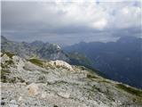 30
30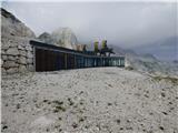 31
31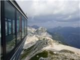 32
32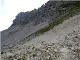 33
33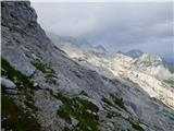 34
34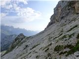 35
35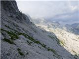 36
36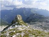 37
37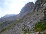 38
38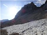 39
39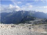 40
40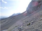 41
41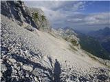 42
42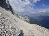 43
43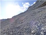 44
44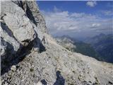 45
45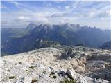 46
46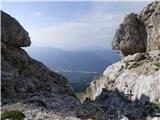 47
47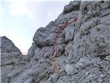 48
48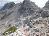 49
49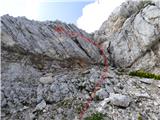 50
50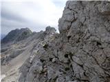 51
51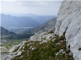 52
52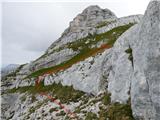 53
53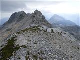 54
54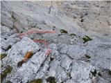 55
55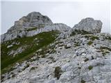 56
56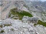 57
57 58
58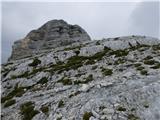 59
59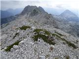 60
60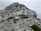 61
61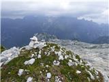 62
62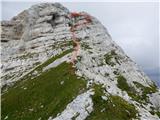 63
63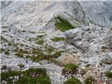 64
64 65
65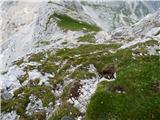 66
66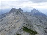 67
67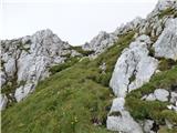 68
68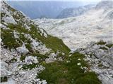 69
69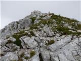 70
70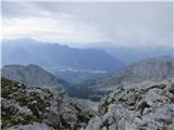 71
71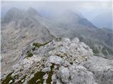 72
72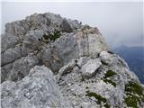 73
73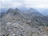 74
74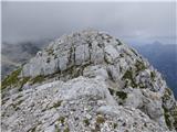 75
75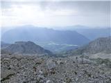 76
76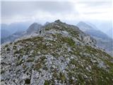 77
77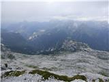 78
78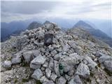 79
79
Discussion about the trail D station - Lopa
|
| ljubitelj gora20. 08. 2019 |
Lepa tura, sem jo pred parimi leti za svoj rojstni dan prehodil.
|
|
|