Črni vrh - Javornik above Črni vrh (via Šajsna Ravan)
Starting point: Črni vrh (686 m)
| Lat/Lon: | 45,9259°N 14,0434°E |
| |
Name of path: via Šajsna Ravan
Time of walking: 2 h 30 min
Difficulty: easy marked way
Altitude difference: 554 m
Altitude difference po putu: 650 m
Map: Nanos 1:50.000
Recommended equipment (summer):
Recommended equipment (winter): ice axe, crampons
Views: 21.239
 | 1 person likes this post |
Access to the starting point:
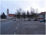
From Logatec, drive towards Idrija or vice versa, but only as far as Godovič, from where you continue to Črnji vrh and Col. Park in the centre of Černý vrh in one of the car parks.
The starting point can also be reached from the Vipava valley via Col.
Path description:
From the centre of Černý vrh, continue along the main road towards Colo, but only until the end of the 1st serpentine. Here you will notice a direction sign pointing to the left on the footpath in the route Javornik. The path, which continues to climb through the forest, soon crosses the first cart track, where we continue straight ahead. When the path leads to the second wider cart track, follow it to the left and climb it in a cross-climb until you reach the macadam road leading to the hamlet of Šajsna Ravan. The relatively zložna road on which we continue our ascent, then past the cross and the chapel leads us out of the forest, where we see some houses in front of us. A little before the hamlet, signs direct us to the right to a wide cart track, after which we walk a few steps to a marked crossroads located in the immediate vicinity of the houses.
Continue straight on in the route Javornik (sharp right Čelkov vrh) along the path which passes the houses and then climbs over a grassy slope. Higher up, the path from Kampelec joins us from the right, and we continue to the left, where after a few steps we enter the forest. We continue to climb through the forest, then the path crosses a larger, partially overloked clearing and continues with a few short ascents and descents. The path soon returns to the forest and leads us higher from the northern slopes to the southern slopes. Here the path turns slightly to the left and continues along cart track, which takes you over a number of grassy slopes. After a while you reach a marked crossroads, where you continue up to the left in the route Javornik (straight ahead Pirnatova koča) along an increasingly steep path. Follow this path, which in the last part passes through the forest, to the top of Javornik, where there is a lookout tower.
From the top you can descend to the mountain lodge in 5 minutes.

Pictures:
 1
1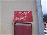 2
2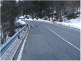 3
3 4
4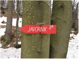 5
5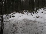 6
6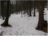 7
7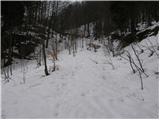 8
8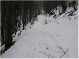 9
9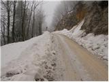 10
10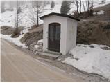 11
11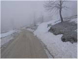 12
12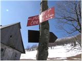 13
13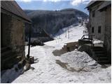 14
14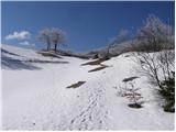 15
15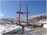 16
16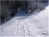 17
17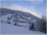 18
18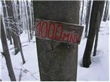 19
19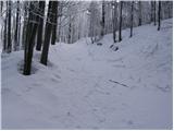 20
20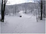 21
21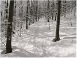 22
22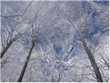 23
23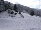 24
24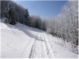 25
25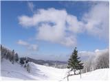 26
26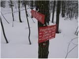 27
27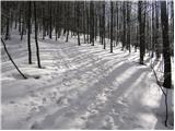 28
28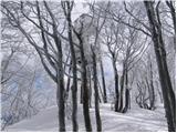 29
29 30
30
Discussion about the trail Črni vrh - Javornik above Črni vrh (via Šajsna Ravan)
|
| d1licen15. 02. 2010 |
Tako pa zgleda res zimska tura,v le delno zgaženo pot.Na vrhu pa te čaka umetnina narave. 
|
|
|
|
| akbara16. 02. 2010 |
14 dni nazaj smo pionirsko gazili proti vrhu, vendar smo se zaradi napornega udiranja - tudi do pasu! - po cc. 1,5 ure odpravili nazaj, ker je bilo prenaporno  Kljub vsemu je bilo zelo lepo, sončno in zasneženo. V drugačnih razmerah je to zelo prijetna, lahka pot 
|
|
|
|
| gregor17. 02. 2010 |
Velika škoda ker ste obrnili kajti predvidevam da vam po 1.5 H do vrha ni mankalo prav veliko . Da je bilo kod v pravljici pa vam verjamem ,ker sem tudi jaz velikokrat hodil,gazil in smučal prav z vrha in tudi s sosednjih vrhov (Habatov vrh,Velika peč,... )
|
|
|
|
| mohikanec18. 02. 2010 |
Mi smo bili v nedeljo, vendar pol poti po smučišču iz vasi Lome, nato pa na celo po gozdu, šlo je do kolen. Na vrhu pa dobra jota in še boljša ocvirkova potica. Pohvala oskrbniku Pirnatove koče.
|
|
|
|
| ulmusglabra21. 12. 2011 |
Jaz še nikol nism šel na Javornik peš, vedno grem gor s kolesom, ker sm pač iz okolice Logatca. Ponavadi grem čez Hrušico in potem desno po (pomoje) bolj stranski gozdni cesti, ki je na začetku precej strma, a vseskozi dobro vozljiva... Druga opcija pa je iz Logatca do Godoviča, nato na Črni vrh in potem pri gostilni, preden se začneš spuščati proti Colu, desno. Nato čez Kanji dol do Pirnatove Koče. Je pa dosti več asfalta. No, to zimo morm it pa tud peš enkrat gor, ker s stolpa res lepo vidi! 
|
|
|
|
| basist21. 12. 2011 |
a ni pravilno: ... se začneš spuščati proti Colu, levo... ?
|
|
|
|
| ulmusglabra26. 01. 2012 |
basist in Loni: imata prav, moja napaka! tam itak da levo drgač sm pa šel učer peš gor in sm bil zelo zadovoljen Do Črnga Vrha sm prekolesaril, pol pa skril bicikl u gozd in zagrizu u klanc. Lepa pot, dobro markirana, prečudovita narava! Je blo kr precej mraz, po moje je blo med izhodiščem in vrhom okol 7 stopinj C razlike. Gor na stolpu pihal k stu matr!  Ampak razgled je pa bomba aja, piše da se hod 2 h in pol; jst sm rabu 1h in 45 min, pa sm šou lagano sportski, k morm pol še domou z biciklom (dobrih 30 km) 
|
|
|
|
| rečan27. 01. 2012 |
dober si
mene zanima kako je s stolpom
a je res v slabem stanju
|
|
|
|
| D0men13. 09. 2022 12:32:19 |
Stolp na vrhu ni več izpraven in je zaprt. Je potrebna nova konstrukcija.
|
|
|