Crngrob - Archangel Gabriel (Planica)
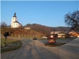
Starting point: Crngrob (385 m)
| Lat/Lon: | 46,1986°N 14,308°E |
| |
Time of walking: 1 h 30 min
Difficulty: easy marked way
Altitude difference: 439 m
Altitude difference po putu: 470 m
Map: Škofjeloško in Cerkljansko hribovje 1:50.000
Recommended equipment (summer):
Recommended equipment (winter):
Views: 19.743
 | 4 people like this post |
Access to the starting point:
a) From Ljubljana, drive to Medvode and from there continue to Škofja Loka. When you arrive at Škofja Loka, do not drive into the centre, but continue "straight on" in the direction of Kranja. In Dorfarje, you will see signs for Crngrob, which will direct you to the left, onto the road that will lead you through the village. First, we pass the Prevc furniture salon, then the turn-off to the farm at Brojan, and then the Cegnar and Zakotnik nurseries, after which the rather narrow road through the village widens slightly. After the village, there is a short descent and the path leads past a large parking lot next to the Slovenian army firing range. Behind the parking lot, cross the small stream Ušovca, and the road enters the forest and starts to climb moderately. Follow the asphalt road, then quickly arrive in the village Crngrob, where you can park in the parking lot in the middle of the village.
b) First drive to Kranj, and from there continue to Škofja Loka. Before arriving in Škofja Loka, turn right at Dorfarje in the direction of Crngrob. First pass the Prevc furniture salon, then the turn-off to the farm at Brojan, and on past the Cegnar and Zakotnik nurseries, after which the rather narrow road through the village widens slightly. After the village, there is a short descent and the path leads past a large parking lot next to the Slovenian army firing range. Behind the parking lot, cross the small stream Ušovca, and the road passes into the forest and starts to climb moderately. Follow the asphalt road, then quickly arrive in the village Crngrob, where you can park in the parking lot in the middle of the village.
c) From Žiri or Cerkno, drive to Škofja Loka and from there turn left towards Železniki. As you approach the area Škofja Loka called Podlubnik, you will come to a crossroads where you continue slightly to the right in the direction of the settlement Pevno. A little further on, you will reach the next marked crossroads, where you will again continue to the right, this time in the direction of Pevno and Crngrob. A few more crossroads follow, and we continue following the signs for Crngrob. When the road has lost its asphalt coating, it turns into a forest and leads us to a small crossroads by an old chapel. Here the left road leads directly to the church in Crngrob, but there are no parking spaces, so we continue along the right road, which after a moderate descent of a few 100 m we reach the parking area in Crngrob. d) From Železniki take the Škofja Loka, then before the road turns slightly right and starts descending towards the main bus station, continue left towards Pevno. A little further on, you will reach the next marked crossroads, where you continue to the right, this time in the direction of Pevno and Crngrob. There are a few more crossroads to follow, and we continue following the signs for Crngrob. When the road has lost its asphalt coating, it turns into a forest and leads us to a small crossroads by an old chapel. Here the left road leads directly to the church in Crngrob, but there are no parking spaces, so we continue along the right road, which after a moderate descent of a few 100 m we arrive at the parking lot in Crngrob.
Path description:
From the starting point, first walk to the church above the village, and from there continue along the marked path that starts to the left of the abandoned building. After a short climb across a meadow, the path goes into the wods, and after a few minutes joins the cart track, which continues along the path. Climbing moderately, cart track turns slightly to the left, then turns right and begins a gradual descent. The descent ends after a few minutes, and then we start to climb moderately, following a path which leads us a little further past a bench a few metres away. Follow the marked path, which continues through the forest for some time, then the forest ends and we pass a trestle to reach a macadam road, where we are joined on the right by an unmarked path from the settlement of Dorfarje.
Continue straight ahead, along the road which becomes asphalted and which leads us past a bench and a water trough to a slightly larger crossroads, where we continue left in the direction of Planica (here we will see the NOB memorial to the right and straight ahead). The way ahead leads us along an asphalted road, which quickly leads us to the settlement of Planica, where we take a sharp right at the first houses in the direction of the church at Planica. At the nearby sign (cross), leave the road and continue along a pleasant path which begins to climb moderately. The trail continues through the forest, only in the part where the trail leads us past the cottage, a nice view opens up, which reaches Polhograjsko hribovje and Lubnik. Higher up, the trail leads to a nondescript ridge, along which, within a minute or two of further walking, we reach the Church of St. Gabriel the Archangel at Planica.
Description and pictures refer to the situation in 2015 (March).

Pictures:
 1
1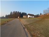 2
2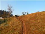 3
3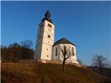 4
4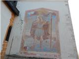 5
5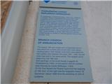 6
6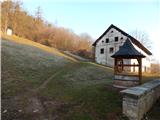 7
7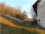 8
8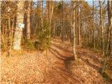 9
9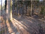 10
10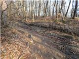 11
11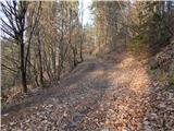 12
12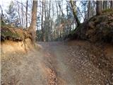 13
13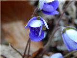 14
14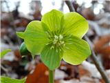 15
15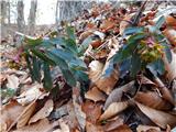 16
16 17
17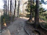 18
18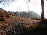 19
19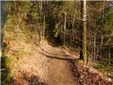 20
20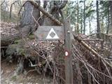 21
21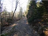 22
22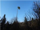 23
23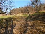 24
24 25
25 26
26 27
27 28
28 29
29 30
30 31
31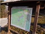 32
32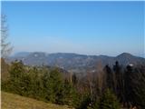 33
33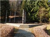 34
34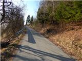 35
35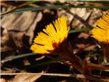 36
36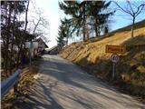 37
37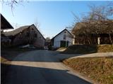 38
38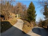 39
39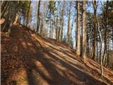 40
40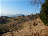 41
41 42
42 43
43 44
44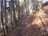 45
45 46
46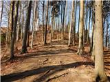 47
47 48
48 49
49
Discussion about the trail Crngrob - Archangel Gabriel (Planica)
|
| Guest29. 03. 2007 |
Lep izlet v prelepe kraje ,tudi opis je temu primeren! Moti le nepravilno napisano ime izhodišča ,ki je v Crngrobu in ne v Črngrobu!
Pa lep dan še naprej vam kliče M 4.!
|
|
|
|
| Lisica23. 01. 2011 |
Lep izlet, lepa večinoma široka pot.
|
|
|
|
| Lisica7. 02. 2011 |
Za cerkvico na Planici je baje energijska točka-tam kjer je klopca na desni strani.
|
|
|
|
| KARAMELICA27. 01. 2013 |
Se strinjam, s predhodnimi komentarji, lepa tura, tudi za popoldanski sprehod. Ja za energetsko točko sem slišala, da je baje pri lipi, tam kjer je klopica. 
|
|
|
|
| ales5018. 02. 2013 |
Energetskih točk je precej na Crngrobu,je območje vulkanizma in je energija močna
|
|
|
|
| KARAMELICA29. 12. 2014 |
Na čudovit dan kakršen je bil današnji, smo se zopet odpravili na Planico. Pot je shojena, le pod cerkvijo je bilo treba napihan sneg, ki ga je do pasu, pregaziti (slika 10).
|
|
|
|
| ločanka30. 12. 2014 |
Jutri grem tudi jaz na ta pohod! Mislim, da bo za Silvestrovo to enkratno doživetje, seveda s čelko in gamašami. Če bo jasno, si obetam tudi kopico zvezdnih utrinkov!
|
|
|
|
| KARAMELICA30. 12. 2014 |
Ja ločanka za Silvestrovo bo sigurno enkratno, sploh ker bo jasno in zaradi snega svetlo, pa še luna je že večja. Mi gremo vsako leto k polnočnici na Planico, ravno tako iz Crngroba, pa je vedno enkratno.
|
|
|
|
| ločanka31. 12. 2014 |
Hvala Karamelica za to informacijo o polnočnici, bom upoštevala za naslednji Božič.
|
|
|
|
| ločanka5. 01. 2015 |
Mislim, da je ta izlet dosti lepši, kot je razbrati iz teh priloženih slik. Če bi se odločal po teh slikah, bi šel najbrž raje kam drugam. Zato priporočam to turo, ki se jo da potem še razširiti, odvisno od časa, ki je na razpolago.
|
|
|
|
| KARAMELICA6. 01. 2015 |
Ja možnosti za hojo je več kot dovolj. Lahko se gre po grebenu na Križno Goro, lahko pa potem proti Joštu... Midva sva zadnjič šla iz Crngroba na Planico potem pa po asfaltu v smeri Jošta naprej - končna postaja Brezje. Hodila sva počasi, dvakrat sva se še izgubila v gozdu malo pred Besnico, tako da sva hodila 5 uri in pol. Ampak dan je bil čudovit, vzela sva si čas in bilo je super.
|
|
|
|
| Linhart9. 01. 2015 |
Kdaj pa imajo odprto cerkev v Planici?
|
|
|
|
| KARAMELICA9. 01. 2015 |
Na Planici je cerkev drugače zaklenjena. Če je mišljeno v tem smislu kdaj je odprta, mislim da nedeljskih maš ni. Vem da je polnočnica za Božič, takrat je vedno super vzdušje. Lahko pa da je tudi kdaj med letom, to pa ne vem.
|
|
|
|
| Linhart10. 01. 2015 |
KARAMELICA, hvala za izčrpno pojasnilo. Enako sirt1 za link!
|
|
|
|
| Tadej21. 03. 2015 |
Zgornji opis je popravljen, vključno z dostopom do izhodišča, dodane pa so tudi nove slike.
|
|
|