Starting point: Colfosco (1581 m)
| Lat/Lon: | 46,55071°N 11,85608°E |
| |
Time of walking: 3 h 15 min
Difficulty: easy marked way
Altitude difference: 894 m
Altitude difference po putu: 900 m
Map: Tabacco 07 1:25.000
Recommended equipment (summer):
Recommended equipment (winter):
Views: 2.273
 | 2 people like this post |
Access to the starting point:
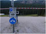
a) From Kranjska Gora via the Koren saddle to Austria, where at the first major junction continue left towards Podkloštro / Arnoldstein and Trbiz / Tarvisio. At the end of Podklošter, signs for Šmohor / Hermagor direct you to the right on the regional road, which takes you past the town to the end of the Ziljska Valley, or more precisely to Kötschach-Mauthen, where you turn right towards Oberdrauburg. The road continues over the Gailbergsattel Alpine pass (982 m), after which you descend into the above-mentioned town. After crossing a bridge over the River Drava, turn left towards Lienz. At the main roundabout in Lienz, turn left towards Sillian and Itali. Next we cross the national border between Austria and Itali, and we follow the main road past Dobbiaco / Toblach, Villabassa / Niederdorf, Monguelfo - Tesido / Welsberg - Taisten, Brunico / Bruneck. Just after the last mentioned town, which is passed by a bypass road, we turn left into the Alta Badia valley. Continue along the valley and turn right at La Villa towards Passo Gardena. Continue along the ascending road, following the signs for Passo Gardena. Follow the road to Colfosco. One bend before the sign for the village, park in the large pay parking area on the left side of the road (4€ - June 2012).
b) Take the motorway towards Venice/Venezia. At Portogruaro, leave the motorway towards Venice and turn right on the motorway towards Pordenone. At the next motorway junction near Conegliano, turn right towards Belluno. The motorway ends near Belluno and we continue towards Cortina d'Ampezzo at the next junctions. When you arrive in Cortina d'Ampezzo, follow the signs for the Passo Falzarego Alpine pass. At the Passo Falzarego (2105 m), turn right towards Alta Badia and ascend the neighbouring Passo Valparola (2192 m) before descending into the valley. At La Villa, turn left towards Passo Gardena. Follow the ascending road, following the signs for Passo Gardena. Follow the road to Colfosco. One bend before the sign for the village, park in the large pay parking area on the left side of the road (4€ - June 2012).
Path description:
From the parking lot, first cross the main road and then you will see signs by the bus parking area. Follow the signs "Sassongher, Utia de Puez" to the trail that runs along the main road. The path leads to a signpost indicating the village of Colfosco / Calfosch. Continue along the pavement to the first crossroads and then turn right onto the tarmac road. At the next crossroads, turn left and walk towards the church. At the crossroads by the church you will see the signs again and continue to the right (north) following the signs "Sassongher". The road then turns left towards the ski resort and then starts to climb quite steeply.
Later, when you come out of the village, the road is closed to traffic. Shortly after this, the asphalt ends and the footpath to the right branches off towards the Col Pradat hut. We continue straight ahead on the dirt road, which climbs alongside the ski slope and pastures. We walk along the road for a while, which offers a fine view of the Sella mountain group and the nearby Sassongher, and then soon reach the Edelweiss hut.
From the hut, continue along the dirt road, which soon leads to a crossroads where the path to the Sella Gardena pass branches off to the left. We continue right along the road and after a short climb we are back at the crossroads. Straight ahead on the road, the path leads to the Col Pradat hut, and we continue left up the footpath past the 'Sassongher' markings.
From the crossroads, the path first climbs along the bed of the torrent, then follows a climb in the keys, which leads us to a crossroads where the path from Col Pradat joins us from the right.
Continue to the left and start climbing up the valley to the north-west. The path then leads past the chapel and soon we are back at the crossroads.
The path to the right leads to the Sassongher summit, and we continue straight ahead and continue up the valley. The path then turns slightly to the left and leads us close to Lake Lech de Ciampai, which often dries up. At the lake the path turns right and first crosses the slopes above the lake, then climbs to the notch Forcella de Ciampei where there is a marked crossroads.
To the left the path leads to the top of Sas Ciampac and the notch Forcella de Crespeina, straight down the path into the Langental valley, and we continue to the right following the "Puezhütte" signs.
Just after the crossroads, the trail turns left and starts to climb gently northwards. A relatively level path later leads to another crossroads where the path to Sassongher branches off to the right.
Here the path again turns slightly to the left and you can already see the flag in front of you, which is located near the hut. The scenic route continues to be gentle and soon leads to the hut, which is situated on the grassy slopes below the Puezkofel peak.

Pictures:
 1
1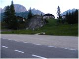 2
2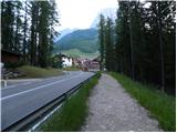 3
3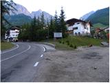 4
4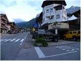 5
5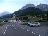 6
6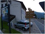 7
7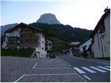 8
8 9
9 10
10 11
11 12
12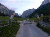 13
13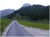 14
14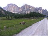 15
15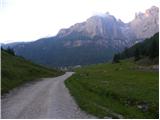 16
16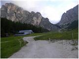 17
17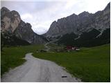 18
18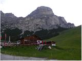 19
19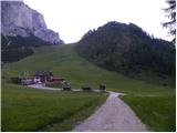 20
20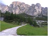 21
21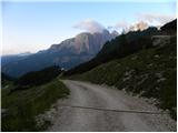 22
22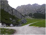 23
23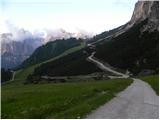 24
24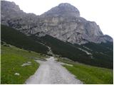 25
25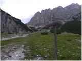 26
26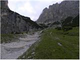 27
27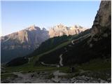 28
28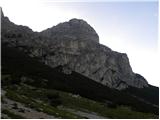 29
29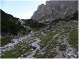 30
30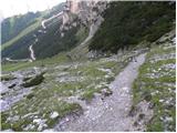 31
31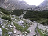 32
32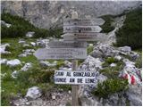 33
33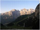 34
34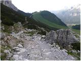 35
35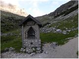 36
36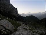 37
37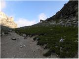 38
38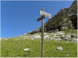 39
39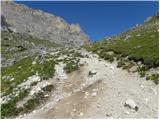 40
40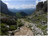 41
41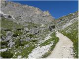 42
42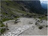 43
43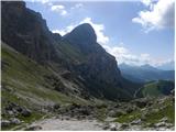 44
44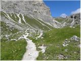 45
45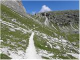 46
46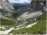 47
47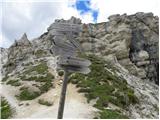 48
48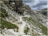 49
49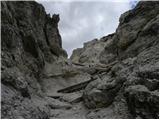 50
50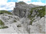 51
51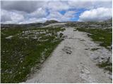 52
52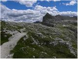 53
53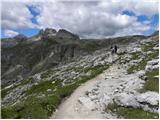 54
54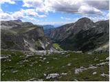 55
55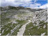 56
56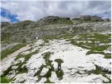 57
57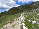 58
58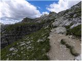 59
59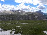 60
60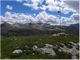 61
61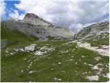 62
62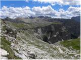 63
63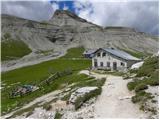 64
64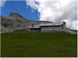 65
65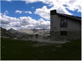 66
66
Discussion about the trail Colfosco - Rifugio Puez