Col - Špiček (Špečk) (via Križna gora)
Starting point: Col (627 m)
| Lat/Lon: | 45,8816°N 14,001°E |
| |
Name of path: via Križna gora
Time of walking: 1 h 10 min
Difficulty: easy unmarked way
Altitude difference: 359 m
Altitude difference po putu: 370 m
Map: Nanos 1:50.000
Recommended equipment (summer):
Recommended equipment (winter):
Views: 3.201
 | 2 people like this post |
Access to the starting point:
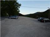
a) From the expressway Razdrto - Nova Gorica, take the Ajdovščina exit and then continue in the direction of Cola and Idrija. When you reach Col turn left towards Predmeja and then after a few metres turn right into the parking lot opposite the parish church on Col. You can also park in the parking lot next to the nearby sports ground.
b) Drive to Logatec, and from there continue to Idrija. At the end of Kalce, turn left towards Podkraj and Cola, then follow the slightly curvier road first to Podkraj, then follow the slightly flatter road to Cola. At Col, where you join the road from Ajdovščina, turn right and then after a few 10 metres turn left in the direction of Predmeja. Towards Predmeja, drive only a few metres, as just after the crossroads turn right into the parking lot opposite the church of St. Lenart.
c) Drive into Idrija, then continue towards Logatec. When you reach Godovič, leave the main road towards Logatec and turn right in the direction of Črni Vrho, Cola and Ajdovščina. When you reach Col, turn right towards Otlica and Predmeja and then right again into the nearby parking lot opposite the church.
Path description:
From the parking lot, return to the main road Ajdovščina - Godovič, then walk along it towards Godovič and Črnji Vrh. Soon the narrower road to Vodice branches off to the right, and the marked trail continues to Javornik, while we continue along the main road. The way forward leads us past the CPG road base, and behind it leads us to a small crossroads, where a worse road or dirt track branches off to the left down which we continue (if we continue along the main road we can reach Špiček and Križna gora via Špička).
The track then leads us across the hayfield, then at a small crossroads in front of the power line we continue to the right, and after the power line we turn right again, this time on a barely visible path that begins to climb moderately between sparse bushes. The path is better visible during the bushes, but then it completely disappears in the meadow. Continue straight up to the upper part of the hayfield where the track becomes more distinct and easier to follow. The path continues through the woods, crosses a pasture fence at a higher level, and turns left after it to a wide track. Follow cart track for some 10 m and then, on the right-hand side, you will see the continuation of the path. The path continues to climb through the forest, and partly across the grassy slopes. Higher up, the forest ends and the path, which bends to the right and, as it lays down, suddenly disappears. As the track disappears, orientation becomes a little more difficult, but if you continue towards the small isolated spruce tree in the middle of the hayfield, you will do quite well, as just above the spruce tree the track reappears. There is a short, slightly steeper climb and you reach the bench on Križna gora. The unmarked and unmarked summit is still a few steps ahead.
From Križna continue along the unmarked path, which descends gently along the ridge and the edge of the forest, and then, when the descent ends, step onto a fainter track, which you follow to the right. Cart track ends quickly, and we continue along the forest track, which continues along and along the ridge. Follow this path for another 10 minutes or so and it will lead you to the scenic Špiček.

Pictures:
 1
1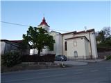 2
2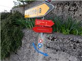 3
3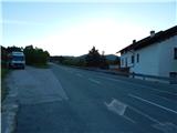 4
4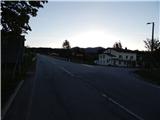 5
5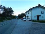 6
6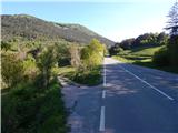 7
7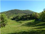 8
8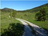 9
9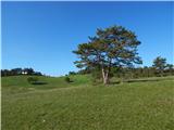 10
10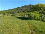 11
11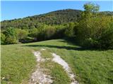 12
12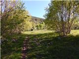 13
13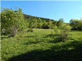 14
14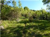 15
15 16
16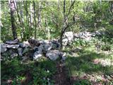 17
17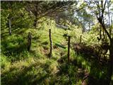 18
18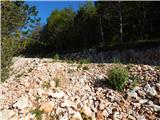 19
19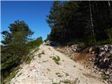 20
20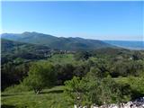 21
21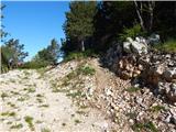 22
22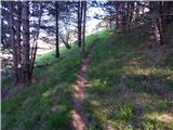 23
23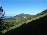 24
24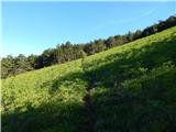 25
25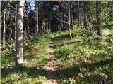 26
26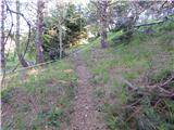 27
27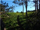 28
28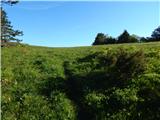 29
29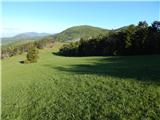 30
30 31
31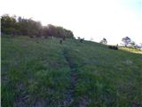 32
32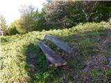 33
33 34
34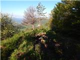 35
35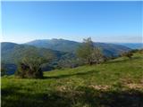 36
36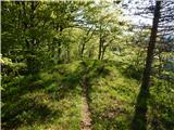 37
37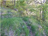 38
38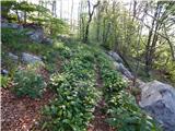 39
39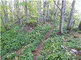 40
40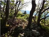 41
41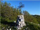 42
42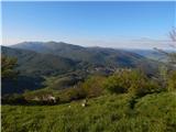 43
43
Discussion about the trail Col - Špiček (Špečk) (via Križna gora)