Cerkno - Sveti Jošt in Trebenče
Starting point: Cerkno (325 m)
| Lat/Lon: | 46,1308°N 13,9873°E |
| |
Time of walking: 1 h
Difficulty: partly demanding unmarked way
Altitude difference: 248 m
Altitude difference po putu: 248 m
Map: Škofjeloško in Cerkljansko hribovje 1:50.000
Recommended equipment (summer):
Recommended equipment (winter): ice axe, crampons
Views: 2.079
 | 2 people like this post |
Access to the starting point:
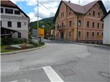
a) From the regional road Idrija - Tolmin, at the village of Straža in the hamlet of Želin, turn right at the semaphore-controlled intersection in the route Cerkno (turn left if coming from the route Tolmin). Continue along the valley of the river Cerkno, past the Petrol station until you reach Cerkno, where at the crossroads behind the Church of St. Jernej (there is also a cemetery and a parking lot next to the church), turn left in the direction of Železniki, the ski resort Cerkno, the Franja Hospital and the centre of Cerkno. At the next marked crossroads, turn left towards Zakojca and Gorje. If you have not parked at the church before, you can park a little further away from the NOB monument in one of the car parks in Cerkno.
b) From the road Škofja Loka - Žiri, after the settlement Trebija turn right in the direction of Sovodnja and Cerkno (from the direction of Žiri turn left before Trebija), from where you first go to Sovodenj, and from there over the pass Kladje (the pass is located in the settlement Podlanišče) start descending towards Cerkno. At the first major crossroads in Cerkno, go straight on (right to reach the point centre and St Anne's Church), and then at the second crossroads, about 300 m further on, turn right in the direction of Železniki, the Cerkno ski resort, Franja Hospital and the centre of Cerkno. Cerkno is the first major crossroads in Cerkno, and the first crossroads in Cerkno is the first crossroads in Cerkno. At the next marked crossroads, turn left towards Zakojca and Gorje and then park in one of the car parks in Cerkno.
c) From the road Škofja Loka - Podbrdo, at Zali Log, turn left in the direction of Davča and the ski resort Cerkno (if coming from Podbrdo or Soriška planina, turn right at the end of the resort). The road continues up to Davča and then starts descending towards Cerkno. In the centre of Cerkno, turn right at the post office, then park in a suitable place a little after the NOB monument.
Path description:
From the starting point, continue along the asphalt road, which continues along the Zapoška stream and initially leads us past the ETA E. G. O. factory. The rather gently sloping road then continues past several houses, and then leads us to a small crossroads, where we continue to the right across the bridge (straight Okrepčevalnica pr Padkejc). After the bridge, the road starts to climb more visibly, and then quickly takes us to the settlement Trebenče, where we stick to the main road. At the end of the settlement, the road passes a larger cliff on the left, at the top of which is the Church of St. Jost. From here, you continue along the main road for a few minutes, and then you reach a picnic area, next to which there is a grassy sports field (volleyball, small football, playground, trampoline, etc. ).
Just by the log cabin, a narrow macadam road (straight ahead Poče, Gorje, Jesenica. . . ) branches off to the right and you continue climbing. The road soon turns into the forest, where it makes a long left turn. At the bend, leave the road leading to the nearby houses and continue right to a nearby steep slope, where you will see a less well-trodden path that begins to climb crosswise to the right. The steep path soon ascends to a ridge, where you continue left (if you continue straight ahead you can reach an exposed viewpoint in a few steps). What follows is a mostly cross-country climb up a rather steep and, especially in the wet, dangerously slippery slope. During the ascent, we are "helped" by a wire which is supposed to serve as a kind of a zip wire. When the wire ends, the path is laid and we are only a few steps of easy walking away from the church.
You can go down the cart track, which continues on the other side of the church, and then you will reach a larger meadow, which you can follow down to the asphalt road (to avoid destroying the hayfield, it is advisable to go down the less well-trodden path, which leads to a nearby residential house), which we left on the ascent (the descending path described is not technically difficult and can also be used for climbing, thus avoiding a steep ascent).

Pictures:
 1
1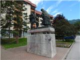 2
2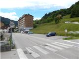 3
3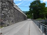 4
4 5
5 6
6 7
7 8
8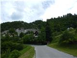 9
9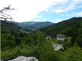 10
10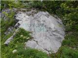 11
11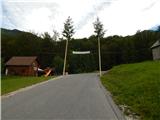 12
12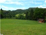 13
13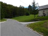 14
14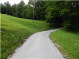 15
15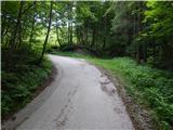 16
16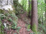 17
17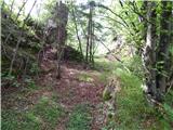 18
18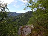 19
19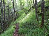 20
20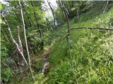 21
21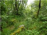 22
22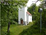 23
23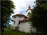 24
24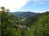 25
25
Discussion about the trail Cerkno - Sveti Jošt in Trebenče