Čabrače - Koča na Blegošu
Starting point: Čabrače (750 m)
| Lat/Lon: | 46,1369°N 14,1185°E |
| |
Time of walking: 2 h 10 min
Difficulty: easy marked way
Altitude difference: 641 m
Altitude difference po putu: 680 m
Map: Škofjeloško in Cerkljansko hribovje 1:50.000
Recommended equipment (summer):
Recommended equipment (winter): ice axe, crampons
Views: 2.860
 | 1 person likes this post |
Access to the starting point:
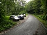
a) From Škofja Loka, drive towards Gorenjska vas and on to Hotavlje, where turn right towards Leskovica and the Cerkno ski centre. Just a little further on, you will reach the next crossroads, where you turn right towards Volaka and Čabrač. Continue past the Marmor factory Hotavlje and after it you will come to a crossroads, where you continue to the left (direction Volaka and Čabrače). After a few metres of further driving you will come to the beginning of the village Volaka, and we continue a little further to the place where the road to the right turns off towards the village Čabrače. Take this road, which starts to climb steeply towards the village. Just past the church in the village, you will come to a small crossroads where you continue along the upper right road towards Likar Farm. From here, drive for about 200 m and then you will see a suitable parking space on the left side of the road.
b) From Sovodnje or Žiri, drive towards Gorenjska vas and then, before the village, turn left at Hotavlje in the direction of the village Leskovica and the Cerkno ski centre. Just a little further on, you reach the next crossroads, where you turn right towards Volaka and Čabrač. Continue past the Marmor factory Hotavlje and after it you will come to a crossroads where you continue left (direction Volaka and Čabrače). After a few metres of further driving you will come to the beginning of the village Volaka, and we continue a little further to the place where the road to the right turns off towards the village of Čabrače (Čabrače). Take this road, which starts to climb steeply towards the village. Just past the church in the village, you will come to a small crossroads, where you will continue along the upper right-hand road in the direction of Likar Farm. From here, drive for about 200 m and then you will see a suitable parking space on the left side of the road.
Path description:
From the starting point, continue along the asphalted road which, after a short climb, leads to Likar Farm. Behind the houses of the farm, the asphalt ends and the road leads to a crossroads, where we continue to the left in the direction of Blegoš (we will notice a direction sign on the right side of a small brick building). Follow the road for about 5 minutes, then continue to the right along cart track, which leads us in a few steps along the edge of a pasture (up to here we can also follow the edge of the meadow).
Here you will see a mountain direction sign for Blegoš, which directs you to the left on a narrow and steep path which climbs along the edge of the pasture. The path then crosses lane of bushes, and then leads to the scenic and grassy southern ridge of Blegoš. Continue up the slope, along which you can see several old military bunkers. Higher up, the path gradually turns into forest and after a few minutes of further ascent leads us to the First Level (1289 m), where it is also laid.
Continue slightly to the left along the path, which climbs slightly at first and then begins to descend. During the slight descent, the path passes a larger bunker, after which you enter a forest road, which quickly leads to another wider road, where there is also a marked crossroads.
Continue straight ahead (right Jelovica, left Jelenk) along the road, from which a path soon branches off to the left to Blegoš (the fork is marked).
Take the above-mentioned path, which leads us into a dense forest and after a few minutes leads to a marked crossroads, where we continue to the left in the direction of the Hut on Blegoš (straight ahead Blegoš).
Continue through an overgrown clearing and then return to the forest. Crossing the mostly southern slopes of Blegoš, the trail then turns right, where an unmarked trail with Leskovica joins from the left, and an unmarked trail to Blegoš branches off to the right.
Continue straight on, following cart track, which then begins to descend gently. After a few minutes of further walking, we emerge from the forest and see the Blegoš Cottage, which is only a short walk away.

We can extend the trip to the following destinations: Blegoš
Pictures:
 1
1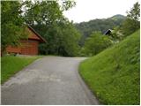 2
2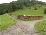 3
3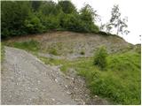 4
4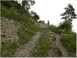 5
5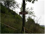 6
6 7
7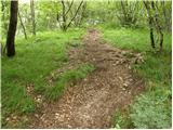 8
8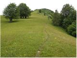 9
9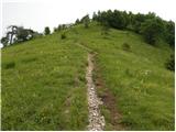 10
10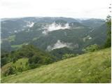 11
11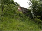 12
12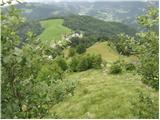 13
13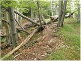 14
14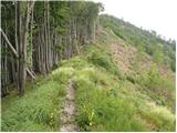 15
15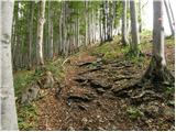 16
16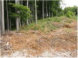 17
17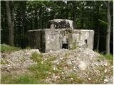 18
18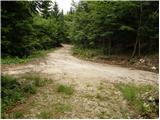 19
19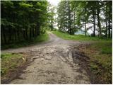 20
20 21
21 22
22 23
23 24
24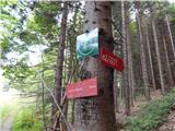 25
25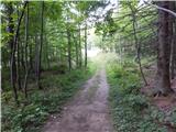 26
26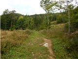 27
27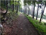 28
28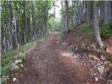 29
29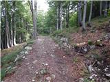 30
30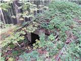 31
31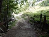 32
32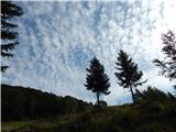 33
33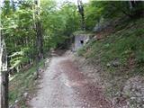 34
34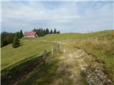 35
35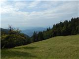 36
36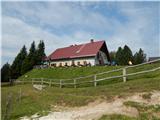 37
37
Discussion about the trail Čabrače - Koča na Blegošu