Starting point: Bukovo (710 m)
| Lat/Lon: | 46,1508°N 13,9019°E |
| |
Time of walking: 1 h 20 min
Difficulty: easy unmarked way
Altitude difference: 208 m
Altitude difference po putu: 310 m
Map:
Recommended equipment (summer):
Recommended equipment (winter):
Views: 1.000
 | 3 people like this post |
Access to the starting point:
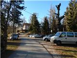
a) From the road Idrija - Most na Soči, at the village of Reka, turn slightly right (from Most na Soči sharp left) onto the road towards the villages Bukovo and Zakojca. Follow the ascending road, which at the crossroads is in the direction of Bukovo and Zakojca. In Bukovo, drive to the parish church of St. Lenart in front of which park in a suitable place.
b) From the Bača pri Modreju - Podbrdo road, in the Grahovo ob Bači settlement, turn in the direction of the Bukovo settlement. First, descend in two serpentines to the bridge over the river Bača, then start climbing towards Bukovo. At the next crossroads, take a sharp right in the direction of Cerkno (slightly left Zakojca). After another 100 metres of driving, you will reach the centre of the village Bukovo, where you turn right and descend to the parking area of the church of St. Lenart.
c) First, drive to the centre of Cerkno (to get here from the road Idrija - Most na Soči, or from Gorenje village and Žiri via the pass Kladje, or from Zali Log via Davča. . . ), and then continue driving in the direction of Zakojca. Just a few metres after we head in the direction of Zakojca, the road to Zakriž branches off to the left, with a steep shortcut leading through it, and we continue along the road that continues along the Zapoška stream. Higher up, the road leads us through the villages Trebenče, Gorje, and then, after crossing the slopes, we pass the village Zakriž on the upper side, where the aforementioned shortcut joins us. A little further on, the road turns further to the right, and after a few kilometres of crossing, we reach the beginning of the village Jesenica, from where we follow the signs for the village Bukovo. Then cross the slopes of Kojca, and when you arrive in Bukovo, drive to the parish church of St. Lenart in front of which you park.
Path description:
From the parking lot, go back a few 10 steps and then, just before the chapel, take a sharp left onto the road which descends to the west and after a few steps turns into cart track. Cart track widens into an asphalt road at the hamlet of a few houses, and then descends to the road leading to the Šentviška plateau, or Bukovo Vrh settlement. When you reach this road, continue left and descend for a few minutes, and along the way you will see some signs for Ponikve, which you should "stick to".
At a small pass the descent ends and we start climbing towards the Šentviška plateau. After two serpentines we reach the first houses in the Bukovo Vrh settlement, and after a small sign we leave the asphalt road and continue slightly to the right on a steeper macadam road, which soon turns right and leads us to a garage.
At the garage, turn left onto cart track, which soon turns into a pleasant lane, and a slight incline leads back to the tarmac road. Follow the road to the right, and walk along it to a marked crossroads from which continue to the right in the direction of Bukovo gaja. Just a little further on, the signs for Bukovo grove point to the left, and we continue slightly to the right, and after a few steps go right again. A few minutes of crossing and a fairly winding road leads us to the homestead at Pircu. Go around the buildings at the farmhouse on the left, then step onto the grassy path that continues between the grazing fences. When you reach an undistinguished ridge, continue along the pasture fence leading along the ridge and within a few minutes of further ascent you reach the Bukovo peak.
Description and pictures refer to December 2019.

Pictures:
 1
1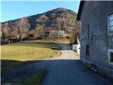 2
2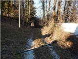 3
3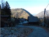 4
4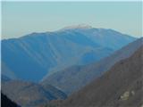 5
5 6
6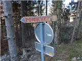 7
7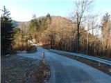 8
8 9
9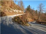 10
10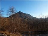 11
11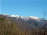 12
12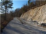 13
13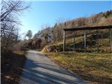 14
14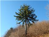 15
15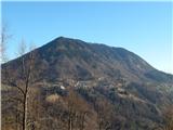 16
16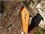 17
17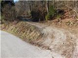 18
18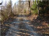 19
19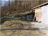 20
20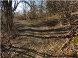 21
21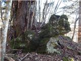 22
22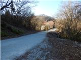 23
23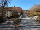 24
24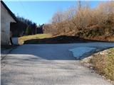 25
25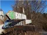 26
26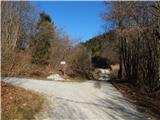 27
27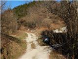 28
28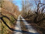 29
29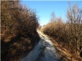 30
30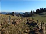 31
31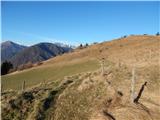 32
32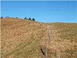 33
33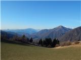 34
34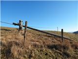 35
35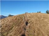 36
36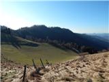 37
37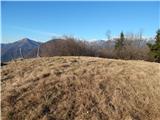 38
38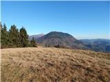 39
39 40
40
Discussion about the trail Bukovo - Bukovski vrh
|
| rosana6. 04. 2025 08:05:51 |
Bukovski Vrh, kot hrib ne obstaja, je samo ime naselja. Tudi Šentviška Gora, Drenov Grič ali Kranjska Gora niso hribi, ampak ime kraja.
Za pravo ime hriba, katerega ste preimenovali, pa vprašajte domačine.
|
|
|
|
| turbo6. 04. 2025 11:50:13 |
|
|
|
|
| rosana6. 04. 2025 18:07:23 |
Sem se pozanimala pri domačinih. Hrib, ki je opisan v tem forumu kličejo Peein, naslednji proti vzhodu, ki je poraščen, pa Bela ali Vela. (način izgovorjave).
V atlasu Slovenije je na 102 strani označen hrib Bela, kot Bukovski vrh in tudi wikipedija ga omenja kot hrib po katerem se imenuje naselje.
Če boste povprašali domačine okoliških vasi za pot na Bukovski vrh, vam bodo pokazali cesto za naselje v Bukovski Vrh. Od tam naprej se boste povzpeli na neporaščen hrib Peein, ali pa poraščeno Belo (Bukovski vrh)
Sama verjamem"domorodcem",in prav je, da se uporablja in ohranja njihova poimenovanja.
|
|
|